
![]()
![]()
|
|
|
|
THE HISTORY OF PUBLIC EDUCATION IN DAGGETT COUNTY, UTAH AND ADJACENT AREAS
A Thesis
Presented to
The Department of Educational Administration
Brigham Young University
Provo, Utah
In Partial Fulfillment
Of the Requirements for the Degree
Master of Arts in Educational Administration
By
Donald Weir Baxter
July 14, 1959
This thesis by Donald Weir Baxter is accepted in its present form by the Department of
Educational Administration of the Brigham Young University as satisfying the thesis
requirement for the degree Master of Arts.
Date_____July 14, 1959________
Thesis Committee
___________Keith R. Oakes____(Signed)_______
___________R. Kent Fielding___(Signed)_______
ii
ACKNOWLEDGEMENTS
Grateful appreciation is expressed to Dr. Keith R. Oakes and R. Kent Fielding of the
thesis committee for their suggestions and criticism of this report.
County Superintendent Jessie Chipp McCort of Sweetwater County, Wyoming, and Clerk
of the Board John C. Allen of Daggett County, Utah were very helpful in making possible the
examination of records and reports. To the librarians of the Sweetwater County Public Library, the Brigham Young University Library, and the Salt Lake City Public Library, appreciation is extended. The author wishes to thank all of the citizens of the region under study who cooperated so readily in the provision of information through interviews. Gratitude is especially directed to Mr. Mark Anson, now deceased, who personally pointed out many of the sites of the earlier schools.
TABLE OF CONTENTSA SYNOPSIS OF DAGGETT COUNTY AND ADJACENT AREAS THE BURNTFORK AND MCKINNON AREA SCHOOLS The Coon Hollow and McKinnon Schools THE EASTERN DAGGETT COUNTY AND BROWN’S PARK SCHOOLS The Eastern Daggett County Schools THE MANILA AND LINWOOD AREA SCHOOLS The Lower Henry’s Fork Schools The
Legislative Background of School in Daggett County The
Development of Daggett Schools under Utah Law Education in Modern Daggett County
LIST OF ILLUSTRATIONS
Fig. 2. – The site of the first Burntfork School Fig. 3. – The site of the second Burntfork School Fig. 4. – The site of the third Burntfork School Fig. 5. – The fourth Burntfork School Fig. 6. – The site of the fifth Burntfork School Fig. 7. – The site of the sixth Burntfork School Fig. 8. – The seventh Burntfork School Fig. 9. – The school at the Gamble ranch Fig. 11. – The McKinnon School Fig. 12. – The Site of the First and Second Beaver Creek Schools Fig.14. – The second Beaver Creek School Fig. 15. – The first Bridgeport School Fig. 16. – The second Bridgeport School Fig. 18. – The Clay Basin School Fig. 19. – The Flaming Gorge School Fig. 20. – The site of the school on the Dick Son ranch Fig. 21. – The site of the first school Fig. 22. – The site of the school at the Stouffer ranch Fig. 23. – The site of the west Linwood school Fig. 25. – The site of the first Washam School Fig. 26. – The second Washam School Fig. 27. – The Antelope school Fig. 28. – The third Greendale School Fig. 29. – The site of the first Manila School Fig. 30. – The second Manila School Fig. 31. – The third Manila School Fig. 32. – The fourth Manila School Fig. 33. – The west wing of the Manila School Fig. 34. – The east wing of the Manila School
INTRODUCTION
The purpose of this study is to trace the development of public education in Daggett County, Utah, including certain areas of Sweetwater County, Wyoming and Moffat County, Colorado, adjacent to the county political unit under consideration in this report. The region concerned in this research consists at the present time (1959) of Daggett County, Utah, the southwestern area of Sweetwater County, Wyoming, and the northwestern area of Moffat County, Colorado.
Upon early investigation into the problem, it became apparent that many schools in the Daggett area were organized to serve the needs of pupils according to geographic location, rather than political boundaries. Territorial and state boundary lines were usually aligned for political expediency without regard to geographical features such as rivers, creeks, deserts, and mountain ranges. Schools, on the other hand, were organized at the time and place where they were needed.
A certain school would be established across the line in Colorado, yet serve the needs of pupils residing in what is now Daggett County, Utah. This was also true of schools located along the Wyoming boundary. Daggett County pupils might have attended this particular school for years because it served the citizens of the region for miles around. This was especially true of the early schools when transportation was poor.
It was felt that a comprehensive picture of public education in Daggett County could not be adequately presented without the inclusion of these Wyoming and Colorado Schools.
Greater emphasis is placed upon the schools of the town of Manila, the county seat of Daggett County. In regard to the number of pupils attending and modern day educational importance, the Manila schools hold the center of attention. Consolidation brought about through improved transportation narrowed the number of operating schools in the region to the elementary school at McKinnon, Wyoming, and the new Flaming Gorge School at Dutch John, Daggett County. The foregoing schools, with the exception of the Flaming Gorge School, have been in session longer, due to their location at population centers of crossroads, and they merit more consideration in this study.
Research into the problem was commenced by personal observation in the Daggett School District for a period of five years. The sites of the schools under study were visited several times. Personal interviews were undertaken with superintendents, principals, teachers, and pupils, past and present, along with the patrons and residents of the area under investigation. Research was carried on through the records of the Sweetwater County schools, the Minutes of the Board of Education of Daggett School District, the archives of Daggett County, the Biennial Reports of the Utah Territorial and State Superintendents of Public Instruction, and the records and reports of the individual schools concerned.
Reading was done on the general history of the Daggett County region. The inventory of Daggett County Records No. 5 and a short history of Daggett County written by Dick and Vivian 1
Dunham were used as specific references. For a general history of public education in Utah, the work of Dr. John C. Moffitt served as a valuable source. Several unpublished master’s theses dealing with the subject were studied. In regard to thorough history of the schools of Daggett County, no published reference would be located.
The services of the University of Utah Library, the Brigham Young University Library, the Salt Lake City Public Library, and the Sweetwater County Public Library were utilized extensively in this research.
Throughout the implementation of this study various inconsistencies were noted among sources in regard to certain facts. Where possible, written records and reports were given precedence over oral information based on the memory of the person being interviewed, and the statements of those personally participating in a given activity were given credit over the statements of those who were not so intimately involved. Some of the information contained herein was based wholly upon the memory of a person, as no written record could be discovered. This was particularly true of the earlier schools of the region.
A combination of the chronological and topical methods of writing history was considered the most appropriate mode in writing up the results of this research.
Much of the history of the Daggett County area schools is a repetition of the events and occurrences of other similar districts. However, each school system and school represents a story of evolution and development. In view of its comparative isolation, until recent years, and the historical interest of the region, the schools of the Daggett County area present a unique story in and of themselves. It is hoped that this study will serve as a contribution to the general history of education in Utah and will aid in encouraging an appreciation of their system of public education for the people of Daggett County, Utah.
CHAPTER I
A SYNOPSIS OF DAGGETT COUNTY AND ADJACENT AREAS
The Geographical Format
The region under study. Daggett County is situated in the extreme northeastern corner of the state of Utah at the point where the boundaries of Utah, Wyoming, and Colorado conjoin. This county assumed legal existence on January 7, 1918 and the Governor’s Proclamation of November 16, 1917 declared the bounds of the new state subdivision to be:
Commencing at the point of intersection of the boundaries of Utah,
Wyoming, and Colorado, thence west to the one hundred and tenth meridian of
west longitude, thence south to the watershed of the Uinta Mountains, thence
east along said watershed to the Colorado state line, thence north to the
point of beginning.1
In view of the fact that there is no clearly marked watershed line in
the eastern section of the Uinta range and the controversy that soon followed
between Daggett and Uintah Counties, in 1943 the Utah Legislature established
the present political limits of Daggett County.2
Irregularly rectangular in shape, Daggett County averages approximately fifty miles in length and seventeen miles in width. Sweetwater County, Wyoming, joins it on the north, Moffat County, Colorado, on the east, Uintah County, Utah on the south, and Summit County, Utah, on the west.
The northern, eastern, and western boundaries were established by
legislative enactment, however, the southern county limit is marked by one of
the most unique mountain ranges in North America, the Uinta Mountain Range,
which is, apparently, the only major mountain system in this continent running
in and east-west direction. The
geological history of the region reveals that millions of years ago, the range
was one hundred and fifty miles long and thirty-five miles wide, reaching a
height of 32,000 feet, surrounded by a great sea.3
Glaciation and river and stream erosion have created some of the most spectacular and beautiful scenery in Utah, and Daggett County has its full share. The Green River and its tributaries have carved canyons of outstanding beauty and grandeur. The Flaming Gorge, Horseshoe, Red and Ladore Canyons of the Green are magnificent to behold. Sheep Creek Canyon, with its vertical rock ledges and folds provides scenery to rival that of Zion Nation Park.
Deep, rugged canyons cleaving the Uintah sandstone and quartzite; the
steep, narrow hogbacks, with the narrow gaps of gateways cutting through them;
these show the work of fast flowing water.
The rounded summits of the “Baldies,” the great glacial cirques and
mountain show the carvings of the flowing
1Utah, Governor’s Proclamation: document in files of Secretary of State, November 16, 1917.
2Dick Dunham and Vivian Dunham, Our Strip of Land: A History of Daggett County, Utah. (Lusk, Wyoming: The Lusk Herald, 1947), p. 91.
3Ibid., 1.
rivers
of ice. And all these things bear
witness to the millions of years of building up and tearing down which
have made this area called Daggett County one of the most rugged, isolated and
beautiful spots in the nation.4
The Green River, tributary of the Colorado, enters Daggett County at a point on the Wyoming boundary about eight miles east of Manila, the county seat. It travels in a general southerly direction, turning east about seven miles south of the Wyoming line and flowing in that direction until it reaches Brown’s Park in eastern Daggett about five miles from the Colorado limit. It then turns south for a few miles and east again into Colorado.
Two of the Green’s tributaries, Henry’s Fork and Sheep Creek, shared an important part in the settlement of the Daggett area. Henry’s Fork flows in a general easterly direction along the Utah-Wyoming border, entering the Green about eight miles east of Manila. Sheep Creek, arising in the Uintas, flows in a northeasterly path, pouring into the Green about five miles southeast of Manila. Other tributaries of the Green, in the county, are extant throughout the Uinta area, most of them flowing in a north or northeasterly direction into the Green where it bisects Daggett County east and west.
In the northwestern zone of the county line are two tributaries of Henry’s Fork, along which various ranches and home were established. They are Birch Creek and Burnt Fork, the former running in a general northerly direction and entering Henry’s Fork about 12 miles west of Manila, just across the Utah-Wyoming border.
The Uinta region abounds with lakes, some of which are Daggett, Weyman, Spirit and Green Lakes. The creeks and lakes of the locality are visited throughout the season by sportsmen and seekers of recreation. The Ashley National Forest includes the greater portion of the Uinta watershed and coniferous trees are plentiful.
To the north and east of this great Uinta mountain range lies a vast area of semi-arid land, extending into Wyoming and Colorado, covered with various arid-type vegetation, such as sage and juniper. These semi-arid areas in and around Daggett County have become extensive sheep ranging lands, while cattle are grazed in the grassier sections of the county, particularly along the Green and its tributaries. The settlement of the region was largely determined by the location of sources of water.
The towns and hamlets.
Beginning in the western extremity of the county, in the southwest
corner of Sweetwater County, Wyoming, near the point where the Summit and
Daggett County lines intersect the Wyoming boundary, lies the settlement of
Burntfork, consisting of several scattered ranches.
The 1950 census lists one hundred and seventy persons living in the
Burntfork region at that time.5
About three miles east of Burntfork is the hamlet of McKinnon, Wyoming, in which there
4Ibid., 2
5U.S. Bureau of the Census, Seventieth Census of the United States: 1950. Population, I, p. 50-9.
is a church, a general store, a school, and a few homes and cabins. The population of McKinnon, in 1950, was given as seventeen persons.6 There are numerous ranches throughout the locality which center their business, church, and educational activities at McKinnon.
On some maps the name “Antelope” appears, which designates a number of ranches situated about four miles west of Manila. The residents carry on their social, educational and business affairs through the town of Manila.
Continuing further east there is the town of Manila, located just across the Wyoming-Utah boundary. There were one hundred and forty-seven persons living in Manila in 1950.7 A church, a school, a theater, and a quantity of homes are found there.
Across the Wyoming line, about three miles northeast of Manila, is the hamlet of Washam. Fifty-four persons are listed as living there in 1950.8 It consists of a number of ranches centering around a school which is no longer in use.
About four miles due east of Manila, along the Utah-Wyoming boundary, lies the village of Linwood, Utah. Its population in 1950 was eighteen persons.9 There are placed there a few cabins, homes, a post office and a general store.
Eight miles southeast of Linwood, in the Uinta Mountains, are situated some isolated ranches marked on most maps as the locality of Greendale. The Green’s Lake Fishing and boating resort is also in this area.
Seventeen miles southeast of Manila stands the new town of Dutch John, Daggett County, which is the site of the construction of the Flaming Gorge project on the Green River. This is the most modern city in Daggett County, with paved streets, some permanent-type homes, various Bureau of Reclamation buildings, construction camp structures, a school, a post office and shopping center. At the present time (January, 1959) this town numbers about five hundred persons.10 Within the next few years it is expected to grow to over 2,500 workmen and their families.11 After completion of the dam, a smaller number will live at Dutch John for the purpose of maintaining the dam and power facilities.
Twenty-seven miles due east of Manila is Clay Basin Camp of the Mountain Fuel Supply
6Ibid., 50-9.
7Ibid., 44-10.
8Ibid., 50-9.
9Ibid., 44-10.
10Deseret News, January 2, 1959
11Ibid., May 15, 1958
Company, which is the center of the development of natural gas wells in Daggett County. It includes buildings and homes erected by the company.
Approximately eight miles southeast of Clay Basin lies an area known as Brown’s Park, consisting of a few scattered ranches and the uninhabited hamlet of Bridgeport. Just across the Colorado line, continuing as a section of Brown’s Park, are some isolated ranches comprising the Moffat County precinct of Ladore, the 1950 census of which was thirty-three persons.12
The total population of Daggett County, in 1950, was three hundred and sixty-four persons, residing in an area of seven hundred and eight square miles.13 Since 1957, however, the number of people living in the county has tripled as a result of the Flaming Gorge project, and still more growth is expected during the next three years.
Roads and highways. As early as 1881, a military road was constructed by Judge Carter’s interests, joining Fort Bridger with Fort Thornburgh, across the Uinta Mountains near the present site of Vernal, Utah. Although it was extremely rough, the road was maintained until the abandonment of Fort Bridger in 1890.14
Another road followed Henry’s Fork from the Burntfork area, east, toward what was later to become Manila and Linwood. It continued on east to Brown’s Park, crossing the creek several times. Two roads joined Green River, Wyoming, with the Henry’s Fork settlements, one north from Linwood and another northeast from Burntfork, Wyoming.
Until 1954, Daggett County could not be reached via a paved road. In that year, Sweetwater County, Wyoming, completed the paving of Highway 530 south from Green River to the Utah-Wyoming line at Linwood. A paved road, Highway 43, joins Linwood and Manila, and continues west through Daggett County along the Utah-Wyoming boundary, linking with the Wyoming road through McKinnon and Burntfork, Sweetwater County.
Daggett County’s main connection with Utah is Highway 44, which extends south from Manila and then turns east and again south over the Uinta Mountains and into Vernal. A new paved road has been constructed east from Linwood to the dam site town of Dutch John, Daggett County. This highway also marks the erection of a temporary bridge across the Green River about four miles east of Linwood, thus ending the extreme difficulty of vehicular travel between eastern and western Daggett County. A former trip from Manila to Clay Basin, for example, involved a roundabout journey through Rock Springs, Wyoming, except for short periods when the Green was frozen in winter.
Another bridge was recently completed at the dam site making it possible to motor directly from the Greendale area to the town of Dutch John.
12Census, op. cit., p. 6-15.
13Ibid., 44- 9-10.
14Dunham, op. cit., p.
6
There are a number of other county roads, including a scenic drive along Highway 44 south from Manila, thence west along Highway 165 to the Summit County line and north , again, down Birch Creek to the McKinnon-Burntfork area. The latter road is one of the routes to the Spirit Lake fishing area in the high Uintas. These byways are not paved, but work towards their improvement is progressing.
Natural resources. The resources of the county are primarily agricultural, with sheep and cattle as the principal livestock raised in the region. Crops include wheat, oats, barley, hay and legumes, and white potatoes, along with varying amounts of other vegetables. The Uinta Mountains have yielded a quantity of coniferous timber throughout the years.
Natural gas wells were drilled in the Clay Basin zone of eastern Daggett County during the thirties, but resources, other than agricultural, have not been highly developed. Small deposits of metallic ores have been discovered in the Uinta Mountains and a small coal mine existed near Linwood for a number of years. The county has a large deposit of phosphate which has not been tapped.
The power potential of Flaming Gorge Dam is now being developed and the probability of expanded tourist and recreational activity, within the county, is certain to increase with the completion of the project.
The Historical Background
Early fur trappers and explorers. The Spanish explorer, Father Escalante, passed to the south of the Uinta Mountains and did not enter Daggett County, however, there is some belief, among certain historians, that other Spanish explorers and traders might have visited the area before 1776.
The history of the Daggett County region is quite unique in that it was the first area in the state of Utah to be visited by White Americans.15 In the spring of 1825, William Henry Ashley, the founder of the Rocky Mountain Fur Company, determined to try to find an easier route for the transportation of his company’s furs to the east. He decided to explore a portion of the Green River and to select a site for a general rendezvous for his trappers.
Beginning near the point where Henry’s Fork empties into the Green, Ashley and his party followed the course of the river through Flaming Gorge, passing into Brown’s Park and on to Ladore Canyon, arriving far down the river at the present site of Green River, Utah. Indians convinced them of the inadvisability of navigating the river further. They recrossed the Uintas to the point of rendezvous at the mouth of Henry’s Fork.16 According to some accounts, the rendezvous was moved further west on Henry’s Fork to the present site of Burntfork.
Ashley thus became the first white American to visit the Daggett area and write about it. Among his company of trappers were the names of men who were to become famous through the history of western America; Jim Bridger, Etienne Provost, Andrew Henry, Jedediah Smith, James Beckworth, Thomas Fitzpatrick, and Antoine Robidoux.17
The name “Browns Hole” or “Browns Park” was derived from one
Baptistie Brown who settled in the area in 1827 or 1835, and is reputed to be
the first white settler in Daggett County.18
In 1837 three trappers, Thompson, Craig, and Sinclair, built Fort David
Crockett in Brown’s Hole.19
Another trapper who came to the Daggett County area during the fur era was “Uncle” Jack Robinson, who built the first permanent home in the county. It still stands as a portion of
15Charles Kelly, The Outlaw Trail (Salt Lake City, Utah: The Author, 1938), pp. 55-56.
16Harrison C. Dale, The Ashley-Smith Explorations (Glendale, California: Author H. Clark Co., 1941), pp. 138-139.
17Dunham, op. cit., p. 10.
18Kelly, op. cit., p. 57.
19William M. Purdy, An outline of the History of the Flaming Gorge Area, Anthropological Papers, No. 37, University of Utah (Salt Lake City: U. of U. Press, 1959), p. 7.
the Keith Smith property in Linwood.20 Jim Baker arrived at an early date, making a name as a mountain man and guide, later becoming a rancher in the region.
By 1840, the supply and market for beaver pelts began to decline rapidly, and this signaled the end of the day of the trapper.21
In 1843 John Charles Fremont, with Kit Carson as guide, came east from Salt Lake through portions of Daggett County. During this period the Brown’s Hole region was frequently visited by other travelers heading west. The place was well suited for the wintering of cattle, and during the eighteen fifties, it was used for that purpose.22
The Mormons, who were the figure so strongly in the colonization of the western United States, bypassed the Daggett area in 1847, their route being some sixty miles to the north. Attempts were made to settle Ashley Valley on the south of the Uintas, but no Mormon colonists arrived in quantity until near the turn of the century.
Scientists were studying the geological and natural resources of the area following the Civil War, including Mr. Clarence King of the Fortieth Parallel Survey, who was working in the Uintas by 1872.23
The later history of Brown’s Park. In 1869, Major John Wesley Powell conducted his exploration down the Green River, and in 1871, traveled the Green and Colorado.24 To him is given the credit for changing the name “Brown’s Hole” to “Brown’s Park” because he was so greatly impressed with its beauty. Powell also named the Flaming Gorge Canyon. He noted where Ashley had left his name and the date, near Ashley Falls on the Green.
One of the most interesting episodes of the history of this region was the “great diamond hoax” perpetrated by two prospectors, Philip Arnold and John Slack, against some of the richest and most influential financiers of California. In 1871, diamond samples, supposedly from a newly discovered deposit located somewhere “a thousand miles east of San Francisco,” were presented to William Chapman Ralston and his associates. Ralston, who was the head of the Bank of California, was duped, along with other men of means, into investing some $660,000.00 into the project, after mining experts had assured him of the authenticity of the find. It was only after Clarence King, the surveyor, noted that some of the diamonds were not placed where natural formation would require them to be, that the hoax was discovered. Ralston shouldered
20Ibid., 17.
21Dunham, op. cit., p. 12.
22Ibid., 19.
23Ibid., 32.
24John Wesley Powell, Explorations of the Colorado River of the West, (Washington, D.C.: U. S. Government Printing Office, 1875), pp. 19-23.
the total loss himself, and the confidence men escaped with their loot. Diamond Mountain, in eastern Daggett County, is a memento of the swindle.25
As early as 1872, J. S. Hoy brought in a herd of cattle to Brown’s Park, and in 1875, he established a cattle ranch in Colorado, near the mouth of Ladore Canyon.26 In 1873, Hardin and Sam Spicer moved cattle into the Park, followed by Valentine Hoy. In the seventies, W. G. “Billy Buck” Tittsworth settled a ranch north of the Park. J. C. “Judge” Allen had a claim on the Green River in Colorado, and Charles Crouse arrived and purchased the Jimmie Reed cabin on the south side of the river opposite the mouth of Willow Creek.27
In 1879, “Doc” Parsons instituted a store and Edward Rife and C. B. Sears moved in. John Jarvie started a store in the Daggett end of the Park. Tom Davenport settled a ranch on Willow Creek. Others who soon followed were Martin Goffonti and Lewis Caro, who established a ranch at the mouth of Beaver Creek, with Charles Crouse. George Bradshaw, Frank Goodman, Jim Warren, Jim McKnight, James Peterson, Alfred Morey, George Kelvington, Speck Williams, Aaron G. Overholt, and others, too numerous to mention, soon appeared.28
Brown’s Park gained some notoriety in the eighties and nineties as the abode of some of the most notorious outlaws of the late West, the most famous of which was Butch Cassidy. Others, such as Matt Warner, “Bignose” George Curry, Lonny and Harvey Logan and Harry Longabaugh used the Park as a headquarters from time to time.
Trouble between the large cattle ranchers and smaller operators over alleged rustling on the part of certain Brown’s Park residents, resulted in the arrival of the controversial Tom Horn, thought by some to be a fearless fighter for law and order, and by others to be nothing but a ruthless, paid killer.
By 1900, the forces of the law had pretty well ended the reign of the rustler and train robber in Brown’s Park.29 Some of the most interesting stories of the West center in and around this section of eastern Daggett County, Utah, and western Moffat County, Colorado. Today, Brown’s Park consists of a number of scattered ranches and a sparse population. There are no paved roads and it is still a remote and isolated section.
The Burntfork and McKinnon region. In 1857, Colonel Johnston was sent west with an army to punish the Mormons who were supposedly in rebellion against the authority of the
25George D. Lyman, Ralston’s Ring, (New York: Charles Scribner’s Sons., 1937), pp. 190-201.
26Dunham, op. cit., p. 41.
27Ibid., 42.
28Ibid.
29Dunham, op. cit., p. 41.
United States government.
Through the efforts of Mormon raiding parties and the lateness of the
season, Johnston was forced to take to winter quarters at Fort Bridger.
The post sutler, William A. Carter, who was to figure prominently in
the history of the area, took a number of government horses, mules, and cattle
down to Henry’s Fork to winter, and became acquainted with the possibilities
of cattle raising in that zone.30
One of Johnston’s scouts, a Mr. Phil Mass, aided in the removal of the army stock to Henry’s Fork, and some time later, after his discharge from the army, settled at Montoya Meadows on Henry’s Fork, about two miles north of the present McKinnon, Wyoming. He thus became the first resident cattle rancher in the upper Henry’s Fork or Burntfork area. In 1862, he married Irene Beauxveaux and from this union there arrived nine children. An interesting sidelight into the life of this man is that he served as one of the original drivers of the overland stage into Salt Lake City, and as a pony express rider for a short time.31
The first permanent settler at Burntfork, some three miles southwest of
the Phil Mass homestead, was Mr. George Stoll, who established a ranch there
in 1870. Mr. Stoll had served in
the First Nevada Cavalry commanded by General Connor, and traveled with his
regiment to Salt Lake City. In
the spring of 1864, the troops moved to Fort Bridger, crossing the mountains
near Burnt Fork and Mr. Stoll became interested in the region at that time. In March, 1866, he married Miss Mary A. Smith and from this
family came the first school children at Burntfork. One of his sons, George Jr., became the postmaster at
Burntfork in 1895, marrying one of the early teachers, Miss Lillian McDougall,
November 4, 1890. The John B.
Anson and James Widdop families soon followed the arrival of George Stoll Sr.
and these three groups became the first continuous residents of the settlement
of Burntfork.32
Approximately two miles east of Burntfork is Birch Creek, a tributary of Henry’s Fork, along which were established a number of ranches, including that of Robert Hereford, who was the first to homestead on the latter creek. Hereford removed from his ranch in 1896.33 Garibaldi “B” Gamble, Charles Wyman, and Clark Logan also commenced ranching in this section.
Coon Hollow is a tract of land located about four miles east of Burntfork which was inhabited by permanent settlers by 1898.34 The area is just north of the present McKinnon, Wyoming.
The earliest permanent ranches were thus established at both the western and eastern
30Ibid., 19.
31Progressive Men of the State of Wyoming (Chicago: A. W. Bowen and Co., 1903), pp. 146-147.
32Ibid., 525-526.
33Dunham, op. cit., p. 48.
34Ibid., 101.
extremities of the Daggett region, however, ranches were soon to appear along the Henry’s Fork and its tributaries parallel the Utah-Wyoming line.
The central Daggett County region. In the eighteen sixties, on Al Conner left his name to a basin lying five miles southwest of Manila and this later became the George Solomon ranch.
Further east, along Henry’s Fork, Charley Davis had a ranch about
one-half mile west of the present site of Linwood, by 1873.35 A. W. A. Johnson is supposed to have run cattle on the lower
Henry’s Fork in the early seventies and Shade Large was living on the
Charley Davis ranch by 1878. Lige
Driskell settled further east along Henry’s Fork at an earlier date.
At the mouth of Henry’s Fork was the George Finch ranch.
George Hereford lived just west of the Driskell and Finch ranches,
about one mile east of the present site of Linwood.
Dick Son instituted a ranch about three miles due north of Manila on
Henry’s Fork, and Dave Washam located himself just west of the Dick Son
ranch about 1890. His name still designates the area, including the school
built there.36
Starting west
from the river and going up the Fork around about 1890, you’d probably have
stopped to say hello to Lige Driskell, George Finch, and George Hereford, not
far from each other. You might
have stopped to visit at the little school just between the Finch and Hereford
ranches, where Charley Driskell, Neal’s son, was teaching, or at Jim Large’s
cabin close by. Then, where Keith
Smith how has his home in Linwood, you’d find Bill Large.
Going up the stream a ways, you’d come to Shade Large’s ranch.
Then if you turned off up Birch Springs Draw, or “Dry Valley” to
where Cliff Christensen now lives, you’d find the Finch horse ranch, with a
small cabin and corral; and where the C. F. Olsen ranch is, you’d see a
similar setup, the Shade Large horse ranch.
If you had the time, you might go over to Conner Basin to see George Solomon, but more likely you’d cut back over to the Fork to Dick Son’s store and post office. Then going up to Burntfork, you’d pass the ranches of Dave Washam, John Wade, John Stouffer, Si Erdley, Alex Hayden, C. B. Stewart, Clark Logan, Henry Perry, Jim Hauser, Tom Welch, Will Harvey, Phil Mass, Billy Pearson, and Robert Hereford. Then if you cut back over to Birch Creek you’d find the ranches of Zeb Edwards, B. Gamble, and Charles Wyman.37
The formation of political units; Manila.
In 1893, Ellsworth Daggett, first surveyor-general of Utah, sent Adolph
Jessen to northeastern Utah in order to complete a survey of the area.
Jessen became aware of the potentiality of the region for farming, if
water could be secured, and with the aid of Daggett and Mr. R. C. Chambers, he
formed the Lucerne Land and Water Company.
Shares were sold to prospective buyers, many of whom came from Beaver
County, Utah. The valley which
was to be developed came to be known as “Lucerne.”38
In the summer of 1895, The company completed a canal from Conner Basin to what was known as the Birch Springs ranch, about four miles southwest of the present site of Manila, and
35Ibid., 44.
36Ibid., 50.
37Ibid., 72.
38Ibid., 76.
on November 6, 1895, the first settlers, Mr. Frank Ellison and his family, arrived. Ellison was to serve as foreman of the Birch Springs ranch. Other settlers soon followed, including the George Warby family, Steve Warby, Joe Warby, the Franklin Twitchell and Daniel Nelson families and Alvin E. Smith. Others located farms throughout the Lucerne Valley. Among them were E. J. Briggs, Fred Robinson, Charles Potter, J. K. Crosby, Billy McKnight, and Jim Merchant.39
Because of a desire of the pioneers for community benefits, such as church and school, Jessen determined to survey a townsite, following the Mormon pattern of north-south, east-west streets. The three north-south streets were named Jessen, Chambers, and Daggett, while the east-west lanes were numbered, the first being the present state highway. Jessen had planned to name the new hamlet “Chambers” in honor of the third founder of the company, however, the news of Dewey’s victory at Manila Bay in 1898 arrived and it was decided to name the town in recognition of that event. This town was to become the county seat of Daggett County.40 Manila was a “town” only in the sense that there were a group of homes and buildings clustered together. Until 1959, the hamlet was believed to be the only unincorporated county seat in the United States, however, in that year it became and incorporated town.41
Linwood. In 1899,
following the example of the Lucerne Company, the People’s Canal Company was
organized to bring water from Henry’s Fork into the lower half of Lucerne
Valley. George Solomon, Edward Tolton, M. N. Larsen, George W.
Stevens, and Daniel Nelson were the incorporators.
Original shareholders were Frank Ellison, Ben F. Marsh, John DeSpain,
J. B. and Hugh Hughbert, Daniel Nelson Sr., Frank Twitchell, Joe, Sam, Steve,
James H. and George Warby, Charles Large, George Finch, Alvin E. Smith, James
Reid, William McKnight, Fred Robinson, and Willard Schofield.42
George Solomon laid out a townsite some four miles east of Manila, naming it “Linwood” after a variety of cottonwood trees planted in the tract. In 1902, Keith and Sanford Smith and their father, Frank W. Smith, purchased a number of ranches in the area, including the townsite itself. A village more or less “grew.” A store was started in 1903, which is still active.43
By 1906, business became brisk with the use of the town facilities by the sheepherders of the region, and because of its location, a thriving trade grew in supplying the wants of the sheepmen. Gambling and other associated activities prospered, and one particularly noteworthy
39Ibid., 77-78.
40Ibid., 84.
41Personal interview with Nels Philbrick, Daggett County Assessor and resident of Manila, June 14, 1959.
42Dunham, op. cit., p. 84.
43Ibid.
establishment situated just across the Wyoming line was known as the “Bucket of Blood.”44
Within a few years, however, the sheep boom died out, with the coming of trucks and easier freighting of supplies to the camps from Green River City. Several large sheep companies went bankrupt and the roaring days of Linwood were over.
Daggett County. As can be noted from the geographical description of Daggett County, the Uinta Mountains presented a natural barrier which separated Daggett from the rest of the state of Utah, particularly in winter. By 1916, the citizens of the northern slope of the Uintas felt that they were not receiving their rightful share of the benefits from taxes collected as a portion of Uintah County.
In conformance with a state law of 1914, a petition was prepared for the separation of the portion north of the Uinta Mountains as a new county, and in July, 1917, an election for this purpose was carried.45 The county assumed legal existence on January 7, 1918, and was named after Ellsworth C. Daggett, the only surviving member of the Lucerne Land and Water Co.46
At an election held the preceding November, the following officers were elected: George C. Rasmussen, Nels Pallesen, and Marius N. Larsen, county commissioners; A. J. B. Stewart, clerk and recorder; Daniel M. Nelson, assessor and treasurer; Ancil T. Twitchell, sheriff; and C. F. Olson, county attorney. On January 16, the Board of Commissioners held their first meeting in a room attached to the rear of the old dance hall, which served as the county courthouse until 1922.47
Thus, Daggett County came into existence with virtually the same boundaries as it has today. Before 1865, it had been included in the old Green River County, Territory of Utah. In that year much of the Green River County land was lost to Idaho (later, Wyoming) and in 1868, the present Utah-Wyoming border was established, with Daggett County becoming an extension of Summit County, Utah. In 1880, the unit was attached to Uintah County, Territory of Utah, and, as was indicated, became a separate political entity in 1918.48
Clay Basin and Dutch John. In 1924, natural gas wells were drilled in an area about twenty-seven miles due east of Manila, known as “Clay Basin.” A small community or “camp” was set up in 1929 by the Mountain Fuel Supply Company for employees and their families, which is still in existence.
44Ibid., 85.
45Ibid., 89.
46Ibid., 90.
47Ibid.
48Milton R. Hunter, Utah in her Western Setting (Salt Lake City, Utah: Sun Lithographing Co., 1951), pp. 429-430.
The Congress of the United States approved an appropriation for the construction of a concrete dam on the Green River about eighteen miles southeast of Manila, in 1956. By he winter of 1956-57, a townsite was in the process of being surveyed under the direction of the U. S. Bureau of Reclamation, which was to be located about seventeen miles southeast of Manila, just north of the damsite. The new town was named “Dutch John” after an early resident of the area.
Dutch John is the largest population center in Daggett County, numbering between five and six hundred persons, and it is expected to grow even larger. After completion of the project, the community will house about two hundred people in connection with operation and maintenance of the dam.49
This summary of the history of the Daggett County region was attempted in order to contribute toward an understanding of the background of the citizens of the area, and their schools. Many of the names mentioned earlier will appear again as a more detailed study of each school is undertaken. These were the patrons of the schools of Daggett County and its environs, and the history and character of public education in this region was largely determined by these people.
49Deseret News, January 2, 1959.
Summary
The foregoing chapter told how the region under study is rich in the lore of western history having been visited by many whose names are among the most famous in the tradition of America’s frontier.
An attempt was made to show how life in Daggett County was, and is, determined by geography and economic resources, with the earliest settlers seeking locations where there was sufficient water and grassland for their stock. In turn, many of these early cattle ranchers were superseded by the Mormon farmer and the county has remained predominantly L.D.S. in religion and white in race.
Politically joined to Utah, most of the county’s economic, social, and recreational activities were associated more with Wyoming than with the parent state.
A rugged and arid land with an economy based upon agriculture resulted in a sparse population, spread over many square miles, preventing the growth of large towns, which is indicated by the fact that as late as 1950, there was no doctor, hospital, drugstore, bank, library, or movie theater in the entire region.
With the advent of Flaming Gorge, a community was established, larger than all of the other hamlets in the area combined. The immediate effects of this activity are now being experienced by the residents of the county. That there will be an increase in the number of visitors to the area is almost certain. What permanent changes will result in the life and economy of Daggett County, perhaps, only time will tell.
CHAPTER II
THE BURNTFORK AND MCKINNON AREA SCHOOLS
A Private Ranch School
The private school at the Phil Mass ranch. In Chapter I of this research report a short paragraph was devoted to the mention of Mr. Phil Mass, who settled on Henry’s Fork sometime around or after 1862. His ranch was located about twelve miles west of Manila and two and one-half miles north of the present McKinnon School.
Mr. Mass was sincerely interested in the education of his four boys and
five girls, and during the eighteen seventies he hired private tutors,
maintaining the school at his ranch home.1
He engaged Mr. William Pearson as the first tutor about the time of the
coming of the railroad. (1869) Mr.
Pearson taught at the Mass ranch until 1884, when he began teaching at
Burntfork.2
It seems evident, from the research done in the area, that this school was, in effect, the first in the region under study. Judging from the opinions of those who knew him, Mr. William Pearson was an outstanding teacher and it may be assumed that the Mass school was one of comparative high character.
1Personal interview with Mr. Vorhees Pearson, son of William Pearson and native of Burntfork, January 26, 1957.
2Personal interview with Mr. Mark Anson, early resident of Burntfork and lifelong citizen of the region under study, January 16, 1957.
The Burntfork Schools
The first Burntfork school. The first public school in the region under study was located at Burntfork, Wyoming, when District Number Eight, of the Territory of Wyoming, was organized on September 10, 1877, to be known as “Henry’s Fork Joint District with Uintah County, Utah.”3 The trustees for the district in 1877 were John B. Anson, Clerk, George Stoll, Treasurer, and W. H. Mass, Director, and on January 9, 1878, the amount of $163.36 was apportioned for the education of a total of nine children, the funds reserved at the office of the County Treasurer at Green River, Wyoming.4
Burntfork is situated approximately sixteen miles west of Manila and the first school building was placed on property owned by George Stoll, Sr., which is now the Orson Behunin ranch. It stood about two hundred and fifty feet north of the present ranch home. Fig.
2. – The site of the first Burntfork School
George Stoll was the patron largely responsible for securing the school for the use of his children and the progeny of the Anson and Widdup families who resided there.5
The school building was a log structure of one room, about sixteen by eighteen feet in size. It had a plank floor with a dirt roof, and was heated by a large wood stove. Drinking water was secured from the spring at Burntfork.6
This school operated on an average of six months of the year, from 1877 to 1883, when a new location was chosen.7 The building was subsequently utilized as a milkhouse and its final disposition is unknown.
County funds were apportioned for the support of this school as follows: January 9, 1878 $163.36 December 17, 1881 $275.91 December 14, 1882 $516.81 1883 $537.208
There were nine pupils attending the school in 1877 and enrollment never rose to over
3Record Book No. 1, of the County Superintendent of Schools, 1873 to 1893, Sweetwater County, Wyoming. (in the files of the County Superintendent of Schools), p.19.
4Ibid.
5Mark Anson, interview, January 16, 1957.
6Ibid.
7Ibid.
8Record Book, op. cit., pp. 19-35.
twelve students.9 There was no grading and pupils studied the same subject at the same time. Parents were notified of pupil progress by word of mouth. A small blackboard was available for the use of the school.
There is no record of the names of the trustees who served between 1877 and 1833, however, Mr. George Stoll Sr. continued as Treasurer throughout this period.
Early teachers at this school were Mark Manley, Robert Hereford, and William Pearson, each of whom taught for an average salary of $50.00 per month.10 The precise years of their employment were unknown. Mr. Pearson became well known as a teacher at Burntfork and other schools of the area. That these teachers were proficient in the use of disciplinary methods common at the time is indicated by the statement of Mr. Mark Anson, while being interviewed, that, “Since hickory was not available, birch was utilized.”
The curriculum consisted of reading, writing, arithmetic, spelling and history.
The second and third Burntfork Schools. On June 27, 1884, District Number Eight was reorganized into District Number Five with boundaries as outlined:
The
south and west boundaries shall be on the south and west boundaries of
Sweetwater County. The eastern
boundary six miles east of and parallel with county line.
The northern boundary shall be one mile north of Henry’s Fork Creek
and parallel with the same.11
Coincident with the changing of the district boundaries and the establishment of the new District Number Five, the first Burntfork School was abandoned and a structure was moved onto a portion of what is now the Orson Behunin ranch, about one fourth of a mile east and one fourth of a mile north of the present Burntfork School in order to be nearer the center of population. Fig.
3. – The site of the second Burntfork School
The children of the Stoll, Anson, Widdup, and Mass families attended.
As soon as possible, a new school building was constructed near the site of the old edifice on what was know as the “Dave place.” Fig.
4. – The site of the third Burntfork School
This new school was eighteen by
twenty feet and consisted of one room of log construction.
It had a plank floor, dirt roof, and was heated by a wood stove.
Glass windows were installed, and all of the labor and material was
donated by the Stoll, Widdup, Anson, and Mass families.
The school continued in operation from 1883 until 1894.12
9Ibid.
10Ibid.
11Ibid., 36-38.
12Mark Anson, interview.
County
funds were apportioned for the support of the school as follows:
1883 $537.00
1889 $159.60
1884 $201.09
1890 $206.47
1885 $424.83
1891 $139.97
1886 $292.00
1892 $116.8013
1887 $
61.00
1893 $245.00
1888
$418.59
Enrollment
in this school was as the following list indicates:
1884 10
1888 19
1891 14
1885 27
1889 15
1892 16
1886 11
1890 23
1893 1114
Grading began in this school in the Burntfork area.
The curriculum consisted of reading, writing, arithmetic, spellings,
language, geography, and history. There
was great dependence upon recitation of the formal type.
In the forenoon, pupils studied arithmetic, reading, and history, and
in the afternoon, spelling, geography, and language.
Parents were notified by note whether or not the pupil was doing
satisfactory work.15
The school had a blackboard and homemade benches and desks.
There were a number of small maps and a large Atlas, along with books
on geography, reading, and arithmetic, plus copy books for writing.
For recess, the pupils played baseball, using balls made of buckskin
wrapped around a core of cork. A
halfbreed named Robinson made the balls for them.16
Teachers
had now begun to be certified by Sweetwater County after attending normal
school and were granted graded certificates.
School was held on the average of four to six months and teachers
received about $60.00 per month.17
The first teacher who taught at this school was Mr. William Pearson,
who was there in 1884.18 An
interview was afforded by the son of this outstanding early teacher.
Most of the children of the school learned to write in his style by
copying sentences he had written. He
was highly respected by the
residents of the district.
13Record Book, op. cit., pp. 35-58.
14Ibid.
15Mark Anson, interview.
16Ibid.
17Record Book, op. cit., p. 55.
18Mark Anson, interview.
Another teacher at the third Burntfork School was Miss Lillian McDougal, who was granted a teacher’s certificate on September 1, 1888, and later married George Stoll, Jr., son of the early patron of the Burntfork schools.19
Mr. I. Otis Wesner was granted a second grade certificate on January 16, 1891, and was engaged to teach at Burntfork for six months. Mr. Wesner was described, by one of his pupils, as being a truly outstanding teacher.20 Miss Mary Grant was there in 1892 and she was succeeded by Addie McDermott, who taught for the next two years.21
The fourth Burntfork School.
By 1894, the third school was no longer the center of the population
and it was abandoned in favor of the Episcopal parish house, which is located
about thirty yards southwest of the present Burntfork School.22
Fig.
5. – The fourth Burntfork School
The building was originally built as a church
and town amusement hall and served as a school for one year only.
It is a log structure, two stories high, with a shingle roof and plank
floor, about sixty feet long and thirty feet wide.
The building still stands, but is no longer in use.
Funds appropriated for this school in 1894 amounted to $214.50 from
which the teacher was paid $55.00 per month.23
It was at this school that Mr. H. E. McMillin began his career as a
teacher in the Burntfork area, and from all accounts he was one of the most
outstanding teachers of the time. He
was firm, but fair, and believed in the liberal use of the hickory stick,
always keeping a switch right over the door where it would be most handy for
immediate use.
The following is an account of one of Mr. McMillin’s experiences as
told by Mr. Mark Anson:
In 1911, Mr. McMillin went to Lonetree to teach.
Evidently the pupils there had given prior teachers quite a bit of
trouble, including the use of a knife to threaten or intimidate one teacher
into resigning.
Mr. McMillin opened school and began by thrashing the particular pupil
who had tendencies toward the use of the knife.
The father of the pupil was annoyed and told Mr. McMillin that such
treatment of pupils was no longer permitted in the public schools, this being
stated in front of the recalcitrant son.
Of course the father failed to mention that threatening teachers with
knives was not particularly approved of either.
Mr. McMillin then removed his coat and offered to settle the matter
with the father right then and
19Record Book, op. cit., p. 49.
20Mark Anson, interview.
21Record Book, op. cit., p. 58.
22Mark Anson, interview.
23Record Book No. 2, op. cit., p. 4.
there. The father
retreated hastily, and Mr. McMillin stated that if left alone, he felt he
could straighten out the son, and under no circumstances would he tolerate
undue interference on the part of the parent.
The pupil was straightened out, according to subsequent accounts.24
While educators of today do not particularly approve of the methods used by Mr. McMillin, the story indicates some of the conditions under which early teachers had to cope, without recourse to such institutions as principals and juvenile courts.
The fifth Burntfork School. In 1895, the school building which had served between 1884 and 1894 as the center of public education at Burntfork, had been moved to what was then the Vincent homestead and is now the Anderson ranch, about one-half mile north and one and three-quarters miles east of the present Burntfork School.25
Fig.
6. – The site of the fifth Burntfork School
It was the identical building as described earlier, and had about the same type of equipment and furnishings. The school continued in operation until 1900, and the final disposition of the building is unknown.26
County funds were apportioned for the support of the school as follows:
1896 $197.80 1898 $192.65
1897 $235.55
1899 $267.0727
These funds were supplemented by appropriations from the Common School Land Income Fund.
The curriculum of this school consisted of reading, writing, arithmetic, history, geography, language, spelling, and drawing. Pupils advanced through subject matter that became increasingly difficult, and advancement was measured by attainment of certain specified work. Parents were notified of progress by word of mouth or by note.
It was stated in the County Record Book that the average cost of educating one pupil in Sweetwater County in 1896 was $2.70 per month.28 There were, on the average over these four years, twelve pupils attending school at Burntfork, and it was in operation from five to seven months of the year.29
24Mark Anson, interview.
25Record Book No. 2, op. cit., p. 7.
26Mark Anson, interview.
27Record Book No. 2, op. cit., pp. 9-26.
28Ibid., 4.
29Mark Anson, interview.
Mr. H. E. McMillin served almost continuously as the teacher between 1895 and 1900, for which he received an average monthly salary of around $50.00. Mr. McMillin was granted a third grade certificate on February 16, 1896, and a second grade certificate in August of 1899.30
The sixth Burntfork School. On January 10, 1900, Agnes L. Davis, Sweetwater County Superintendent of Schools, entered the following in the County Record Book:
Being petitioned by two thirds of the
voters of the District No. 5 to divide the district, have done so. One will be District No. 5, the other No. 14.31
A written date of the construction of the next Burntfork School was unavailable, but personal interviews indicate that it was around 1900, and this coincides with the division of District 5 into two districts, which is recorded in the County Record Book.
The construction of the sixth Burntfork School marked a step forward in public education in the area, both in regard to a better quality of building and advancement in teaching methods and materials.
This school Building was located about one-quarter of a mile east of the present Burntfork School, on the north side of the Burntfork road. Fig.
7. – The site of the sixth Burntfork School
It was a log structure, later
covered with wood lining, and had a plank floor and a shingle roof.
It consisted of one room, thirty-five feet wide and forty-five feet
long, heated by a box heater in the center of the room.
It operated continuously until May of 1924, when it burned down after
being ignited by smoldering trash.32
County funds were apportioned for the support of the school as follows:
1900 $304.66
1905 $221.53
1901 $268.75
1906 $251.49
1902 $278.95
1907 $247.60
1903 $238.70
1908 $320.08
1904 $226.30
1909 $117.3633
By 1906 there were twenty-two pupils attending school at Burntfork and
in 1907, twenty. In 1908, the
number rose to twenty-four.34
There is no record available on enrollment between
30Record Book No. 2, op. cit., pp. 9-26.
31Ibid., 30.
32Personal interview with Mrs. George Peterson, student at this school and resident of Daggett County, February 11, 1957.
33Record Book No. 2, op. cit., pp. 54-87. 34Ibid., 58-77.
1909 and 1916. Following is a list of enrollment after 1917:
1917-18 14 1921-22 25 1918-19 43 1922-23 33 1919-20 26 1923-24 24 1920-21 1935
During the early years, little attention was given to grading, but in 1908, there was a definite grade placement system. By 1921, school was taught to the ninth grade.36 The school-year averaged between six and seven months in length, and there was no established time for opening or conducting sessions. Outlying districts, such as Burntfork, often had to resort to conducting school in the summer because of lack of available teachers for their winter sessions. On November 9, 1903, the following was entered in the County Record Book:
Went to Burntfork, School was in session in one district, the other districts were unable to secure teachers. I find teachers who do not care to go into the country for so short a term, only in the summer.37
The curriculum consisted of reading, writing, arithmetic, history, geography, language, spelling, and drawing. In 1917, the first report cards appeared, which consisted of a white card with percentages marked in each subject as indication of progress in school.38 The school was well equipped with blackboards, maps, and books.
A list of trustees for this district was not available, however, E. H. Driskell, H. Clyde Stewart, and William Stoll all served as treasurers for the school. Mrs. George Stoll Jr. and Mrs. Tom Welch did much to help and encourage the institution. Vorhees Pearson, Dave Logan, and Roy Perkins served as trustees between 1917 and 1923.39
A listing of the teachers who taught at the sixth Burntfork School follows, as accurately as there was information available:
H. E. McMillin 1901-02 1906-07 H. E. McMillin 1902-03 H. E. McMillin 1907-08 H. E. McMillin 1903-04 H. E. McMillin 1908-09 H. E. McMillin 1904-05 Molly Listrum 1909-10 Grace Hathaway 1905-06 Monroe Ashton 1910-11
35Report of enrollment of Sweetwater County Schools, 1917-1953 (in the files of the Sweetwater County Superintendent of Schools).
36Personal interview with Mrs. Lucille Luke, teacher and resident of the region under study, and Mrs. Harry Katzmyer, resident of Daggett County, February 25, 1957.
37Record Book No. 2, op. cit., pp. 43.
38Lucille Luke and Mrs. Harry Katzmyer, interview.
39Ibid.
24
1911-12 Lucille Hanks 1918-19 1912-13 Lucille Hanks 1919-20 1913-14 Lucille Hanks 1920-21 Amaza Davidson 1914-15 Etta Katzmyer 1921-22 Amaza Davidson 1915-16 Lucille Hanks 1922-23 Mary Graham 1916-17 Norma Hardin 1923-2440 Lucille Hanks 1917-18
Other teachers who were mentioned as having taught here, but who could not be pinpointed as the actual year, were:
Jessie Muir Mr. McArty Deliah Decker Pat Murphy41
The school was used as a community center for recreational activities and a race track was built on the site after it burned in 1924.
The seventh Burntfork School. Following the fire which destroyed he sixth school, a new building was erected in 1924. It is of frame construction, with a shingle roof, and is forty feet wide and sixty feet long. It still stands today at Burntfork, about fifteen yards north of the present Burntfork road. Fig.
8. – The seventh Burntfork School
It consists of a large hall,
heated by a coal stove, and cost $3,000.00 which was secured by bonding the
district.42
The school was in continuous operation until 1946, when it closed
because of lack of teachers and a declining enrollment.43 Children who formerly attended at Burntfork are now
transported to McKinnon, some four miles east.
Although the curriculum remained basically the same, improved materials
and books were brought in. Education
was carried on to the eighth grade. By
1927, there was a public school bus or team for he transportation of pupils,
who heretofore, rode horseback or walked to school.44
As an indication of the increase in the cost of education in the
Burntfork district, the
40Ibid.
41Ibid.
42Ibid.
43Ibid.
44Ibid.
annual meeting of the trustees,
in 1942, was called to consider expenses amounting to $2,500.0045
Following is a list of the enrollment between 1924 and 1946:
1924-25
20
1932-33
21
1939-40
11
1925-26
18
1933-34
21
1940-41
16
1926-27
19
1934-35
19
1941-42
14
1927-28
26
1935-36
13
1942-43
13
1928-29
30
1936-37
15
1943-44
9
1929-30
13
1937-38
13
1944-45
12
1930-31
13
1938-39
13
1945-46
1046
1931-32
17
A
complete listing of the trustees, clerks, and treasurers of the district could
not be located, however, next is a roster of some of the men and women who
served this school between 1933 and 1946:
Harry
Hudson
Harry Katzmyer
Jerrine Rupert William
Welch
Ida
Stoll
Orson Behunin Mrs.
George Stoll
Earl Gamble
Lyle Anderson47
Following
is a list of the teachers who taught at this Burntfork School:
Lucille
Hanks
1925
Glen Walker
1935-36 Etta
Katzmyer
1926-26
Glen Walker
1936-37 Etta
Katzmyer
1926-27
June Landis
1937-38 Jessie
Chipp
1927-28
June Landis
1938-39 Jessie
Chipp
1928-29
June Landis
1939-40 Anna
Angelovic
1929-30
Norma Buckles
1940-41 Anna
Angelovic
1930-31
Norma Buckles
1941-42 Ruth
Perkins
1931-32
Lyda Hussman
1942-43 May
Branson
1932-33
Norma Gamble
1943-44 May
Branson
1933-34
Eva Ruple
1944-45 May
Branson
1934-35
Carylyn Liggett
1945-4648
45Minutes of the Board of Trustees, District No. 5, Burntfork, Wyoming, 1942. (in the files of the County Superintendent).
46Report of Enrollment, loc. cit.
47Minutes of the Board, Dist. 5, op. cit., 1933-46.
48Lucille Luke and Mrs. Harry Katzmyer, interview.
26
The Burntfork school began to participate in public health clinics during the thirties, and various public health nurses and doctors continued to visit the school from that time onward. During the Depression, the teacher served hot soup and by 1940, a general lunch program was underway.
There was meager playground equipment, but basketball was played in the hall from time to time. The school served as a community recreation center and meeting place, and continues to be used for that purpose.
An indication of the problems which may confront a school district located on the border of two states is given from the minutes of the annual meeting of the school trustees, dated 1941, from district Number Five:
The big event was voting the sum of money as per notice of school
election. The legal rights of
some voters were discussed, also, their qualifications.
Whether voters were legal voters if they were not living in the
district, and precinct. Some had
children in school, but live in Utah. Others,
no children in school, claiming Wyoming as residence, yet living in Utah. Nothing definite reached in this regard.
Common sense was suggested and voters voting in general election were
recommended by clerk of district for School Board.
Members and only taxpayers of District for voting moneys.49
This concludes the history of public schools of Burntfork, Wyoming, which operated almost continuously from September 10, 1877, until September, 1946. The elementary school age children of the area now attend at McKinnon, Wyoming, and the high school pupils are enrolled at Manila, Utah, or other Wyoming schools.
The school at the Gamble ranch. In 1897, a school was organized for residents of Utah living in the area of Birch Creek, about sixteen miles west of Manila and some four and one-half miles south of the present Burntfork School. The school was established as District Number Thirteen of Uintah County.50
A building was erected on property belonging to Mr. Garibaldi Gamble, and still stands on a different location at the old Gamble ranch. Fig. 9. – The school at the Gamble ranch
It was of log construction, about twelve feet square with a dirt roof, plank floor, and glass windows. Blackboards and other equipment were provided.
This school was in operation for two years, 1897 to 1898, and was attended by children from the Chase, Wyman, Stoll, and Gamble ranches. Enrollment reached as high as fifteen
49Minutes of the Board, Dist. 5, op. cit., 1941.
50Biennial Report of the State Superintendent of Public Instruction (Salt Lake City, Utah: State of Utah, 1897), p. 296.
pupils, attending grades one through eight. The teacher in 1897 was Millie Catterson and in 1898, Mr. H. E. McMillin.51
Funds received from the Utah State Treasury for the support of this school were $100.65 in 1897, and $55.22 in 1898.52 With the influx of new settlers to Manila, school funds were diverted to that district, and the school in District Thirteen came to a close.
51Personal interview with Mr. and Mrs. Earl Gamble, residents of the Burntfork area, February 25, 1957.
52Biennial Report, Dist. 5, op. cit., pp. 296-356.
28
The Coon Hollow and McKinnon Schools
The Coon Hollow School. With the division of District Number 5 into Districts Five and Fourteen, on January 10, 1900, the Coon Hollow School, located some twelve miles west of Manila and three-quarters of a mile north of the present McKinnon School, came to be situated in District Fourteen of Sweetwater County, Wyoming. The building was erected about 1898 as a log structure about sixteen by eighteen feet, with a dirt roof. It continued in operation until 1916, when a new school was build at McKinnon. The final disposition of the building is unknown.53
County funds were apportioned for the support of this school as follows:
1900 $ 73.73 1905 $229.24 1901 $199.28 1906 $223.81 1902 $262.15 1907 $229.15 1903 $249.10 1908 $242.13 1904 $235.85 1909 $264.0554
These funds were supplemented by appropriations from the Common School Land Income Fund.
This school was graded from one through eight and the curriculum consisted of reading, writing, arithmetic, history, geography, language, spelling, and drawing. In 1906, there were sixteen pupils in attendance at Coon Hollow, thirteen in 1908, and twelve in 1914.55
Because of the lack of written records, it was rather difficult to obtain information about the Coon Hollow School, particularly in regard to the teachers. Following is a list of teachers who taught at Coon Hollow:
May Vance Lucille Katzmyer Lucille Luke Niels Pallesen Charles E. Fish Lucille Smith Cora Smith Jane Brower Mary Graham56
It was at the Coon Hollow School that one of the most outstanding teachers of the region under study began his career. Mr. Niels Pallesen came from Denmark to the U. S. in 1889, and attended the Nebraska State Teacher’s College. He taught at Coon Hollow in 1905, where he met and married one of his pupils, Miss Dora Pearson, daughter of another fine teacher, William
53Vorhees Pearson, interview; Lucille Luke and Mr. and Mrs. Earl Gamble, interview, February 25, 1957.
54Record Book No. 2, op. cit., pp. 30-67.
55Ibid. 56Letter from Mrs. Jessie Chipp McCort, Sweetwater County Superintendent of Schools, Rock Springs, Wyo., May 18, 1959.
Pearson. Mr. Pallesen taught at Lonetree and Washam, Wyoming and Linwood, Utah, in addition to Coon Hollow. After his retirement from teaching, he served as Clerk of the Board at Manila until his death in 1941.57 Few men have given more devoted support to the cause of public education in the region under study than did Niels Pallesen.
The first McKinnon School. With the Coon Hollow School becoming inadequate for the needs of the area, a school was constructed on the site of the present church at McKinnon, Wyoming, some three-quarters of a mile south of the former school. Children in District Number Fourteen attended at the McKinnon School from 1917 until 1925, when the present McKinnon School was established.58
This school building was of board lumber, about thirty by forty-five feet in size, and painted red. It was heated by a coal stove and divided with a canvas partition. Graded from one through eight, it carried on the same general curriculum as the predecessor at Coon Hollow. Following is a record of enrollment at the school from 1917 through 1925:
1917-18 23 1921-22 58 1918-19 24 1922-23 83 1919-20 19 1923-24 72 1920-21 41 1924-25 8559
A list of the teachers at the first McKinnon School is as outlined:
1917-18 1920-21 1923-24 Julia Eriksen Mrs. A. H. Anderson Lowell Morrell Roena Anderson John Vance
1918-19 1921-22 1924-25 Sadie Chandler Robert Hamblin Miss Vaughan Gertrude Hickey60
1919-20 1922-23 Mrs. A. H. Anderson L. E. Christensen John Vance Roena Anderson Sadie Lazzell
The above roster is as complete as available records would allow.
57Personal interview with Mrs. Dora Pallesen, wife of Niels Pallesen, February 11, 1957.
58Lucille Luke and Mrs. Harry Katzmyer interview.
59Report of Enrollment, loc. cit.
60McCort, Jessie Chipp, letter.
The present McKinnon School. The present McKinnon School is located about twelve miles west of Manila, at McKinnon, Wyoming. Fig. 11. – The McKinnon School
It is of frame construction, with tar-paper roofing, the main structure being approximately sixty feet square. The institution opened for instruction in the fall of 1925, and has operated continuously until the present.61 The building was erected at a cost of $9,000.00, which was secured by bonding the district.62
From the time instruction began, the school has maintained an academic year of from eight to nine months, continuing the graded one through eight system, until 1927, when the first two years of high school were added, and carried on according to the availability of teachers and funds.63
This school was financed by the state aid for schools program, including a transportation fund, and the district was expected to tax itself to make up the balance needed to operate the system. Pertaining to the amounts of money needed to carry on the school at McKinnon, it was noted that on June 19, 1933, the electors voted an eight and one-half mill levy in order to raise some $1,500.00 needed to meet expenses for the coming year. On June 17, 1946, it was voted to levy thirteen and one-half mills to raise the sum of $3,219.89 needed to make receipts equal expenses. In May of 1955, the mill levy was set at fourteen mills. On July 23, 1955, Superintendent McCort explained the new foundation program of the state of Wyoming. The basis of finance would be placed on Average Daily Attendance and the citizens of the district were to vote the necessary levy in order to participate. The school was to be allowed two and six-tenths teachers and receive three-fourths of the cost of transportation from the state.64 By 1959, the enrollment at McKinnon had receded to a point that there were only two teachers employed at the school.
A list of enrollment for the McKinnon School is as follows:
1925-26 89 1931-32 61 1937-38 50 1926-50 97 1932-33 58 1938-39 63 1927-28 92 1933-34 49 1939-40 55 1928-29 79 1934-35 47 1940-41 57 1929-30 63 1935-36 43 1941-42 61 1930-31 67 1936-37 43 1942-43 50
61Minutes of the Board of Trustees, District No. 14, McKinnon, Wyoming, 1925. (in the files of the County Superintendent).
62Ibid.
63Lucille Luke, interview.
64Minutes of the Board, Dist. 14, op. cit., 1933, 1946, and July 23, 1955.
1943-44 48 1947-48 47 1951-52 39 1944-45 56 1948-49 42 1952-53 3365 1945-46 37 1949-50 40 1946-47 35 1950-51 43
The curriculum was consistent with the normal course of studies available in most of the smaller Wyoming schools, up to the tenth grade, including typing and sewing. In recent years, the children have had use of the L.D.S. ward hall for indoor sports, such as basketball, and there is a small playground available.
A list of those who have served the McKinnon district as trustees, clerks, and treasurers, since 1925 follows:
Roena Anderson John A. Anderson Thomas Anderson John Briggs William Heiner L. R. Anderson F. D. White William Cox H. S. Anderson G. H. Briggs Crystal Youngberg Harold Brady Reulon Anderson Birnell Olsen Bob Briggs Jex Terry Norma Gamble Della Harris Ruel Triplett Bill Branch S. C. Dorman Glen Walker M. Reynold Heiner Calvin Stevens Christena Behunin Jed McGinnis Jesse Youngberg Morris Anderson Orson Behunin66
On June 14, 1950, a special election was held in Districts Five and Fourteen on the question of consolidation of the two. The election was carried and District Five was merged with District Fourteen.67 In 1955, District Fourteen was incorporated into District Two, and is now directed by the Superintendent at Green River, Wyoming.
Following is a list of teachers employed at the McKinnon School since 1925:
1925-26 1926-27 1927-28
Ernest Clayton Veloy Terry Valentine Anderson Mae Terry Mae Terry Evelyn Daniels Veloy Terry Valentine Anderson Bessie Heiner Ernest Clayton S. Adciel Norman
65Report of Enrollment, loc. cit.
66Minutes of the Board, Dist. 14, op. cit., 1925-1956.
67Ibid., June 14, 1950.
1928-29 1929-30 1930-31
Val Anderson Luella Blackner Gertrude Bicart Roena Anderson Opal Walker Glen Walker Opal Walker LeGrand Jarman Agnes Marshall Jennie Lusher Veloy Terry LeGrand Jarman J. D. Harper
1931-32 1932-33 1933-34
J. D. Harper J. D. Harper Glen Walker Julie Harper Glen Walker J. D. Harper Glen Walker Bartley Heiner Merle Johnson Veloy Terry Merle Johnson H. B. Heiner
1934-35 1935-36 1936-37
Owen M Clark D. D. Lamph Flora Murray Bartley Heiner Glen Walker Leona Booth Glen Walker Bartley Heiner D. D. Lamph
1937-38 1938-39 1939-40
Leona Booth Rose Stainbrook Glen Walker Cloketa Brough Rose Stainbrook Glen Walker Ruth Rollins Verdi Powell Verdi Powell
1940-41 1941-42 1942-43
Anna Collett Anna Collett Marie Clifford Leah Boyer Leah Boyer Glen Walker G. Ariel Sharp G. Ariel Sharp Carylyn Liggett Patricia O’Hara Patricia O’Hara
1944-45 1945-46 1946-47
Roena Anderson Rose Lewis Iva Montgomery Glen Walker Glen Walker Lucille Luke Roena Anderson Lida I. White Glen Walker
33
1947-48 1948-49 1949-50
Lucille Luke Lucille Luke Roena Anderson Glen Walker Roena Anderson Margaret Olsen Puschel Honeycutt Lucille Luke Owen B. Williams
1950-51 1951-52 1952-53
Lucille Luke Lucille Luke Lucille Luke Owen B. Williams Norma Gamble George Hepworth Jennie Rigby M. Jean Goodrich Boyd G. Williams Robert Rigby Hartwell Goodrich
1953-54 1954-55 1955-56
Agnes M. Briggs Agnes M. Briggs Boyd G. Williams Roena Anderson Boyd G. Williams Norma Gamble Lucille Luke Lucille Luke Ralph Baddley Boyd B. Williams
1956-57 1958-59
Norma Gamble Norma Gamble Roena Anderson Merle Elmer68
Since its organization, the district has had a unique transportation problem, and as late as August, 1954, with an enrollment of about thirty pupils, had to contract for buses to carry pupils on four different routes.69 An arrangement with Daggett District permitted the attendance of Utah pupils at McKinnon for the sum of $350.00 tuition per student for the year 1950.70 A similar arrangement existed for a number of years, although, after 1952, Utah students were transported through McKinnon to Manila to attend school.
About 1935, the McKinnon School initiated hot lunches, and a modern kitchen and
68Teacher Enrollment in Attendance at Sweetwater County Institutes and Later Sweetwater Rural Teacher’s Institutes. 1925-1954. (In the files of the County Superintendent.)
69Ibid., August, 1954.
70Ibid.
lunchroom was constructed in 1954.71 The building served as a community center for all types of activity, including dances, sporting events, and church services.
At the present time the McKinnon school enrolls about twenty pupils, and with improved roads in recent years, the time may not be far off when the school will be closed and all McKinnon pupils will be transported to the improved school at Manila.
71Lucille Luke, interview.
35
CHAPTER III
THE EASTERN DAGGETT COUNTY AND BROWN’S PARK SCHOOLS
The Brown’s Park Schools
Turning from a review of the schools in the western extreme of the region under study, attention now turns to the educational centers in the eastern extremity of the Daggett area, extending into the northwestern section of Moffat County, Colorado. As indicated earlier, this area was one of the first to be settled in Daggett County, and is known as “Brown’s Park.”
The first school in Brown’s Park was held in 1879 in a dugout under the bank close to the Green river near the Ladore School in Colorado. The windows were covered with flour sacks, tightly stretched to keep out the cold and admit the light. Mrs. Jennie Jaynes was the first teacher, instructing some seven pupils.1 This school was located some twenty miles into Colorado and had nothing to do with the education of pupils living in the Territory of Utah.
The first Beaver Creek School. The first real public school in Brown’s Park was established in Beaver Creek, about forty-four miles southeast of Manila, some three quarters of a mile east of the Utah-Colorado boundary, and just north of the present road.2 Fig.
12. – The Site of the First and Second Beaver Creek Schools
Charles Crouse and a number of other settlers constructed the building
about 1890, and hired and paid the teachers to instruct the children of the
Jarvie, Davenport, Warren, Goodman, Bassett, and Crouse families, until the
school was abandoned about 1911 when a new school was build at Ladore, some
eighteen miles further southeast into Colorado.3
About sixteen by thirty feet in size, the building was of log
construction, with a dirt roof, and heated by a wood stove.
School was in operation five to six months of the year for an average
enrollment of fifteen pupils. There
were eight grades with a curriculum including reading, writing, spelling,
language, geography, and history. A
blackboard and homemade desks were available.4
The first teacher at this school was Mr. Peter Dillman, who became a
prominent settler of Uintah County. Between
1891 and 1895, Mrs. William Blair taught, later serving as postmistress
1Esther Campbell, “Trails and Tales of Yesterday in Brown’s Park,” Craig-Moffat Golden Jubilee Historical Booklet, Craig, Colorado: Privately Printed, 1958), p. 10.
2Personal interview with Mrs. Minnie Crouse Rasmussen, early resident of Brown’s Park, January 25, 1957.
3Personal interview with Mrs. Leah Myers, early resident of Brown’s Park, pupil at Beaver Creek, May, 1957.
4Ibid.
36
at Ladore. From 1895 to 1897, Mrs. V. S. Hoy was the teacher. Two others who taught here were Mrs. Jennie Jaynes and Blanche Kilton.5 Names of other teachers were not available.
As was true of many of the earlier schools, this was a recreational center and meeting hall for the residents of the area.
It should be remembered that this Beaver Creek School was in operation in an area that continues to be one of the most remote and isolated sections in the West, and at that time, had recently been a center of activity of several outlaw gangs. That the country was rather wild is indicated by the two incidents related by Mrs. Leah Myers, who recalls that in 1891, the schoolhouse door was left open during the night, and when the students arrived the next morning, two coyotes, who may have felt that they needed a little learning, too, emerged quite rapidly, much to the concern of the children. The second incident occurred when a number of playful pupils threw loaded cartridges into the wood stove.6
A final sidelight, which reveals the resourcefulness of Charles Crouse, was the building of a bridge across the Green River in about 1898 or 1899. In 1900, Mrs. Rasmussen watched the ice destroy the latter, which, for the short time it existed, was the only crossing on the Green River between Green River City, Wyoming, and the Uinta Basin in Utah.7
The Ladore School. With the closing of the school at Beaver Creek, a new one was built at Ladore in 1911, about eighteen miles southeast of the former location, and situated in District Number One of the state of Colorado. Of frame construction, with a tarpaper roof, it is about thirty feet wide and fifty feet long, with a good wooden floor resting upon a cement foundation, it still stands at the original location.
School continued in operation, rather irregularly, from
1911 until 947, when it closed due to a lack of enrollment.
No figures were available in regard to enrollment at Ladore, however,
some Utah pupils attended there, with tuition being paid by the Daggett School
District. Evidently an effort was
made to maintain a school for a short time in the Utah end of Brown’s Park
between 1914 and 1915, as the Utah School Directory lists a William and Lucy
McClure as teaching at Bridgeport, Utah during those years.8
No further information could be located about this school.
The Ladore School was well equipped with blackboards, desks, and other
materials. Following is a list of
the texts that were being used in 1911 at the Ladore School:
5Ibid.
6Ibid.
7Minnie Crouse Rasmussen, interview.
8State of Utah Public Schools, The Utah School Directory, Compiled by the Superintendent of Public Instruction (Salt Lake City: State Dept. of Public Inst., 1914-16), pp. 37 and 60.
Hunt’s
“Progressive Speller”
“Rational Health”
Brooks’ and Barnes’ Readers
Wentworth’s and Smith’s Arithmetic
Hoenshel’s Grammar
McMaster’s History
Fry’s Geography
Fulich’s and Overton’s Physiology9
School was in session from six to eight months in the earlier years,
reaching nine months for the forties. Teachers
received about $60.00 per month after 1911.10
The first teacher was Miss Winifred Denney, who taught for six months
and received a salary of $65.00 per month.11
Others who taught here were Helen Langley, G. Bowers, Mattie Taylor,
and a Mrs. Campbell.12
In the sparsely settled area in which it is located, this building
served as a recreational and civic center, and dances are still carried on
there from time to time.
Pupils who attended at Ladore now go to the present Brown’s Park
School or “board out” to larger Colorado towns.
The second Beaver Creek School:
In 1918, the need was felt for a new school at Beaver Creek, and in
that year, a building was erected on the site of the first schoolhouse.
Of frame construction, about twenty by thirty feet, it was situated on
the concrete foundation pictured in Figure 12.
The building was moved in 1948 some miles east to its present location.13
Fig.14. – The second Beaver Creek School
Following the same general curriculum of the Ladore School, the enrollment averaged around fifteen pupils. Next is a list of some of the teachers who taught at this school:
Maxine Clifford
Miss Shay
Harold Babock
Vera Worl
Mary Kawchack
Vera Bandewender
Catherine Fry
Ranna Hardin
Isabelle Stewart14
9June Sweeney, “Education in Moffat County,” Golden Jubilee, op. cit., p. 42.
10Leah Myers, interview.
11Sweeney, op.cit., p. 43
12Leah Myers, interview.
13Ibid.
14Ibid.
As a final item on the second Beaver Creek School, this institution was still in operation at its new location in 1957, with one teacher and three pupils.
The Bridgeport School. As was mentioned earlier, Mr. Charles Crouse constructed a bridge across the Green River in Brown’s Park, and since that time, the point at which this structure stood has been known as “Bridgeport.” About one mile southeast of the latter spot, was established the first school located in the Utah end of Brown’s Park.
By 1925, residents of Brown’s Park, living in Utah, were meeting with the Board of Education of the Daggett School District on the possibility of establishing a school for their children. Because of the lack of funds and the difficulty in securing teachers, little was done, and the Utah children continued to attend at the Colorado school in Ladore.15
On September 1, 1934, the Board of Education determined to establish a school at Bridgeport, using a building donated by Mr. Charles Taylor, which was to be moved onto the location, thirty-eight miles southeast of Manila.16 Mr. Taylor and his wife were leaders in the movement to obtain a school at Bridgeport. The site was chosen because it was the center of the school population and there was a spring for drinking water.
Build of logs, with a shingle roof and wooden floor, the building was heated with a wood stove. It is about twelve by fifteen feet in size, later serving as a teacherage when a new school was built nearby. The building still stands at Bridgeport. Fig. 15. – The first Bridgeport School
In September, 1936, the school opened for a six months term, with Twilla Christensen as the first teacher.17
On August 6, 1938, Mr. Levi Reed was awarded a contract for the
construction of a new school at Bridgeport, for the sum of $285.00. This structure is sixteen by eighteen feet in dimensions, of
log construction, with a shingle roof, lumber floor, and walls lined with
celotex.18 This school
operated from 1938 until 1943, when it closed due to the inability of the
Board to obtain teachers for the remote area.
It was sold to Jesse Taylor for $100.00 in 1952.19
Fig.
16. – The second Bridgeport School
This school functioned with eight grades, for
an enrollment of about ten pupils, with
15Minutes of the Board of Education, Daggett School District, Manila, Utah, 1925. (in the files of the Daggett School District.
16Ibid., September, 1934.
17Ibid., September, 1936.
18Ibid., August 6, 1938.
19Ibid., February, 1952.
children from the Taylor, Cole,
Radosevich, Jenkins, Garrison, and Allen families in attendance.
A general curriculum of reading, writing, arithmetic, spelling,
language, geography, and art was carried on.
There was good furniture, a blackboard, and materials and supplies that
were mailed in.20
Funds for the support of the school were appropriated from the moneys of the Daggett School District. After its close, patrons were allowed amounts of money in lieu of transportation for school-age children who had to be sent out for their education.
Mr. Larson made a motion to allow Jesse Taylor $25.00 per month, from
start of school, to aid him in paying tuition on five children in another
school because of no teacher in the Bridgeport School.
This 2nd. By Mr. Reed and approved.21
A similar policy was continued throughout the history of the Daggett School District until the present time.
Teachers were paid from $60.00 per month in 1936 to $80.00 per month in
1942.22 This salary
was supplemented by a rent-free teacherage, consisting of the one-room cabin
which was described earlier.
A listing of the teachers at the Bridgeport School is as follows:
Twilla Christensen
1936-37
Mary E. Tinker
1939-40
1937-38
J. D. Harper
1940-41
Mary E. Tinker
938-39
Della Blake
1941-42
Twilla Calloway
1942-4323
It was at this school that one of the outstanding teachers of the
region under study served between 1938 and 1940.
Mrs. Mary E. Tinker arrived in Daggett County in 1914, with her
husband, who was the only doctor who ever practiced in Daggett County until
the advent of the Flaming Gorge. She
taught at Washam, Greendale, Linwood, Bridgeport, and Manila, taking
employment in order to support her family after the death of her husband.
Arriving in the fall of 1938 at Bridgeport, accompanied by her little
daughter, Isabel, Mrs. Tinker moved into the old school building which served
as a teacherage. This structure
had no ceiling and was entered via a battered old door. Rats ran around on the logs near the roof and one morning,
these rodents ran off with her stockings.
The bathroom consisted of a wretched privy built of cast-off boards,
with a gunnysack as a door. For
recreation, she and her daughter
20Personal interview with Mrs. Mary E. Tinker, long-time teacher in the schools of the region under study, February 5, 1957.
21Minutes of Daggett District, op. cit., November, 1943.
22Ibid., 1936-1942
23Ibid.
hunted arrowheads.24
What courage it must have taken for a woman and her daughter to live alone in a one-room cabin of such description in the middle of a sagebrush flat, miles away from the nearest fellow human, in a region that continues to be a lonely and sparsely settled section. Mrs. Tinker now lives in a well-deserved retirement at Manila.
The private school at the Charles Crouse ranch. Prior to attending the public school at Beaver Creek, Mrs. Rasmussen stated, in an interview, that her father maintained a private school for his children at his ranch in Brown’s Park about a mile southeast of the Beaver Creek location.
Mrs. Rasmussen stated that she attended this private school the year before she began at Beaver Creek, thus the school must have been in operation about 1889.25 Charles Crouse hired a private tutor, whose name was not available, and purchased books and supplies for the education of his children.
Mr. Crouse deserves much credit for promoting education in this region, as does Phil Mass at Burntfork, for attempting to provide schooling for their children when no public facilities were available.
All of the Brown’s Park schools have been quite isolated from the greater area of Daggett County, because of the path of the Green River, and it has only been since 1957 that a bridge was built connecting the Manila-Linwood area with the road leading to Brown’s Park.
24Mary E. Tinker, interview.
25Minnie Crouse Rasmussen, interview.
The Eastern Daggett County Schools
The Clay Basin School. As was stated in Chapter I, Clay Basin is the site of the Mountain Fuel Supply Company camp in eastern Daggett County.
From the Minute Book of the Daggett School District the following is quoted:
September 30, 1939. It was
moved by Mr. Schofield, seconded by Mr. Reed, and carried, that the Daggett
School District advertise for bids to build the Clay Basin School House
according to specifications now on file and accepted by the State Board of
Education
October 30, 1039. It was
moved by Mr. Schofield and carried that Mr. Licht’s bid of $2,170.00 to
build the Clay Basin School House be accepted.26
The building is twenty-four feet by forty-five feet in dimensions, of shiplap lumber with a shingle roof. It is plastered on the inside, with a plywood-type wallboard on the lower section of the walls. There is a good wood floor, and the school is heated and lighted by gas. It is divided into a main school room, a hall, teacher’s room, and lavatory. The structure still stands at Clay Basin Camp, about twenty-seven miles due east of Manila. Fig.
18. – The Clay Basin School
This school was in operation from September,
1940 until the spring of 1950, when it ceased because of lack of enrollment,
one child of school age being present at the camp that year. Enrollment remained around twelve pupils, declining rapidly
during the last few years of its existence.
The common curriculum, similar to that of the Bridgeport School was
carried out, including education to the eighth grade.
A small library was maintained, the building was well equipped with
furniture, blackboards, and teaching materials. A nine-month program was instituted throughout the years
school was in session.
In 1940, the first teacher was paid a salary of $75.00 per month, and
by 1948, an annual salary of $1,880.00 was recommended for the position.
Following is a list of teachers at the Clay Basin School:
Marion Platt
1940-41
Florence Fletcher
1945-46
Mary J. Nielsen
1941-42
Florence Fletcher
1946-47
Florence Fletcher
1942-43
Florence Fletcher
1947-48
Florence Fletcher
1943-44
Florence Fletcher
1948-49
Florence Fletcher
1944-45
Helen Leatherwood
1949-5027
A good set of playground equipment was provided for the school, and the
building served as a center for recreational activities in the camp.
26Minutes of Daggett District, op. cit., September and October, 1939.
27Utah School Directory, op. cit., 1940-1950.
Money for the support of this school was received from the general funds of the Daggett District under the program of the Utah State School Equalization system. In order to continue the school, it was felt that there should be a minimum of twelve pupils in attendance. It is now the policy of the Mountain Fuel Supply Company to refrain from sending men with families of school-age children to remote areas such as Clay Basin.
The building began to deteriorate rapidly when, in 1953, the State Fish and Game Department offered to lease the structure and keep it in good condition, under the stipulation that it must be made available for school purposes upon thirty days notice. The school continues under that arrangement at the present time.28
The Flaming Gorge School. On November 19, 1956, a special meeting was called for the Board of Education of Daggett School District in order to consider the needs for application for federal support regarding schools in connection with the construction of the Flaming Gorge Dam. The purpose was to consider application for federal aid under Public Law 815, which is designed to help finance school construction and operation in areas where the need has arisen due to federal activity.
Information was obtained from Bureau of Reclamation and State Department of Education officials which was as follows:
Estimation of school children to be
provided for in classrooms:
End of 1956 school-year, estimate of 30 increased enrollment over
present 88. End of 1958, to increase by 39 or an enrollment of 117 in
Manila.
At the damsite, estimate of 376 average daily membership and to increase by 110 to a total of 486 when work is at capacity. By end of 1958, on federal property, 269, not on federal property, 39. Or probably 143 temporary, 165 permanent.29
This estimate was an indication of what was expected, however, enrollment did not increase as rapidly as predicted.
On March 4, 1957, the following was noted in the Minutes of the Board:
Telegrams from Senators Watkins and Bennett and Representative Dixon
were read stating that application for Federal Aid to build the school at the
damsite had been approved for 120 students and in the amount of $159,179.0030
On August 22, 1957, the bid of $108,655.00 submitted by the firm of Hogan and Tingey was approved and accepted as low bid for the construction of a four-room elementary school at
28Minutes of Daggett District, op. cit., Sept. 1953.
29Ibid., November 19, 1956.
30Ibid., March 4, 1957.
Flaming Gorge Dam.31 After alterations in the specifications, this bid was raised to 140,000.00.32 Construction began during the winter of 1957-58, and the school was ready for use by the opening of the school term for 1958-59.
This institution is currently in operation, with an ever increasing enrollment as work progresses on the Flaming Gorge Dam. The new community in which the school is located was named “Dutch John.”
Situated about twenty miles southeast of Manila, the building is a brick structure, buff in color, with green trim and a gravel composition roof. Fig. 19. – The Flaming Gorge School
The school consists of four
classrooms and an office, with tiled floors and plaster walls.
It is equipped with new, modern furniture and materials, and is,
without a doubt, the finest school building ever erected in the region under
study.
Since September, 1958, the school has been in operation, and will
continue throughout the construction period, during which time, its peak
enrollment will be reached. After
completion of the project, it will serve the families of the maintenance
workers stationed at Dutch John.
Enrollment for the 1958-59 school-year was ninety-five.33
Pupils in grades one through six attend a Flaming Gorge, while junior
and senior high school students are transported to Manila.
The curriculum consists of the basic course of study for grades one
through six currently in use in the state of Utah.
Progress reports continue with the letter system of grading, however,
study has been undertaken toward the adoption of a different type of report
card, similar to that used by other Utah districts.
Financial support comes through federal aid and the general funds of
the Daggett School District. Salaries
for teachers with a Utah Certificate and Bachelor’s Degree, at Flaming
Gorge, range from 4,000.00 per year to a maximum of $5,500.00 for 1958-59.
Following is a list of teachers
who taught at Flaming Gorge during 1958-59:
Aleda T. Beling
Hazel B. Polhamus
Dorothy E. Bussell
Patience Stewart34
31Ibid., August 22, 1957.
32Personal interview with Kay W. Palmer, Superintendent of Daggett School District, May 10, 1959.
33Ibid.
34Utah School Directory, op. cit., 1958, p. 74.
During the first year of its existence, the school has served as a community center for Dutch John. Square dancing, club, and scout activities have been carried on there.
Plans are being studied for the addition of new rooms to the existing building in 1959 as enrollment rapidly increases.
With the report of the Flaming Gorge School, the history of the schools of eastern Daggett County is concluded. It was noted the Brown’s Park schools were contemporary with the early schools at Burntfork, on the western extreme of the region under study, and that the educational activity is growing in eastern Daggett County as a result of the Upper Colorado Storage Project.
45
CHAPTER IV
THE MANILA AND LINWOOD AREA SCHOOLS
The Lower Henry’s Fork Schools
From the eastern extremity of the region under study, attention is turned to the central portion of the Daggett area and the schools on Henry’s Fork.
The school on the Dick Son ranch. The first public school in the Manila-Linwood area was established on the Dick Son ranch, about three and one-half miles north of Manila, in Wyoming, on the property now owned by Mr. Tom Swett. It stood just north of the present road on the hill above the Tom Swett ranch. Fig.
20. – The site of the school on the Dick Son ranch
District Number Eight of Sweetwater County was established on July 1, 1888, with the following trustees:
F. M. Easton R. E. Son D. H. Washam1
School began operation in 1888 and continued until 1892 with an enrollment of between eight and fifteen pupils from the Shade Large, Dick Son, and John Wade ranches.2
About fourteen feet by sixteen feet in size, the building was of log construction, with a dirt roof. Final disposition of the structure is unknown.3
County funds were apportioned for the support of the school as outlined:
1888 $263.09 1891 $79.90 1889 $171.00 1892 $65.704
The curriculum consisted of reading writing, arithmetic, spelling and history, with no grading, and an academic year of about five months. The first teacher was Miss Annie Pape, who was certified on September 1, 1888.5 On June 9,1891, Miss Mary Grant was engaged
1Record Book No. 1, op. cit., p. 50.
2Ibid., 50-58.
3Mark Anson, interview.
4Record Book No. 1, op. cit., pp. 50-58.
5Ibid., 50.
46
to teach at Henry’s Fork at $60.00 per month.6 In 1892, Miss Bernadotte LeCount taught at the school.7
Mr. Richard E. Son served as treasurer of the district throughout its existence. Mr. Son and Shade Large had married Indian women, and many of the pupils were of mixed blood. The wife of Shade Large became well known as a midwife and nurse in an area which was fifty miles from the nearest doctor.8
The first Daggett County School. The first public school located in what is now the county of Daggett was situated about five miles due east of Manila, just south of the Utah-Wyoming line, on Henry’s Fork. Fig.
21. – The site of the first school
The site is located on property
which, until recently, belonged to Mr. Keith Smith.9
There is no written evidence of its existence, but many old-time
residents verified and described it in detail.
Of log construction, the cabin was about fourteen by sixteen feet, with
a wooden floor and dirt roof, heated by a wood stove.
The building was later used as a homestead by Jim Large and was
ultimately torn down.10
Established about 1893, the school continued for two years instructing
pupils from the Large, Finch, and Hereford families.
There is no record of the number of students enrolled.
Slates were used, and the curriculum consisted of reading, writing,
arithmetic, spelling and geography.11
The teacher who served here was Mr. Charles Driskell, who was paid by tuition fees charged for each student. Mr. Driskell was, in effect, the first public school teacher in what is now Daggett County, Utah. It must have been a real challenge because the Finch, Hereford, and Large children were, like their contemporaries at the Dick Son ranch, of mixed blood, living in an area far removed from many of the more tranquilizing facets of civilization.
The school at the Stouffer ranch.
On December 20, 1899, District Number Twelve of
Sweetwater County, Wyoming, was organized, and a school was established
about six miles northwest of Manila, by the south bank of Henry’s Fork on
property which became part of the
6Ibid., 55.
7Ibid., 58.
8Personal interview with Frank and Mable Adamson, long-time residents of the Washam-Linwood area, January 23, 1957.
9Mark Anson, interview.
10Ibid.
11Ibid.
47
John Mackay ranch.
Fig. 22. – The site of the school at the Stouffer ranch
Mr. John B. Wade and Mr. John
Stouffer were largely responsible for securing the school, and Mr. Stouffer
served as treasurer for most of the period of its existence.12
A log
structure, the building was about sixteen by eighteen feet, with a dirt roof.
Water was obtained from nearby Henry’s Fork.
The final disposition of the building is unknown.13
Children
from the Wade, Slagowski, and Stouffer ranches attended here from the summer
of 1900 until May, 1908. By 1906
there were ten pupils in District Twelve and in 1908, this number rose to
eighteen, dropping abruptly the next year with the purchase of surrounding
ranches by the Mackay sheep interests.14
School was carried on from four to six months of the year, with a
curriculum of reading, writing, arithmetic, geography, history, spelling and
drawing. There was no grading.
Funds
were apportioned for the school as follows:
1900
$150.00
1903 $207.00
1906 $197.55 1901
$209.00
1904
1907 $237.84 1902
$222.89
1905 $197.55
1908 $221.8515
These funds were supplemented by additional appropriations from the Common School Land Fund, which varied from $40.00 to $60.00 per year.
On December 28, 1900, a second grade certificate was granted to Mr. William Pearson, who began teaching here in that year.16 Mr. Pearson is mentioned in the County Record Books as having taught in District Twelve in 1904 and 1905. Mr. Chesley B. Clark was the teacher in 1907.17 There was no further record of instructors at the Stouffer School.
In 1908, the school came to an abrupt end with the incorporation of a number of smaller ranches into the Mackay sheep outfit, and the school became the property of the latter.
The west Linwood school. About one month after the organization of District Number Twelve, District Number Thirteen was established near Washam on January 12, 1900.18 Charles
12Record Book No. 2, op. cit., pp. 58-77.
13Mark Anson, interview.
14Record Book No. 2, op. cit., pp. 58 and 77. 15Ibid., 30-77.
16Ibid., 30.
17Ibid., 67. 18Ibid., 30.
Large, Robert Swift, Frank Ellison, George Finch, and George Hereford were instrumental in securing this school for the use of their children. Trustees were Robert Swift, John Despain, and Frank Large.19
A log building, about twelve by fourteen feet in size, it had a dirt roof and plank floor, and was heated by a wood stove. The school was located about three and one-half miles northwest of Linwood. Fig. 23. – The site of the west Linwood school
The building was later moved and is now used as a shed by one of the ranchers.
From the spring of 1900 until the spring of 1904, this school continued in existence, until a new school was completed on the Utah-Wyoming line about one mile to the east. It was in session from four to six months of the year, usually in the spring and summer months, for an enrollment that ranged from eighteen, in 1900, to twenty-six in 1904.20 Reading, arithmetic, and history were studied in the morning, while geography and spelling were undertaken in the afternoon. Report cards consisted of yellow cards, with the letter system of grading.21
County funds were apportioned for the support of this school as follows:
1900 $150.00 1903 $249.10 1901 $219.26 1904 $240.6522 1902 $262.15
Teachers were paid between $55.00 and $60.00 per month. The first teacher at this school was Miss Lizzie Muir, who later resigned and was replaced by H. E. McMillin.23 Mr. McMillin was followed by Mr. William Pearson, who was he last teacher in the school.24
The Linwood School. Following is an account of one of the most interesting schools in the region under study. It is a unique example of interstate cooperation in an educational endeavor, wherein the districts of two states, Utah and Wyoming, joined forces to provide a school for children living in a zone divided by a state boundary line.
With the closing of the school two miles west of Linwood, a new school was built through the cooperative efforts of Sweetwater County District Number Thirteen and Uintah
19Personal interview with Mrs. Francis Campbell, pupil at the Linwood area schools, February 6, 1957.
20Record Book No. 2, op. cit., pp. 30-47.
21Francis Campbell, interview.
22Record Book No. 2, op. cit., pp. 30-47.
23Ibid., 30. 24Francis Campbell, interview.
49
County District Number Seventeen in the fall of 1904.25 Materials and labor were donated by citizens of both districts and the school was located on he Utah-Wyoming state line, about three and one-half miles due east of Manila and one mile west of Linwood. The ridgepole of
the building was laid directly on the line so that the southern half of the
school was in Utah and the northern half in Wyoming.
Consisting of one large room, thirty-five feet by twenty-three feet in
size, the building is of frame construction with an outside cover of metal
sheeting, painted red. It was
heated by a large wood stove and lighted by coal oil lamps stationed on
shelves around the room. The
interior was attractive, with wall-board and a matched pine floor.
There was a blackboard on the west wall and good furniture was
provided. After the close of the
school, the building was finally sold to Thomas Jarvie and it still stands at
its original location.26
Curriculum consisted of music, reading, penmanship, arithmetic, and spelling, in the morning, with language, geography, history, and penmanship in the afternoon. There were long recitation seats, and much more dependence on formal recitation and drill than in modern times. The pupils used slates and pencils, and various lessons were placed upon a frame while the teacher turned the leaves over, going from lesson to lesson. Grading was from one through eight, and progress was reported to parents with the use of the letter system cards, coming into use after 1912.27
School was in operation
from seven to eight months of the year with an enrollment which ranged from
about twenty, in 1905, to forty in 1907, declining to about 20 by 1917.28
Next is a list of pupils at Linwood School in 1907:
LINWOOD
SCHOOL
District No. 17 Linwood Township
Uintah county, Utah IVAR
C. BUTTS, Teacher
Utah Pupils
Julia Tolton
Nona Finch
Verna Hereford
Ernie Finch
Ella Finch
Cleophus Hereford
Edith Towe
Ethel Hereford George Finch
Vera Stephens
Alonzo Finch
Wilford Tolton Pearl Finch
Nora Finch
Lavina Smith
Inez Hereford
25Record Book No. 2, op. cit., p. 47
26Frank and Mable Adamson, interview.
27Josephine Peterson, interview.
28Frank and Mable Adamson, interview.
Frank Towe
Edgar Finch
Alice Finch
Lucille Smith Cinda Tolton
Willie Herford
Mary Tolton
Marguerite Olson Mabel Olson Directors
Keith Smith
Edward H. Tolton
George Finch
District
No. 13 Lucerne Township
Sweetwater County, Wyoming
Wyoming
Pupils
Myrtle Smith
Rena Swift
Edith Ellison
Nora Son Ira Ellison
Evard Richardson
Nina Swift
Clinton Ellison John Marsh
Othniell Son
Francis Ellison
Letha Smith Edna Swift
May Marsh
Clara Marsh
John Ellison Frank Marsh
Charlie Richardson
Lola Swift
George Marsh
Directors
Robert D. Swift
Seletha
J. Swift
Effie Large29
These students either walked or
rode horses to school and a hitchrack was provided near the building.
For recess, they played ball and tag games.
Trustees were elected from both districts to administer the institution
and it received support from the county funds of Wyoming and Utah. Robert D. Swift, Bill Large, Keith Smith, George Finch, M. N.
Larsen, George Hereford, and George Solomon were largely responsible for
securing the school.30 Following
is a list of those who served as trustees:
Melissa
M. Despain
Robert D. Swift
M. N. Larsen
Effie
Large
George Finch
Keith Smith
Edward
Tolton
Seletha Swift31
Next is a list of Sweetwater County funds apportioned for the support
of Wyoming pupils at the school:
29Copy
of school list loaned by Francis Campbell.
30Personal
interview with Timothy and Bertha Potter longtime residents of the Linwood-Washam
area, January 18, 1957.
31Ibid.
51
1905 $241.13
1908 $298.81
1906 $256.11
1909 $330.05
1907 $242.72
(End of Record Book)32
In regard to discipline in this school, the hickory stick mode was
prevalent, and one story tells that in one of the states, corporal punishment
was frowned upon, while it was more or less condoned in the other.
Thus, all the teacher had to do was escort the recalcitrant pupil to
the appropriate state, just across the room, and administer whatever he felt
was necessary for the situation. In this same line, Hilda and Rulon Anson graduated out of the
eighth grade, one sitting in Utah and the other in Wyoming.33
Following is a list of teachers who taught at the Linwood School:
Mr. Pinckney
1905
F. W. Tinker
1911-12
Thomas Hopkins
1905-06
Gerald Thorn
1912-13
Norman Betts
1906-07
1913-14
Ivar C. Butts
1907-08
Mary E. Tinker
1914-15
Niels Pallesen
1908-09
Mary E. Tinker
1915-16
Mr. Doty
1909-10
Ruth Stevens
1916-17
1910-11
Ruth Steinaker
1917-1834
Little information on teacher salaries was available, however, Mr. Niels Pallesen was paid $75.00 per month during the 1908-09 school-year.35
Among the outstanding teachers at this school was Mr. Pinckney, who was
highly regarded. Gerald Thorn was
a small man who had to deal with large boys, some of whom threatened to drag
him through Henry’s Fork. Mr.
Thorn resorted to the use of a rubber hose as a weapon and successfully
defended himself.36 Dr.
Tinker, who came to the area as both a doctor and a teacher, was respected by
pupils and parents. Neils
Pallesen and Mary E. Tinker were discussed earlier.
One can only look in admiration, however, to all of these early
teachers, who certainly taught under conditions that were just as difficult
and trying as many that confront the modern pedagogue.
The School was a recreational center during most of the period of its
existence. As was mentioned, it
had a good floor, and almost every Friday night, a dance was held, with Edward
Tolton doing the Calling. Baseball
games were engaged in on the ball ground, and, considering
32Record
Book No. 2, op. cit., pp. 54-88.
33Timothy
and Bertha Potter, interview.
34Frank
and Mable Adamson, Mr. and Mrs. Timothy Potter, interviews.
35Dora
Pallesen, interview.
36Frank
and Mable Adamson, interview.
52
some of the types who
frequented the area as spectators, and the rivalry between the hamlets of
Linwood and Manila, many was the time that the umpire had to be given and
escort off the field.37
One incident is reported wherein a gentleman, with a 30-30 rifle,
walked up to the door of the schoolhouse and fired a round into the wall at
the rear of the hall. No damage
was done to any person because a fast dance had just ended and all were
sitting down around the sides of the room.38
About 1910, Wyoming pupils began attending school at Washam, one mile
to the west of the Linwood School, near the site of the first school in
District Thirteen. Utah pupils,
living in or near Linwood, continued at Linwood School until 1918, when they,
too, began attending at Washam, and the Linwood School was closed.39
In ending this account of the two-state school, one must remember that this was a frontier country in the early twentieth century, and the people who lived here were scraping a living out of a reluctant environment. It is a credit to them that they had enough interest in schooling for their children to establish and maintain an institution as fine as the Linwood School.
The first Washam School. In
the summer of 1910, the citizens of Washam, who had been sending their
children to the Linwood School, decided to build their own school on a hill
just above the site of the original District Thirteen site, about three and
one-half miles northeast of Manila on ground owned by Mrs. Frank Adamson, and
continuing as Sweetwater County District Number Thirteen.40
Fig. 25. – The site of the first Washam School
Mr. and Mrs. Charles large and George D. Solomon initiated the establishment of the school, which continued in existence on the location from the fall of 1910 until 1925, and in 1926, was moved about on-half of a mile directly west to a place on property owned by Mr. Timothy Potter, and attached to a new school building constructed in 1925.41
Built by Mr. Daniel M. Nelson, the structure is of frame lumber, with a
shingle roof, and is twenty feet square.
The interior was of matched lumber and it was heated by a wood stove
and lighted with gas lamps.42
37Frank
and Mable Adamson, interview.
38Ibid.
39Ibid.
40Ibid.
41Ibid.
42Ibid.
The school operated from six to eight months, as an eight graded unit,
with an average enrollment of fifteen students, who studied a curriculum of
reading, writing, arithmetic, spelling, geography, history, and physiology.
Report cards came into use by 1918.
Following is a list of some of the texts used at the school in 1915:
Milnes’ Standard and Elementary Arithmetic
Jones’ and Blodgett’s Readers
Mother Tongue Grammar
Tarr’s and Murray’s Geography
Blaisdell’s Physiology
Gordy’s and Barnes’ Elementary History
Palmer’s Writing Methods43
Citizens who served this school as trustees were George D. Solomon,
Charles Large, Effie Large, Mr. and Mrs. Timothy Potter and Frank Adamson, who
was District Number Thirteen Treasurer from 1914 through 1931.44
The majority of the citizens of Washam supported their schools to an
admirable degree, and all of the families resident there deserve credit for
their support of public education.
Average salary for teachers, in 1910, was between $60.00 and $65.00 per
month and by 1920, this had risen to about $100.00 per month.45
A listing of the teachers who taught at the first Washam School
follows:
Anna Williams
1910-11
Sadie Lazzell
1918-19
Lilly Kepner
1911-12
Sadie Lazzell
1919-20
Mrs. Gus Hagerman 1912-13
Sadie Lazzell
1920-21
Miss Sprowl
1913-14
Gussie Chandler
1920-21
Niels Pallesen
1914-15
Bessie Finch
1921-22
Niels Pallesen
1915-16
Beatrice Iverson
1922-23
Mary Moahn
1916-17
Bessie Finch
1922-23
Marie Cole
1917-18
Mary E. Tinker
1923-2446
Outstanding teachers in this school were Miss Marie Cole, who was
particularly well-versed in the teaching of mathematics, and Mrs. Mary E.
Tinker and Mr. Niels Pallesen, who were mentioned earlier.
The second Washam School. In
1925, because of increased enrollment and the need for
43Minutes
of the Board of Trustees, District No. 13, Washam, Wyoming, May 1, 1915.
(in the files of the County Superintendent).
44Frank
Adamson, interview.
45Ibid.
46Ibid.
establishing a school at a more
centralized location, District Number Thirteen constructed a new school about
one-half mile directly west of the first Washam School, on land owned by Mr.
Timothy Potter.47
Built under contract with Mr. Niels Pallesen for the sum of $2,600.00,
this structure was of logs, with a shingle roof, twenty by thirty feet in
size. The interior was walled
with “Celotex” and was heated by a coal stove, with gas lamps for light. It was equipped with blackboards and good furniture, and
water was obtained from a tunnel driven into a hill behind the school.
A bell was provided, which could be heard all around the valley.
The building, along with the original Washam School, still stands at
Washam.48 Fig. 26. – The second Washam School
Operating with grades one through eight, between seven and nine months
of the year, the school maintained about the same curriculum as the earlier
Washam School, with the addition of science and art in later years. Enrollment, in 1925, was fifteen, in 1935, twenty-one, and in
1940, nine. In 1957 there were
twelve pupils from Washam attending the Manila School.49
There were two rooms in the school, and when enrollment necessitated it, the grades were divided into two sections, one through four, and five through eight. By 1918, report cards were in use. At the end of the eighth grade, the pupils took tests, sent out by the County Superintendent, to determine whether or not they graduated. In 1935, there was a small library, connected with the public library in Green River, having nearly three hundred volumes available for use by the pupils. Other equipment, such as wall maps, charts, and globes, was provided.50
This school was supported by county and state funds, supplemented by
local taxes which were levied according to the amount received from other
sources, A budget was outlined
and a public meeting called, in the spring, where patrons could vote adoption
or rejection of this budget. In
1932, the mill levy for District Thirteen was eight and one-half mills, and
this rose to fourteen mills in 1953. In
1939, the estimated cost of operating the school for the year was $3,472.0051
Citizens who served the district on its Board of Trustees were:
Frank Adamson
Bertha Potter
Timothy Potter
Ratie Searles
Charles Lowe
Thomas Jarvie
Josephine Lamb
Dewey Lamb
47Timothy
and Bertha Potter, interview.
48Frank
and Mable Adamson, interview.
49Ibid.
50Timothy
Potter, interview.
51Minutes
of the Board, Dist. No. 13, op. cit., 1932, 1939, and 1953.
55
Gene
Mackay
Elma Walker
Vena Swett
Beulah Lowe Rodney
Schofield52
Most of the families of the district
were faithful in support of the school, including the Solomon, Nelson, and
Large families, in the earlier years, and the Adamson, Potter, Searle, Jarvie,
and Lamb families, later. Particularly outstanding patrons were Mr. Timothy Potter and
Mr. Frank Adamson, from whom much of the information contained herein, was
obtained.
Teacher salaries averaged around $100.00 per month in 1925, declining
to about $60.00 during the Depression, and rising to some $160.00 by 1940.53
Following is a list of teachers who taught in Washam District between
1925 and 1942:
Erma Collett
1925-26
Prescott Walling
1933-34
Eva Voss
1926-27
Mrs. S. J. Scott
1934-35
Hazel Sprowell
1927-28
Prescott Walling
1934-35
Ruth Landis
1927-28
Gracie Boze
1935-36
Mae Terry
1928-29
Claudine Mitchum
1936-37
Erma Collett
1928-29
Evalyn Darling
1936-37
Erma Collett
1929-30
Julia Harper
1937-38
Agnes Marshall
1929-30
Sylvia Martin
1937-38
Ann Noble
1930-31
Otey Benson
1937-38
Elease Elmer
1930-31
J. D. Harper
1938-39
Bessie Finch
1930-31
Anna Spence
1938-39
Bessie Finch
1931-32
Norma Jean Wade
1939-40
Beatrice Mason
1931-32
Helen Weaver
1939-40
Bessie Finch
1932-33
Martha Baltruschat
1940-41
Beatrice Iverson
1932-33
Beatrice Boyle
1940-41
Opal Walker
1933-34
Martha Baltruschat
1941-4254
Mr. Prescott Walling, one of the Washam teachers, served as the first
Scoutmaster in Daggett County.55
In 1933, high school age students at Washam began attending the upper
grades at Manila School. An
arrangement was worked out with the Daggett District in August, 1942, for all
Washam children to attend Manila School to furnish everything except
transportation. In 1957, a
tuition fee of $350.00 per year for each student was charged by Daggett
District for the education
52Timothy
and Bertha Potter, interview.
53Frank
and Mable Adamson, interview.
54Jessie
Chipp McCort, letter.
55Timothy
Potter, interview.
of Washam pupils.56
At the present time, all pupils attending at Manila are transported by
Daggett District vehicles. The first bus route in Washam District was organized in 1936
and transportation was furnished by the district until the fall of 195857
In regard to public health, by 1930, the county nurse gave eye
examinations, and in 1934, physical examinations were provided for pupils.
During the depression, a school lunch program was instituted.58
On June 15, 1936, it was decided to build a teacherage and, after the
close of the school, this house was rented for the benefit of district funds.59
By the spring of 1942, a declining enrollment and the difficulty in
obtaining teachers forced the close of the Washam School. Students continue to be sent to Manila School at the present
time. District Thirteen remained
under the administration of its local trustees until 1955, when it was
incorporated into District Number Two with offices in Green River.60
56Frank
Adamson, interview.
57Ibid.
58Ibid.
59Minutes
of the Board, District No. 13, op. cit., June 15, 1936.
60Frank
Adamson, interview.
Two
Outlying Daggett County Schools
The Antelope School. About
four miles west of Manila lies the hamlet of Antelope, where, because of
transportation difficulties, a school was built for a small number of pupils
in 1916. The building was located
on the M. N. Larsen ranch, and Mr. Larsen, along with Charles Olson, Charles
Terry, and a Mr. Hagerman, were largely responsible for its establishment.61
The building was fourteen by eighteen feet in size, of log
construction, with a shingle roof, lumber floor, and was heated with a wood
stove. It still stands at the
original location. Fig.
27. – The Antelope school
The building
reverted to M. N. Larsen when the school closed, in 1917.
Uintah School District paid a portion of the cost of supporting the
school and families paid tuition. The
enrollment was twelve pupils, who studied a curriculum similar to that of the
Linwood and Washam schools, for seven months of the year.
Lucille Hanks Luke was the teacher at this school, later teaching at a
number of other schools in and around Daggett County.62
A final item about he Antelope School, indicating the frontier-like
conditions in Daggett County in 1916, follows.
One day, when Mr. J. Kent Olson and his two sisters were walking to
school, something crouched behind a dead sheep, alongside the road.
As the three children cam closer, a cougar rose up, arched its back
like a tomcat, and leaped away.63
The Greendale Schools. The
area known as “Greendale,” is situated about twelve miles southeast of
Manila, in the Uinta Mountains, and consists of a few cattle ranches.
There have been three buildings used as schools at Greendale between
1921 and 1955. There was little
information about the first school, except that, on July 5, 1919, the Daggett
School District authorized the amount of $300.00 for building a school if the
residents would do the work.64
It was not until November, 1921, that a school was opened, and it
continued, intermittently, from November, 1921 until May, 1955.65
61Personal
interview with Mr. and Mrs. Charles Olson, early residents of Daggett County,
May 30, 1957.
62Lucille
Luke, interview.
63Personal
interview with Mr. J. Kent Olson, resident of Daggett County, January 21,
1957.
64Minutes
of Daggett District, op. cit., July 5, 1919.
65Ibid., November, 1921; May, 1955.
In 1926, a new school was built of logs, with the people of Greendale
furnishing the material, while the district paid for the work.66
This building was heated by a wood stove, had gas lights, and still
stands at Greendale. It was
fairly well equipped with furniture, a blackboard, and small library.
Enrollment averaged between seven and ten pupils, following a
curriculum similar to that of the other one-room schools of the region.67
Pupils were attending for five months in 1924, seven months in 1936,
and the school-year remained at seven months until the school closed in 1942.68
A school was reopened in the fall of 1952 and continued for three
years, utilizing the bunkhouse of the Burton ranch.
This was a small, tarpaper-covered building, which was attended by
eight students. Fig. 28. – The third Greendale School
Between 1952 and 1955, school was carried on for nine months.
Funds for its support came from the general moneys of the Daggett
School District. Salaries ranged
from $80.00 per month in 1922 to $60.00 per month in 1933, to $70.00 in 1939,
and to 190.00 in 1952.69
Some of the teachers at Greendale were the wives of residents, while
others boarded with families or lived in cabins at Greendale.
Following is a list of teachers who taught at these schools:
Lucille Swett
1921-22
Hyrum C. Toone
1937-38
Maud Martin
1923-24
Hyrum C. Toone
1938-39
Nelson G. Sowards
1924-25
Hyrum C. Toone
1939-40
Vivian Powelsen
1929-30
Mary E. Tinker
1940-41
Anne McDonald 1930-31
Helen Evans
1941-42
Mrs. G. Baril
1932-33
Mary Burton
1952-53
Nelson G. Sowards
1933-34
Mary Burton
1953-54
Nelson G. Sowards
1934-35
Mary Burton
1954-5570
An
outstanding personality in the field of education in Uintah County taught at
Greendale after his retirement as Uintah County Superintendent of Schools.
Mr. Nelson G. Sowards was principal of the Uintah Stake Academy in 1892
and by 1896, had become county superintendent of schools, a position he held
until 1914. He was instrumental
in setting up graded schools and consolidating Uintah County into one school
district, which was accomplished by 1914, only
66Ibid., November, 1956.
67Mary
E. Tinker, interview.
68Minutes
of Daggett District, op. cit., May 3, 1924, March 7, 1936, and October
30, 1939.
69Ibid., May 31, 1922; August 6, 1932:
October 30, 1939; November 1, 1952. 70Utah
School Directory, op.
cit., 1921-1955.
after overcoming
strong opposition.71 After
his retirement, he taught for three years at the Greendale School.
The progress of public education in Uintah County (of which Daggett was
a portion until 1918) between 1896 and 1914 owes much to this man.
The following is quoted from the Minutes of the Daggett School
District:
December 7, 1953. Campbell
moved and seconded by Reed that parents living in Greendale, Bridgeport, Sheep
Creek, and Connor Basin all off bus routes and on farms from which they would
not leave if it were not for their children having to go to school, but who
move to a school, be paid $30.00 per school month in lieu of transportation,
except for time bus service might be furnished.72
Since 1955, no school has been in operation at Greendale, due to
the lack of enrollment and the almost impossible task of obtaining certified
teachers willing to live in such a remote and isolated location.
Since the advent of Flaming Gorge, with the resulting improvement of
roads in the vicinity, Greendale is no longer as isolated as it once was.
It is unlikely that a school will ever open at Greendale again, due to
the proximity of the Dutch John community across the Green River.
The Greendale School was significant due to the fact that it was the
last one-room school in session in Daggett County.
71The
Historical Records Survey, Division of Professional and Service Projects,
Works Projects Administration, Inventory of the County Archives of Utah:
Uintah County, (Ogden, Utah, November, 1940), p. 38.
72Minutes
of Daggett District, op. cit., December 7, 1953.
CHAPTER
V
THE MANILA SCHOOLS
Early Manila Schools
The first
Manila School.
The earliest school in Manila was situated on the northwest corner of
the Archie Lamb property about one block east of the present Manila School,
near the home of Mr. Lamb. Fig. 29. – The site of the first Manila School
The building was
constructed by the Nelson, Warby, Tolton, and Twitchell families for the
education of their children, along with the Large and Hereford progeny.
It served as a school building from 1898 until 1903, when a larger
school was built a few blocks further east to accommodate a growing
population.1 The
structure was later moved and torn down.
About twelve by fourteen feet in dimensions, it was a log building with
a plank floor and dirt roof, heated by a box stove.
Water was obtained from a community tank which was situated one block
to the east, in turn, joined to a tunnel driven into the hill northwest of
Manila.2
This institution was in operation from four to five months of the year
for an enrollment of about eighteen pupils, and there were seven grades with a
curriculum consisting of arithmetic, reading, spelling, writing, and history.
There was much emphasis on handwriting and Bancroft readers were in
use. Good furniture was provided,
along with a small blackboard, an eighteen inch world globe, slates for
beginners, and adequate books, paper, and pencils sent out from Salt Lake
City.3
Recitation benches were utilized, with each group called upon to recite
while others worked. Most of the
students were beginners, and parents were notified by note or word-of-mouth as
to the progress of their children. For
recess the pupils played baseball and tag games.
During the first year of its existence, the school was generally
supported by donations from the citizens, however, in 1898, meetings were held
with the Uintah County school authorities in order to gain support by public
funds of public education at Manila. District
Number Fifteen of Uintah County was organized at Manila, and funds that
formerly were apportioned to District Thirteen (Birch Creek) were diverted to
the more populous Manila.4
Teachers received about $50.00 per month.
The first teacher was Mr. Benjamin Slagowski, who was educated at the
Beaver Stake Academy, and taught at Manila in 1898.
He
1Personal
interview with Mr. DonTwitchell, pupil at the first Manila School, January 24,
1957.
2Ibid.
3Personal
interview with Mr. Benjamin Slagowski, teacher in the first Manila School,
August, 1959. 4Ibid.
was followed by
Mr. Andrew Vernon, who was the first teacher brought in for that specific
purpose. From most accounts, Mr.
Vernon was an outstanding teacher. He
was followed by Mattie Vernon, who was the last teacher.5
The building was one of the first to be constructed on the site of the
new community of Manila, and served as a church and social center as well as a
school.
The second Manila School. With
the increase in school population at Manila, the first school building became
inadequate by the summer of 1904. Meanwhile,
a community hall and church that had been built by the citizens, and this
building was to become the second school in Manila.
Located two blocks east and one block south of the former building,
this school was constructed, originally, as a church and community hall about
1902, under the leadership of Bishop Willis Twitchell and Peter G. Wall.
In 1904, a frame church was erected just south of the community hall,
and the “Old Hall,” as it is referred to, continued as a school until
1912.6
Of log construction, with a shingle roof, this school was about thirty
by forty feet in size, and had the first tongue and groove floor in Daggett
County.7 A twenty foot
addition was attached to the west in 1915, an this section became the first
Daggett County Courthouse.8 After
it ceased operation as a school, the building became the property of Peter G.
Wall. It still stands at its
original location in Manila. Fig. 30. – The second Manila School
While
in session, the school was heated by a large box heater, and drinking water
was secured from the community tank, one block northwest.
It was equipped with blackboards, fairly good furniture, and a number
of wall maps.
It was an eight graded school, with a curriculum similar to that of the
contemporary schools at Linwood, Coon Hollow, and Burntfork.
Report cards were based on percentages written on notepaper, and a
statement was issued at the end of the year stating whether or not the pupil
was promoted. School was in
session about five months, in 1904, growing to eight months, in 1911, with an
enrollment that averaged nearly forty pupils by the latter year.
As the number in attendance grew, two teachers were hired, and the hall
partitioned by canvas, forming two classrooms.
The pupils played baseball or tag games for recess.9
Continuing as a part of
Uintah County School District, the institution remained in
5Don
Twitchell, interview; Bertha Potter, interview.
6Ibid.
7Ibid.
8Ibid.
9Ibid.
62
District Number
Fifteen, administered under the general supervision of the Uintah County
Superintendent. Support came from
local taxes and the school funds of Uintah County.
The citizens were helpful in the donation of building material and
firewood. Patrons who rendered
service for the institution were Peter G. Wall, Willis Twitchell, Anciel Twitchell, Leo B. Stewart, and Daniel M. Nelson.10
Following is a list of those who served as trustees for District
Fifteen between 1904 and 1912:
James E. Twitchell
Anciel T. Twitchell
Daniel M. Nelson
Leo B. Stewart
Peter G. Wall
Charles Olson11
There was no record of the salary of teachers, but their contemporaries
at Burntfork, Linwood, and Coon Hollow were receiving between $50.00 and
$60.00 per month.
Next is a list of teachers who taught at the second Manila School:
Etta Ellingsford
Mrs. Paul Ross
Frank Watkins
Rozina Shephert
Joesphine Lewis
Latrisha Grey
Andrew Loftgren
S. Ira Jensen
Dora L. Wall
Paul Ross
Mr. Spriter12
Mr. Andrew Loftgren is
noted as the first man to start a store in Manila, which was a cooperative
enterprise set up in order to provide necessities for the community.13
This school, as was stated earlier, served as a church and community
center and, although church services have long since ceased, it was utilized
as a community hall as late as 1957. It
has been used as a church, school, dance hall, café, saloon, garage, roller
skating rink, basketball court, and a movie theater.
No other building in Daggett County has provided as many varied
experiences a the “Old Hall.”
The third Manila School. In
1912, a new school was established about two blocks directly west of the “Old
Hall.” Funds were appropriated
from the Uintah County District, and the building was constructed by George
and Adolph Hastrup.14 It
was a frame structure of shiplap
siding, with an interior of planed boards and tongue and groove flooring.
A two story building, there were four classrooms, two on each floor.
The edifice was twenty-five by fifty feet in size and was heated by a
coal and wood stove, with water piped in from the community
10Ibid.
11Utah
School Directory, op. cit., 1904-1912.
12Don
Twitchell, interview; Bertha Potter, interview.
13Bertha
Potter, interview.
14Mark
Anson, interview.
63
tank.
The school was in operation until 1922
when, in that year, it was sold to Daggett County for the sum of $1,600.00,
and continues to serve as the Daggett County courthouse.15
It has recently been remodeled and is one of the attractive buildings
of the community. Fig. 31. – The third Manila School
A curriculum of reading, writing, arithmetic, spelling, geography,
language, and history was provided, and by 1915, the first two grades of high
school were added. In 1913,
printed report cards were in use. The
school was divided into the following classrooms:
on the ground floor, the north room, grades one, two, and three; south
room, four, five, and six. On the
second floor were located grades seven and eight, plus the first two years of
high school. Geometry,
literature, English, and history were taught in the upper grades.
The building was well equipped with blackboards, furniture, and other
necessities.16
For recreation, the school had a find ball ground, although no special
playground equipment was provided. The
town rodeo grounds were, and still are, located nearby.
School was conducted for an average of seven to eight months of the
year, extending to nine months by 1920.17
Following is a list of enrollment at this third Manila School between
1917 and 1922:
1917-18
82
1920-21
87
1918-19
108
1921-22
92
1919-20
11218
Patrons who were particularly outstanding in the support of the
school were: Peter G. Wall, Frank
Nebeker, Samuel Warby, M. N. Larsen, Charles Olson, John Briggs, and Williard
Schofield.19
Following is a list of trustees and board members who served while
this school was in existence: District
Number Fifteen Trustees
1912-14
Anciel T. Twitchell Leo
B. Stewart
15J.
Kent Olson, interview.
16Ibid.
17Minutes
of Daggett District, op. cit., May 17, 1919.
18Biennial
Reports, op. cit., 1917-22.
19Bertha
Potter, interview; J. Kent Olson, interview.
64
Charles
F. Olsen Nelson
G. Sowards, County Supt.
Uintah
County School District Board
Members
1914-15
1916-17
William
Oaks
William Oaks C. B.
Bartlett
C. B. Bartlett A. G.
Goodrich
A. G. Goodrich Lewis
W. Curry
Lewis W. Curry Joseph
H. Bodily
Joseph Bodily Nelson
G. Sowards, Supt.
Earl Thompson, Supt.
1915-16
1917-18
William
Oaks
William Oaks C. B.
Bartlett
C. B. Bartlett A. G.
Goodrich
A. C. Goodrich Lewis
W. Curry
William Siddoway Joseph
H. Bodily
Leonard Harris Earl
Thompson, Supt.
Earl Thompson, Supt.
Daggett
County School District Board
Members
1918-19
1920-21
A. T.
Twitchell
A. T. Twitchell Peter
G. Wall
Charles F. Olsen F. W.
Tinker
John Tolton Keith
Smith
Marion Twitchell A. J.
B. Stewart
Vern Hardy Paul
C. Miner, Supt.
Paul C. Miner, Supt.
1919-20
1921-22
A. T.
Twitchell
Charles F. Olson F. W.
Tinker
Vern Hardy Charles
F. Olson
George W. Walkup John
Tolton
Leo B. Stewart Marion
Twitchell
Marion Campbell Paul
C Miner, Supt.20
20Utah
School Directory, op. cit., 1912-22.
65
It was during the existence of this school that Uintah County was
consolidated into one school district in 1914, thus eliminating all of the
smaller districts within the county.21
In 1917, the residents of Uintah County, living north of the Uinta
Mountains, voted to separate themselves from the parent county unit, and on
January 1, 1913, the new county of Daggett came into existence. On January 24, 1918, the Daggett County School District was
officially established.22
The following is quoted from the
Daggett District Minutes of the Board:
After the organization of Daggett County on January 1, 1918, the
control of the schools was taken from Uintah District.
The District was formally laid out and divided into five representative
Precincts January 24, 1918, when the following division was made and the
following members appointed by the County Commissioners.
First Representative Precinct: The
east half of Manila Townsite proper east of the T. P. line between 19 and 20
East Salt Lake Meridian including Linwood.
Second Representative Precinct: All
south of Manila Townsite east of aforesaid T. P. line including Greendale and
Bridgeport.
Third Representative Precinct: South
Section line at the south of Manila Townsite and west of T. P. above mentioned
to and including Birch Springs.
Fourth Representative Precinct: The
west half of Manila Township and west.
Fifth Representative Precinct: All
west of Birch Springs Ranch to Summit County line.
The following members of the School Board were appointed by the County
Commissioners to serve till the next general election:
No. 1 Henry
Twitchell
No. 2
Elbert E. Waite
No. 3 A.
J. B. Stewart
No. 4
Niels Pallesen
No. 5
Charles F. Olson
The clerk was instructed to procure the necessary minute and account
books for the district, also a seal.
E. E. Waite was appointed to go to Vernal to arrange for transfer of
the school records from Uintah District.23
This School was supported by local taxes, state funds, the Uintah
County School District and, later, the Daggett County School District.
Following is a copy of expected expenditures for 1921-22:
21Ibid.
22Minutes
of Daggett District, op. cit., January, 1918.
23Ibid.
66
The Daggett County School Budget for the year 1921-22 as passed by the
Daggett County School Board and ordered filed with the County Clerk.
Sinking fund
-----------------------------------------------------------
$ 56.00 Interest
-----------------------------------------------------------
338.00 Salary for teachers
----------------------------------------------------------- 4,707.25 Salary for Janitors
-----------------------------------------------------------
176.00 Books and supplies
-----------------------------------------------------------
100.00 Fuel and lights
-----------------------------------------------------------
176.25 Janitorial supplies
-----------------------------------------------------------
20.00 Repairs and replacements -----------------------------------------------------------
15.00 Transportation
-----------------------------------------------------------
313.00 Insurance
-----------------------------------------------------------
30.00 Sites and Buildings
-----------------------------------------------------------
100.00 Postage and Stationary
-----------------------------------------------------------
15.00 Expense of Supt. Office
-----------------------------------------------------------
50.00 Salary of Board Members -----------------------------------------------------------
180.00 Census
-----------------------------------------------------------
15.00 Administration and General
Expense----------------------------------------------- 260.00 Loan Payable
-----------------------------------------------------------
515.00
Total
$6,989.50
Paul C. Miner, Clerk24
Teachers received from $60.00 to $90.00 per month, in 1918, with the
principal earning between $20.00 to $30.00 more per month for carrying on his
added responsibilities.25 Following
is a list of those who taught at the third Manila School:
1912-13
1915-16
S. Ira Jensen
S. Ira Jensen
Beatrice Langston
1913-14
1916-17
Lizzie Rasmussen
Charles M. Iverson
S. Ira Jensen
Edna Jackson
1914-15
Arta Madson
S. Ira Jensen
1917-18
Beatrice Langston
S. Ira Jensen
Elenor Hulet
24Ibid.,
June 1921.
25Ibid.,
March 1918.
67
1918-19
1920-21
Blanche
Foltz
Paul C. Miner Maud
Leatham
Bessie Ransbury Paul
C. Miner
Dessie Willover
Frances Christensen
1919-20
H. Arthur Davidson
Paul
C. Miner
1921-22 Blanche
Foltz
Ellen
Whitmore
Paul C. Miner Elizabeth
Bailey
Ruth Sterling Ethel
B. Miner
Heber Bennion26
It was at this school that one of the teachers was appointed to be
principal, Mr. S. Ira Jensen being the first to occupy that position, in 1924.27
The first man to bear the title of Superintendent of the Daggett County
School District, Mr. Paul C. Miner, was hired in that capacity on September
24, 1918, also serving as Clerk of the Board.28
Mr. Miner, however, worked primarily as a teacher, while the Board of
Education carried on the greater part of the duties of a superintendent and
principal. It was not until the
nineteen fifties that a full time superintendent and principal was hired to
perform those administrative duties. Another
teacher, Mr. Heber Bennion, took up sheep ranching and served Daggett as its
representative to the Utah State Legislature for many years, becoming
prominent in Utah political circles.
Wyoming pupils began attending here to take advantage of the upper
grade education available. A bus
was provided to transport pupils from Linwood after the close of the Linwood
School in 1918. This was a Model
“T” Ford, purchased in August, 1919 and driven by Ancil Twitchell, who was
paid $60.00 per month for his services. Pupils
living more than two and one-half miles from school were to be paid fifteen
cents per day, if the transportation was not provided.29
The Board made provision for the renting of a barn for sheltering
horses ridden by students.
This school played a small part in the maintenance of public health in
Daggett County. The following is
quoted from the minutes of the Daggett School District:
Mr. Miner read a correspondence from the State Board of Health and the
Dept of Health Education regarding a fatal type of small pox, and after a
thorough discussion, a motions was made by Mr. Stewart that the School Board
Purchase 150 tubes of vaccine From the State Board of Health and arrange
26Utah
School Directory, op. cit., 1912-22.
27Ibid.,
1914, p. 60.
28Minutes
of Daggett District, op. cit., Sept., 1918.
29Ibid.,
August, 1991.
for the free vaccination of all school children.
Carried.30
A small Library was instituted, providing for
one checking out of books by students. This
school did not serve as a community center to the extent that others did in
the past, due to the fact that the “Old Hall” was readily available and
more convenient to use. The third
Manila School ceased operation as an educational institution on December 8,
1922.31
The fourth Manila School. Soon
after the formation of the new Daggett County School District, it was felt by
many of the citizens that a new, larger school plant was desirable.
As early as March, 1918, the Board set in motion a plan to bond the
district for the sum of $8,000.00 for the erection of a new building, however,
it was not carried out because of difficulty in securing a certified list of
registered voters from Vernal in time for the election.32
On
August 6, 1920, an election was carried to raise the sum of $26,000.00,
however if apparently was impossible to sell the Daggett District bonds in
that year. Another election was
called on May 29, 1922, for the purpose of voting a bond of $18,000.00. This was carried with a vote of forty-two in favor and two
against.33 On June 26,
1922, the George W. Vallory Company accepted the Daggett District bonds at
ninety cents on the dollar. The
contract for construction was awarded to the Green River Lumber Company for
the sum of $13,932.50 and the bid of Mr. William C. Boren to dig the tunnel
and lay the pipeline for water was accepted at $250.00.
Plans and specification were drawn by Mr. Charles Atkins.34 The
new Manila School was occupied for school purposes on December 9, 1922.35
About
sixty by ninety-three feet in dimensions, the building was located one block
north of the former school. Fig. 32. – The fourth Manila School
It was of frame construction,
with a stucco covering on the exterior and a shingle roof. The interior walls were plaster, with a tongue and groove
floor, and it was heated by two coal furnaces, located in separate rooms,
connected by a corridor, beneath the building.
The main floor consisted of an entrance on the south, a hallway, three
classrooms, a small library, which later served as a classroom, an office, and
a combined auditorium and recreation room.
In
1934, application was made for a federal loan in order to increase the number
of classrooms and provide indoor lavatory facilities.
The basement was completely excavated, providing two classrooms, a
shop, kitchen, two indoor lavatories, and a room to house an
30Ibid.,
January 7, 1922.
31Ibid.,
December 8, 1922.
32Ibid.,
April 11, 1918.
33Ibid.,
May 31, 1922.
34Ibid.,
July 1, 1922.
35Ibid.,
December 8, 1922.
69
electrical generating unit.
Entrances on the east and west sides were also completed.36
After
the excavation project was finished, the school was organized as follows:
In the basement, to the southwest, the first and second grade room; to
the northwest, the kitchen and cafeteria; in the center, to the north two
lavatories; on the south, to two furnace rooms; on the southeast, the third
and fourth grade room; on the northeast, the shop.
On the main floor there were situated:
to the southwest, the fifth and sixth grade room; on the northwest, the
seventh and eighth grade room; in the center, to the north, the combination
auditorium and gym, to the center, south, the library (eleventh and twelfth
grade room) and the principal’s office; to the southeast, the ninth and
tenth grade room.
The
fourth Manila School obtained water from a tunnel driven into the hill, just
to the north, and was lighted by kerosene lamps until January, 1929, when a
light plant was purchased.37 In
1934 an electrical generating unit was placed in the basement, and, in later
years, the school was joined to a power unit operated by Nels Philbrick.38
By 1952, the R. E. A. agency brought electric power into Manila.
In
1953, the graduating seniors, aided by one of their teachers, painted the
exterior white, and in 1955, the building was remodeled and still stands as an
extension of the present Manila school.
This
school operated, continuously, from December, 1922, until it was closed for
remodeling in April, 1955, as an eight graded institution.
The school term was from seven to nine months, according to funds
available.39 With the advent of state equalization, school was carried on
for nine months.
Financial
aid from the state enabled the district to maintain a permanent senior high
school organization. In earlier
years, the Board had to resort to the payment of tuition by high school
students. At a meeting on May 31,
1924:
A.J.B.
Stewart recommended that the parents of the high school students meet with the
Board. Also, that a tuition fee
to paid by all students above the eighth grade.
Discussion
of the high school problem was held and the possibility of paying a teacher’s
salary thru co-operation of the parents in the form of tuition in the total
amount of $750.00. Elizabeth
Stanton moved that P. G. Wall be appointed a committee of one to meet with the
parents of high school students and offer the students high school at a
tuition of $75.00 with an abatement to resident students of amount equal to
the state allotment, but to have a total income from these students of
$750.00. J. L Wade
36Ibid.,
January 6, 1934.
37Ibid.,
January, 1929.
38Nels
Philbrick, interview.
39Minutes
of Daggett Districts, op. cit., March 4, 1935.
seconded. Unanimously carried.40
Because of the inability of many parents to
pay the tuition, upper grade classes had to be discontinued from time to time.
By 1924, some high school work was in session, and in 1928, the first
person to graduate from Manila High School, Mr. John Green, received his
diploma.41
The high school work was usually conducted by two teachers in the
twenties and thirties, and by three, in the forties and early fifties.
Needless to say the curriculum was highly limited, and was carried on
according to the abilities of the small number of teachers, one of whom always
served as the superintendent and principal, until 1952, when Mr. William Purdy
assumed the roll of the first full-time superintendent and principal, without
any teaching duties.42 History,
algebra, geometry, English, and literature were taught in the early years of
the high school. By 1929, a
regular class in typing was conducted.43
From time to time, sewing was taught, and after 1934, provision was
made for a small, poorly equipped shop. Eleen
Williams was the first certificated home economics teacher in Daggett County,
arriving at Manila in 1937.44
Because of a lack of adequate shower facilities and the limited size of
the gymnasium, the physical education program was rather undeveloped.
In the early thirties, Manila had a basketball team, playing games with
small town such as McKinnon and Mountain View, however, there was no league
play of any type until 1958.45
In spite of their isolation and lack of adequate facilities for
conducting a high school, it was a noteworthy achievement of the teachers and
students that no pupil was ever turned down by any Utah institution of higher
learning because of holding a diploma from Manila High School.46
Following is a list of the graduates of Manila High School between 1928
and 1955:
40Ibid.,
May 31, 1924; August 22, 1925.
41Graduate
Record Book, Manila High School, 1928. (in
the files of the Daggett County Superintendent of Schools.)
42Minutes
of Daggett District, op. cit., August 25, 1952.
43Personal
interview with Mrs. Sue Masters, pupil at the Manila School, January 17,1957.
44Ibid.
45Ibid.
46Personal
interview with Mr. John C. Allen, Clerk of the Board, Daggett School District,
February 14, 1957.
1928
1937
1943
1950
John
Green
Harry Mann
June Nelson
Levi Reed Jr.
Eugene Slagowski
Lenord Lemon
Dorl Reed
1929
Delbert Pallesen
Evan Bennett
Glen Harris
Berta Bennett
Hertha Twitchell
Don Briggs Albert
Green
Mary Twitchell
1944
1951
1930
1938
Cifford Christensen
James Ruble
John Olson Alice
Green
Virgie Slaugh
Norma Searle
Lloyd Nelson Muerl
Searles
Lucille Grothe
Ferl Lamb
1939
1931
1945
1952
Gene Campbell
Richard Schofield
Chester Fields
Eutona Anderson
Dixon Christensen
Bonnie Behunin
1932
1940
Donna Twitchell
Shirley Behunin
Nedra Lamb
Mary J. Christensen Scott
Bennett
Dessie Twitchell
Weldon Potter Ora
Schofield
Sybil Slaugh
1946 Wanda
Twitchell
Joy Nelson
1953
Pamela Jarvie
Douglas Jarvie
1933
Ruth Jarvie
Doral Pallesen
James Masters
Larry Biorn Harold
Twitchell
1941
1947
Mickey Larsen
Rex
Masters
Juanita Robinson Sue
Anson
Twilla Twitchell
Reva Slaugh
Darrell Mitchell Mary
Potter
Keith Lamb
Clyde Forbes
Bill Hanks
1948
1934
Ren Nelson
1954
Jess Burton
Eutona Briggs
Farren Boren
Reva Potter
Sheila Masters
1935
Rita Twitchell
Leta Olsen
1942
Marilyn Schofield Ava
Anson
1949 Glen
Eggerts
Melvin Licht
Eugene Ruble
Alonzo Jarvie
1936
Zora Stevens
Alan Pallesen
Mary
Ellen Tinker
Manila High School graduates,
cont.
1955
Burnell Lamb
Leah Potter
Judy Elmer
Ellis Sadlier
Larry Beck
Karl Behunin
David Potter47
The curriculum of the elementary school remained about the same as in
the earlier schools, adding are, music, and physical education in later years.
The basic curriculum of he high school was taught in alternate years
because grades were joined together in one room, ie., seventh and eighth,
ninth and tenth, eleventh and twelfth. As
an illustration, Utah History was taught one year, followed by American
History the next, for the seventh and eighth grades.
Teachers often had to work far astray of their fields as is illustrated
by the following list of teachers at Manila in grades seven through twelve,
with their subjects taught: (1952-53.)
Rae Baxter: English,
Biology, Geometry, Physical Education, and Handicrafts.
Don Baxter: History,
English, and Type.
Florin
Hulse: Arithmetic, Algebra,
Psychology, General Science, Physical Education, and Shop.48
The enrollment for the Manila Elementary and High School between 1922
and 1955 was as follows:
1922-23
1930-31 115
1938-39 119
1946-47 95
1923-24
1931-32 124
1939-40 142
1947-48 98
1924-25
1932-33 110
1940-41 128
1948-49 101
1925-26
1933-34 131
1941-42 139
1949-50 106
1926-27 86
1934-35 116
1942-43 127
1950-51 100
1927-28 114
1935-36 114
1943-44 127
1951-52 101
1928-29 113
1936-37 130
1944-45 105
1952-53 126
1929-30 112
1937-38 113
1945-46 114
1953-54 109
1954-55 11649
47Graduate
Record Book, op. cit., 1928-1955.
48Utah
School Directory, op. cit., 1952-53, p.52.
49Biennial
Reports, op. cit., 1922-55.
73
Wyoming pupils continued to attend at Manila in order to take advantage
of the higher grade level available. The
following is quoted from the Minutes of Daggett District:
The next question of discussion was that of admitting out of state
students, and what fee should be charged them.
It was finally decided to make a tuition fee of $10.00 for all such
students.50
In turn, Daggett County students living in the eastern extreme of the county attended the Colorado school at Ladore.
The clerk was authorized to write a warrant in favor of W. E. Gadd,
treasurer of Ladore School, for the payment of our share in furnishing school
facilities for the children of Brown’s Park.
Approved Nov. 6, 1926.51
Mrs. Jesse Taylor requested by letter that consideration be given to
the matter of paying tuition for two of her children while at the Craig,
Colorado High School, next year. April
19, 1941.52
At various times between 1922 and the present 1959, agreement was reached between the various Colorado and Wyoming districts and Daggett District, on the transfer of students to the nearest available school. Utah children living at Birch Creek, in western Daggett County, attended school at McKinnon, Wyoming, just across the Wyoming-Utah boundary, and Wyoming pupils living at Washam, attended the Manila School after their own closed in 1942.
As of 1952, all Utah children living at Birch Creek, were transported through McKinnon to Manila over a distance of some twenty-five miles, as it was felt that this would be more economical than paying tuition to the Wyoming school district.53 After 1942, all children from Washam attended the Manila School, and high school children living at McKinnon also undertook their studies at Manila High School. In 1956, Wyoming students were given the choice of being educated at the Utah School or boarding out to go to the nearest Wyoming high school.
Isolated pupils, living in Daggett District, have been accorded funds paid in lieu of transportation, dating even before 1922, as was mentioned in the report on the third Manila School. In July, 1953, the amount of $270.00 each was paid to three families living in eastern Daggett County, in lieu of transportation.54
Between 1919 and 1935, pupils made their way to school as best they could, the same being true before the former year. Because of extreme distances, in some cases, and the hardship
50Minutes
of Daggett District, op. cit., Sept. 2, 1922.
51Ibid.,
November 6, 1926.
52Ibid.,
April 19, 1941.
53Ibid.,
May 21, 1951.
54Ibid.,
July 6, 1953.
74
that was apparent, in September of 1935, the citizens presented a petition calling for bus service and the Board adopted a resolution to raise the budget by $300.00 to pay for the transport of children living beyond the two and one-half mile limit from the Manila School. On Sept 28, 1935, the Board appointed Merlin Schofield to transport children over three proposed routes for a period of six months at a salary of $54.00 pr month. Each family was to pay a fee of $3.00 per month in order to help support the program.55 On July 29,1939, Mr. Howard Iverson was given a contract to transport school children, he to provide the conveyance. On September 30, 1939, the following was written in the minutes:
It was moved by Mr. Allen, seconded by Mr. Reed and carried that this
school district purchase the school bus now in use, from Howard Iverson by
paying him $300.00 an paying the Freed Finance Co. $910.1356
This bus was a 1939 Chevrolet Suburban and was the real start of bus transportation in the Daggett School District.
In 1948, the district purchased a 1948 model Ford, twenty-eight passenger bus, and in 1951, another, smaller Ford. In 1952, the larger Ford was sold and a 1952 model Chevrolet was purchased, all for the use of this fourth Manila School.57 In 1955, Daggett District was operating two district-owned vehicles and paying for the use of another, while Washam pupils were transported to Manila in their own bus. It is noted that these four buses were operating for a school with an enrollment of about one hundred pupils, many of whom lived in Manila, which indicates the sparseness of population in the area.
For recreation, the school provided the combination auditorium and gymnasium, which was used for athletic games, movies, dances, and programs of various sorts. In 1947, a number of swings and a slide were erected to the east of the building.58 As was mentioned earlier, some organized basketball was carried on by the high school students, although there was little opportunity for any type of league play until 1958. Many plays were presented over the years, and by 1950, a movie was shown to the student body every two weeks. The annual school picnic became a tradition with the Manila School.
Patrons who were particularly outstanding in the support of this school were: M. N. Larsen, Silver Licht, Niels Pallesen, Leland Mayers, George Walkup, and John C. Allen. Two of the above spent many years in the office of Clerk of the Board; Mr. Pallesen, who, of course, served as a teacher in the various schools in and around Daggett County and was clerk from
55Ibid.,
September, 1935.
56Ibid.,
September 30, 1939.
57Nels
Philbrick, interview.
58Ibid.
1941 until 1959, rendering much
faithful service to the Daggett School District.59
Following is a list of Board Members of Daggett District between 1922
and 1955:
1922-23
1927-28
1932-33
Vern Hardy
Peter G. Wall
John S. Bennett
Charles F. Olsen
John S. Bennett
John C. Allen
Leo B. Stewart
Oscar Swett
Leland A. Mayers
Marion Campbell
Niels Pallesen
Mark A. Anson
George Walkup
Archie Lamb
Anciel T. Twitchell
1923-24
1928-29
1933-34
Vern Hardy
Peter G. Wall
John S. Bennett
Charles F. Olson
John S. Bennett
John C. Allen
Elizabeth Allen
Oscar Swett
Leland A. Mayers
Leo B. Stewart
Niels Pallesen
Anciel T. Twitchell
Eli Briggs
Silver Licht
1924-25
1929-30
1934-35
Vern Hardy
Peter G. Wall
John S. Bennett
Charles Olson
John S. Bennett
John C. Allen
Elizabeth Stanton
Oscar Swett
Leland A. Mayers
J. L. Wade
Niels Pallesen
Anciel T. Twitchell
Peter G. Wall
Eli Briggs
Silver Licht
1925-26
1930-31
1935-36
Vern Hardy
Peter G. Wall
John C. Allen
Charles F. Olson
John S. Bennett
Leland A. Mayers
Elizabeth Stanton
Oscar Swett
Silver Licht
J. L. Wade
Niels Pallesen
Martin Schwab
Peter G. Wall
Eli Briggs
1926-27
1931-32
1936-37
Elizabeth Stanton
John S. Bennett
John C. Allen
Peter G. Wall
John C. Allen
Leland A. Mayers
John S. Bennett
Leland A. Mayers
Silver Licht
M. N. Larsen
Mark A. Anson
Martin Schwab
Oscar Swett
Anciel T. Twitchell
59J.
Kent Olson, interview; John C. Allen, interview; Personal interview with Mrs.
Elizabeth Stanton, former Board Member, and resident of Daggett County,
February 14, 1957.
76
1937-38
1942-43
1947-48
John C. Allen
Leland A. Mayers
Clifford Christensen
Leland A. Mayers
Kenneth Reed
M. N. Larsen
Silver Licht
Archie Lamb
Paul Williams
Kenneth Reed
Vernon Nelson
Howard
Iverson
Frank J. Schofield
Clifford Christensen
Vernon Nelson
1938-39
1943-44
1948-49
John C. Allen
Kenneth Reed
Clifford Christensen
Leland Mayers
Archie
Lamb
M. N. Larsen
Silver Licht
Vernon Nelson
Paul
Williams
Kenneth Reed
Clifford Chistensen
Howard Iverson
Frank J. Schofield
Norman N. Larsen
Vernon Nelson
1939-40
1944-45
1949-50
John C. Allen
Kenneth Reed
Clifford Christensen
Leland A. Mayers
Archie Lamb
M. N. Larsen
Kenneth Reed
Clifford Chistensen
Vernon Nelson
Frank J. Schofield
Norman N. Larsen
Gene Campbell
Paul Williams
John Ylincheta
1940-41
1945-46
1950-51
John C. Allen
Archie Lamb
Clifford Christensen
Leland A. Mayers
Clifford Christensen
M. N. Larsen
Kenneth Reed
M. N. Larsen
Gene Campbell
Frank J. Schofield
Paul Williams
John Ylincheta
Archie Lamb
Kenneth Reed
1941-42
1946-47
1951-52
Leland A. Mayers
Archie Lamb
M. N. Larsen
Kenneth Reed
Clifford Christensen
Gene Campbell
Archie Lamb
M. N. Larsen
John Ylincheta
Vernon Nelson
Paul
Williams
Kenneth Reed
Clifford Christensen
Claude C. Jones
Dick Bennett 77
1952-53
1953-54
1954-55
M. N. Larsen
Gene Campbell
Gene Campbell
Gene Campbell
John Ylincheta
John Ylincheta
John Ylincheta
Kenneth Reed
Kenneth Reed
Kenneth Reed
Dick Bennett
Dick Bennett
Dick Bennett
Alton Beck
Alton Beck60
It was during the existence of this school that the Daggett District
was redistricted into the five representative precincts that are extant today.
On October 6, 1926, the following was recorded in the Minute Book:
At the regular meeting of the County Commissioners Oct. 4, 1926, the
county was redistricted in accordance page 106 Session laws of 1925.
Representative Precinct No. 1, all of Brown’s Park, Greendale, and
the territory east of the Nelson Lane between secs. 16 and 17 TWP. 3 N. Range
20 E. on the north by the Wyoming line, on the south by the Uintah-Daggett
County line and on the East, by the Colorado Line.
Representative Precinct No. 2, bounded on the north by the State Road,
on the east, by the Nelson Lane, on the west the TWP line between Ranges 19
and 20 east.
Representative Precinct No. 3, bounded on the east by the TWP line
between Ranges 19 and 20 E, on the north by the State Road, on the west, by
the line between the Birch Springs an John Briggs Ranches, or the line between
sec. 21 and 22 E N, 19 E.
Representative Precinct No. 4, bounded on the north by the State Road,
on the east, by the Nelson Lane between Sec. 16 and 17 T. 3 N. Range 20 E, on
the west by the line between Birch Springs and John Briggs ranches, on the
north by the Wyoming line.
Representative Precinct No. 5, all west of the line between the Birch
Springs and John Briggs Ranches.
In 1941, Greendale changed from Precinct 1 to Precinct 2.61
This
school was supported by the tax funds of Daggett County, state aid, and, in
later years, by the funds of the state equalization program, which has made it
possible for a high school to exist at Manila.
Manila School was one of the schools accorded a “Special Schools”
status in regard to the number of Distribution Units allotted to it.
The district has received a larger amount of funds than the number of
pupils attending entitled it to receive, because of its status as an extremely
isolated district.
Following
are the three budgets for the years, 1934, 1944, and 1954, which indicate the
growth of expenditures for education in the Daggett District:
60Utah
School Directory, op. cit., 1922-1955.
61Minutes
of Daggett District, op. cit., October 4, 1926.
78
Daggett District:
June
4, 1934
General Control
Salary & expense of School Board
$180.00
Salary of Clerk
180.00
Salary of Treasurer
100.00
Administrative
350.00
$810.00
Instruction
Teachers Salaries
$3,900.00
Text Books and Supplies
300.00
Health
25.00 $4,225.00
Operation of School Plant
Salary of Janitor
$330.00
Janitor’s Supplies
25.00
Heat, Light, and Water
400.00
$755.00
Maintenance of Plant
Repair of Buildings and Upkeep of Ground
$300.00
$300.00
Capital Outlay and Debt Service
Furniture and Fixtures
$125.00
Library Books
50.00
Redemption of Bonds
1,000.00
Interest on Bonds
425.00
Interest on Short Time Loans
20.00 $1,620.00
Total
$7,710.00
Estimated Revenues
Cash on Hand
$400.00
State School
4,400.00
Forest Service
325.00 $4,725.00
Estimated Deficit
$2,995.00
(to be made up by local levy)
Daggett District: June
30, 1944
General Control
Salary
& expense of School Board
$ 240.00 Salary
of Clerk-Treasurer
280.00 Administrative
300.00 $
820.00
Instruction
Teachers Salaries
$9,250.00
Textbooks and Supplies
400.00
Health
120.00
Tuition
500.00 $10,270.00
Transportation
$2,025.00
$ 2,025.00
Operation of School Plant
Janitor and Supplies
$ 720.00
Heat, Light, and Water
500.00
$ 1,220.00
Maintenance of Plant
Repairs and Upkeep of Buildings
$1,000.00
$ 1,000.00
Capital Outlay and Debt Service
Equipment and Furniture
$ 100.00
Library
50.00
Interest
50.00
$
200.00
Total
$15,535.00
Estimated Revenues
State District
$3,650.00
Equalization Fund
1,350.00
Forest Fund
1,000.00
High School
55.00
Uniform School Fund
605.00
House Bill 28
1.571.00
Lunch
561.00
$
8,792.00
Estimated Deficit
$ 6,743.00
(to be made up by local levy)
80
Daggett District:
June
7, 1954
Administrative
Compensation
of Board Members
$350.00 Salary
of Superintendent
3,700.00 Salary
of Clerk
750.00 Election
of Board Members
100.00 Supplies,
Materials, Travel Expense
800.00
$ 5,700.00
Instruction
Salaries of Teachers
$21,000.00
Substitute Teachers
250.00
Textbooks
900.00
Library Books & Periodicals
800.00
Teaching Supplies
500.00
Audio-Visual Supplies
500.00
$23,950.00
Other School Services
Health Services
100.00
Transportation Salaries
1,800.00
Transportation Supplies and Maintenance
750.00
Transportation Insurance
437.00
Transportation Contracts
3,115.00
Payments in lieu of Transportation
1,620.00
$ 7,822.00
School Lunch
2,500.00
$ 2,500.00
Maintenance of Plant
500.00
$ 500.00
Equipment
1,549.00
$ 1,549.00
Operation of Plant
Salaries
1,435.00
Coal
700.00
Power
360.00
Supplies
310.00
$ 2,805.00
Grounds Development Fund
1,100.00
$ 1,100.00
Fixed Charges
Retirement
864.00
Social Security
605.00
Insurance
280.00
Collection of School Taxes
1,500.00
$ 3,250.00
Debt Service
Redemption of Bonds
4,000.00
Interest on Short Term Loan
100.00
Interest on Bonds
2,080.00
Other Debt Service
1,267.00
$ 7,447.00
Total:
$56,723.00
Estimated Receipts
Basic 11 mills
$30,000.00
Transportation
4,964.00
Bond 10 mills
6,964.00
Lunch
2,500.00
Forest
1,200.00
Retirement
1,470.00
Tuition
3,575.00
Cash on Hand
6,300.00
$56,723.0062
For many years, Daggett District experienced some difficulty in trying
to finance its schools, and many references are made in the Minutes to the
need for borrowing money, on short term loans, in order to carry on the
educational program. With the
advent of a stronger state equalization system, the district has been
financially more stable.63
It was during the existence of this Manila School that the first
full-time superintendent and principal assumed his duties. Since the end of World War I, a number of persons have held
the title of Superintendent of Daggett County Schools, however, most of the
administration was provided directly by the Board of Education, even as late
as World War II. Following that
conflict, the state required that more direct administration of the school be
given to a professional superintendent and principal, while the Board of
Education was to perform its more indirect administrative duties. After the war, J. Maiben Stephenson and L. Dale Gibson
assumed more direct administrative duties, however, both taught classes.
In 1952, Mr. William Purdy became the first full-time superintendent
and principal, followed by Mr. Kay W. Palmer, who is the
62Ibid.,
June 4, 1934; June 30, 1944; June 7, 1954.
63John
C. Allen, interview.
82
present Superintendent of
Daggett County School District.64
Following is a list of average salaries paid to teachers at this Manila
School between 1922 and 1955:
1922 $100.00 Per
Month
1934 $
75.00 Per Month
1923 $100.00 Per
Month
1935 $
75.00 Per Month
1924 $100.00 Per
Month
1936 $
75.00 Per Month
1926 $100.00 Per
Month
1937 $
80.00 Per Month
1927 $100.00 Per
Month
1938 $
80.00 Per Month
1928 $100.00 Per
Month
1939 $
80.00 Per Month
1929 $110.00 Per
Month
1940 $
80.00 Per Month
1930 $110.00 Per
Month
1941 $
85.00 Per Month
1931 $100.00 Per
Month
1942 $
85.00 Per Month
1932 $
75.00 Per Month
1943 $100.00 Per
Month
1933 $
75.00 Per Month
1944 $110.00 Per
Month65
On April 22, 1944, the Daggett School district Board of Education met
for the purpose of adopting a salary schedule in conformance with House Bill
28.66 This marked the
first year that an official salary schedule was ever adopted in Daggett
District. Following is a copy of that schedule: 1944-45
Years of
Less Than
Bachelor
Master’s
Experience
Bachelor Degree
Degree
Degree
0
840.00
960.00
1,056.00
to
to
to
to
16
$1,595.00
$1,705.00
$1,801.0067
On May 3, 1948 the following schedule was adopted:
Certified, without a degree, start at $1,800.00 and reach a maximum in
five years of $2,000. Certified
with a degree $2280 and reach a maximum in seven years of $2700.
On March 6, 1950, the schedule was as outlined:
Sixty dollar increase per year for seven years, increased to $75.00 for
next nine years for teachers having a B.S. degree, with base of $2400.00 and a
maximum of $3495.00.
64Minutes
of Daggett District, op. cit., Aug. 25, 1952.
65Ibid.,
1922-1944.
66Ibid.,
April 22, 1944.
67Ibid.
83
March
7, 1955. Bachelor degree and certificate; start at $3300.00 with
annual increase to $4800.00 in fifteen years. Degree
and no certificate start $2800.00 with annual $50.00 increase to
$3550.00 in fifteen years. No
degree and no certificate to start at $2300 with annual $50.00 increase to
$3500 in fifteen years.68
Superintendents and principals received from twenty to fifty dollars more per moth during the twenties and thirties, with the differential increasing in later years.
Following is a list of those who taught at this Manila School:
1922-23
1929-30
1934-35
Erma Bradford
Margaret Berghout
Maxine Myers
Ellen Anderson
Jeanne Stewart
Lucy Watt
Beulah Larsen
A. L. Baxter
Ruth Smith
Paul C. Miner, Prin. & Supt.
C. H. Frogue, Prin.
Olive Galloway
Orville Norton, Prin.
1923-24
1930-31
Marva Bullock
Beulah Stout
1935-36
Arvilla
Meredith
Melba Black
Madge Campbell
Harlow Clarke, Prin.
Ruth Allen
Ruth Peterson
Christine Roberts
Mary Brown
1924-25
D. C. Brock, Prin.
Delmar Nelson
Verda Stewart
J. D. Harper, Prin.
Otey Lewis
1931-32
Harold B. Lindeman, Prin.
Ann Noble
1936-37
Seymore Mikkelson
Madge A. Campbell
1925-26
Melva Black
Ruth Peterson
Verda Stewart
Beulah Stout
Rowena Bangerter
Mary E. Tinker
D. C. Brock, Prin.
John H. McConkie
J. D. Harper, Prin.
1926-27
1932-33
Miriam Burton
Katherine Whitney
1937-38
Wilda Hardy
Lucy Watt
Mary Miner
Legrand Jarman
Ruth Smith
Eleen Thomson
Ephriam Kingsford, Prin.
Franklin Nielsen, Prin. Jane Reid
J. H. McConkie
1928-29
1933-34
J. D. Harper, Prin.
Vanona Whitehead
Maxine Myers
Edna L. Allen
Olive Galloway
1938-39
Norma Jarman
Orville Norton, Prin.
Reca Darnell
Serge N. Benson, Prin.
Eleen Thomson
Warren H. Dean
Jane Reid, Prin.
68Ibid.,
May 3, 1948; March 6,1950; March 7, 1955.
84
1939-40
1945-46
1950-51
Reca Darnell
Agnes M. Briggs
Jean Goodrich
Virginia F. Cady
Mary E. Tinker
Hartwell
Goodrich
Sarah Sargent
Gwendolyn Jackson
Shirley Chumley
Ralph Brown
Lucille Hanks
William L. Garner
Silas M. Young, Prin.
Roy Lee, Prin.
David A. Sullivan
L. Dale Gibson, Prin. & Supt.
1940-41
1946-47
Geneva Marriott
Agnes Briggs
1951-52
Margaret Anderson
Mary E. Tinker
Cherie Smith
Kenneth Whitwood
Eva C. Ruble
Anne Huggins
Roy Spear
Eleen T. Williams
Shirley Chumley
Alvin J. Teuscher,
Prin. Arza H.
Welch, Prin.
Keith C. Badham
Joseph E. Olson
1947-48
William Purdy
1941-42
Agnes Briggs
L. Dale Gibson, Prin. & Supt.
Geneva L. Marriott
Mary E. Tinker
Mary E. Tinker
Eva C. Ruble
1952-53
Thomas K. Pratt
J. D. Harper
Anne Purdy
William Heisler
Harrient Slagowski
Ruth Olson
Jesse C. Holt, Prin.
J. Maiben Stephenson, Prin. Carolyn
Markham
& Supt. Donald Baxter
1942-43
1948-49
Rae Onda Baxter
Vivian Arrowsmith
Neva Beckstead
Florin Hulse
Agnes Briggs
Mary E. Tinker
William
Purdy, Prin. & Supt.
Geneva Marriott
Eva C. Ruble
Mary E. Tinker
Betty Corn
1953-54
Eleen Williams, Prin.
Dean Corn
Fontella Galloway
J. Maiben Stephenson, Prin.
Vesta Jarvie
1943-44
& Supt. Donald Baxter
Agnes Briggs
1949-50
William Jarvie
Mary E. Tinker
Elenor Hemingway
Beverly Palmer
Eva Ruble
Mary E. Tinker
William Purdy
J. D. Harper, Prin.
Orlando Williams
Kay W. Palmer, Prin. & Supt.
Deon A. Gibson
1944-45
Samuel R. Hemingway
1954-55
Agnes Briggs
L. Dale Gibson, Prin.
Fontella Galloway
Mary E. Tinker
&
Supt.
Vesta Jarvis
Eva Ruble
Beverly Palmer
J. D. Harper, Prin.
Rae Onda Baxter
Thomas Welch
Donald W. Baxter
Kay W. Palmer, Prin.
& Supt.69
69Utah
School Directory, op. cit., 1922-1955.
85
Among the teachers at the fourth Manila School were two who have
already been mentioned earlier, Mr. Paul C. Miner, who was superintendent
during the construction of the school, and Mrs. Mary E. Tinker, who taught at
various schools throughout the region under study.
Others who were mentioned in interviews as having performed fine
services in their fields, or who rendered more than the usual time and effort
for the benefit of the community and its school were as follows:
E. O. Kinsford, C. H. Frogue, H. B. Lindeman, Verda Stewart, Otey
Lewis, Orville Norton, Melba Black, Lucy Matt, Maxine Myers, Jane Reid, Alvin
Teucher, Arza Huff Welch, J. Maiben Stephenson, L. Dale Gibson, Vivian
Arrowsmith, William Heisler, Thomas Pratt, Geneva Marriott, Roy Spear, Agnes
Briggs, Samuel and Elenor
Hemmingway, Hartwell and Jean Goodrich, William L. Garner, and William Purdy.70
There were, no doubt, many more teachers who should be mentioned, and
much credit should go to all of these men and women, many of whom taught under
rather trying conditions, with a lack of adequate materials and teaching aids.
During the existence of this school, the status of the school custodian
rose from that of a part-time position to a full-time situation. Following is a list of the custodians of the Manila School:
A. J. B. Stewart
Rex Masters
Rulon Anson
Ren Nelson
Merlin Schofield
George Peterson
Mr. Anderson
Joseph Urwin71
Mr. Urwin served the district for nearly ten years, prior to its closing for remodeling in 1955.
In matters of discipline, as was mentioned, one of the teachers served
as a teaching principal-superintendent during most of the existence of the
fourth Manila School. Severe
disciplinary problems were handled through direct action of the Board.
This administration of discipline was also applied directly to the
activities of teachers as is indicated by the following quotation:
Be it resolved: That it is
the sense of the Board of Education of the Daggett School District, that all
teachers abstain from attending social entertainments after 10:00 p.m. during
the school week which we believe will prevent them from putting forth their
full efforts in teaching.
Be it further resolved: That
any teacher violating this resolution will be called to account for their
action before the Board.72
70John
C. Allen, interview; Elizabeth Stanton, interview; J. Kent Olson, interview;
Nels and Mable Philbrick, interview; Sue Masters, interview.
71Ibid.
72Minutes
of Daggett District, op. cit., Dec 6, 1930.
86
It was not until the advent of a full-time superintendent and principal, in the early nineteen fifties, that discipline became the function of professional personnel, reserving only extreme cases for action by the Board.
With the advent of the depression of the thirties, the Manila School took an increasing part in the maintenance of public health in the county. Mable Philbrick has served as public health nurse for the county since about 1934. By 1937, doctors were coming out and giving physical exams to pupils through the facilities of the school. Since that time, regular eye examination, inoculations, and dental examinations have been common. With the exception of Dr. Tinker and some associated with the Civilian Conservation Corps, Daggett has never had a resident doctor until the beginning of the Flaming Gorge Project.73
The first mention of a school lunch program in the Daggett District Minute Book was dated March 6, 1937:
The serving of school lunch was
discussed and it was decided to furnish some supplies and begin serving March
8, 1937.74
Again on April 2, 1938:
It was moved by Mr. Schofield, seconded
by Mr. Reed and carried that the school lunch project for the school-year of
1938-39 be applied for as prepared by the Ogden Office.75
By October, 1944, the school began serving a “Type A” lunch, charging a fee of ten cents per day. This program has continued until the present, 1959.76
Following is a list of cooks who have served the district since the institution of the lunch:
Patricia Searle Lena Schofield Averill Schofield Bertha Beckstead Ida Schofield Myrtle Reed Josephine Peterson Lilly Nelson Beatrice Beck77
The first books donated to the library arrived in 1923, and since that time, minor additions have been placed therein. By 1955, the library was highly inadequate.
73Mable Philbrick, interview.
74Minutes of Daggett District, op. cit., March 6, 1937.
75Ibid., April 2, 1938.
76Ibid., October 7, 1938.
77Ibid., October, 1944 to August, 1954. 87
From time to time, classes for adult participation have been offered. The public health nurse has given courses in first aid, and studies in crafts and hobbies have been presented according to public interest and available teachers.
The fourth Manila School has served as a community school almost from the day that it opened in 1922. Because of the lack of any civic center, other than the church or “Old Hall,” the residents of Daggett County utilized the schoolhouse for their cultural, recreational, and social activities, perhaps more than any other building. Political conventions, church programs, clubwork, extension service activities, dances, plays, movies, smokers, and funerals were carried on throughout the existence of the building. One of the acute problems of the various boards of education has been the proper administration of the school building as a civic center.
The Fifth Manila School. By 1950, the Manila School had deteriorated into a condition that merited either a complete remodeling or the building of a new school. Two fires had broken out because of overheating of the furnaces, the lavatory and showering facilities were in a run-down state, the plaster on the walls and ceiling was cracked and broken, the roof was in a weakened condition and the stucco exterior was worn and needing repair.
On October 6, 1953, a meeting was held with State Superintendent Bateman and Building Director Fowler on the possibility of participation in a special state building fund for the construction of new buildings. The district was advised that it would need to bond itself in an amount of at least $66,000.00, or more, in order to qualify for aid from the state.78
On February 24, 1954, a special meeting of the Board of Education called for an election to be held on the question of bonding Daggett County School district for the sum of $70,000.00 for the purpose of building a new school. The election took place on March 9, 1954, and was carried by a vote of fifty-two to nineteen.79 The firm of Budd and McDermott was contracted with to draw up plans and specifications.
At the bid opening on June 9, 1954, all of the bids were deemed too high and were rejected by the board.80 It was decided to alter and revise the plans and specifications in order to lower the cost. Efforts were made, in the meantime, to try to gain approval from the State Office of Education to build a complete new school rather than remodel the old one and add to it. Because of the relatively low tax rate in Daggett County and complaints to the State Board of Education that Daggett was receiving too much consideration and not taxing itself to the limit, the remodeling of the old building had to be included.
At a meeting on February 7, 1955, the Board determined to reject all bids submitted at a prior meeting on January 27, 1955 and to negotiate with a contractor on acceptable changes in
78Ibid., October 6, 1953.
79Ibid., March 9, 1954.
80Ibid., June 9, 1954.
88
the plans and specifications in order to lower the building cost. Negotiated figures and acceptable changes resulted in a figure of $40,886.00 for remodeling the old building and the sum of $231,961.00 for the addition, or new building, totaling some $272,847.00. The building contract was awarded to Quinney and Winburn Construction Company on February 7, 1955.81
On April 15, 1955, the school session came to an end and remodeling and construction of the school began.82 Because of unforeseen difficulties and the need for more funds, requests were made to the State Office of Education, and the final cost of the building came to nearly $300,000.00.
81Ibid., February 7, 1955.
82Ibid., January 18, 1955.
89
The Present Manila School
The remodeled Manila School was opened for use by the students in September, 1955, and on January 18, 1956, the completed building was accepted by the Daggett County Board of Education.82 This is the present Manila School, and the addition was placed directly east of the old building, connected to the latter by a brick and concrete corridor.
Fig. 33. – The west wing of the Manila School
Fig. 34. – The east wing of the Manila School
In remodeling the former school, the shingle roof was removed and replaced by a gravel composition material, while all of the old stucco was taken off and new applied. Wooden window frames were torn out and metal frames installed. On the interior, a portion of the flooring and all of the plaster on the walls and ceiling was completely removed, leaving only the wooden framework and studding. Sheetrock was placed upon the walls and acoustical tile added to the ceilings. Linoleum flooring was installed, along with a completely new electrical and heating system.
In the basement, the old first and second grade room and kitchen, on the west, were remodeled into a kitchen and cafeteria-multipurpose room. The two lavatories were rebuilt. The remaining basement area was utilized as a storage room and a center for the water tank and pumping machinery.
On the main floor, to the southwest, the first and second grade room was situated; to the northwest, the third and fourth grade, and directly across the hall from the latter, the typing classroom. The old auditorium was divided into a fifth and sixth grade room and a high school room. The south entrance was left extant, and directly east of that, in the former office, a new library was constructed. In the southeast corner, another high school room was placed.
Following the corridor directly east from the old building and into the new addition, on the north, main floor, was situated a complete new home economics room, equipped with the necessary materials for an effective program in that area. The main section of this level was occupied with a new regulation-sized gymnasium-auditorium, which provided the largest room under one roof ever constructed in Daggett County. To the west, across the hall, a science room was located, and just south of the latter, the principal’s office and the book store. East and across the hall from the office was the faculty and board room, which was recently converted into the office of the superintendent.
82Ibid.,
January 18, 1955.
The boiler room, boys’ and girls’ shower rooms, and a complete new shop, which offered the first real industrial arts program in the Daggett County schools, was located in the basement of the new addition.
The structure was built of buff colored brick, with a gravel composition roof and green trimming, overlooking the town of Manila. At the present time it is the largest and most attractive building in the community, and until the construction of the Flaming Gorge School, was the finest structure in Daggett County.
This institution has been in continuous operation since September, 1955, and serves as one of the two grade schools and the only high school in Daggett County. It is well equipped with new furniture, blackboards, books, and other materials. In the home economics, physical education, and industrial arts areas, the new construction brought about a complete revolution. Cooking and sewing, which, in the past, had been a rather mediocre affair, are now taught at the same level as any other school of comparable size in Utah. The new gymnasium provided the opportunity for competitive games with other small schools, particularly, in Wyoming, and in 1958, the Manila High School, for the first time, played in a competitive league of basketball, with “Class C” schools in nearby Sweetwater County.83
The shop has acquired many new tools, including welding equipment, a planer, power saws, drills, and a forge. Efforts have been made, during the past few years, to improve the science and library areas in order to bring the Manila High School up to standard.
Following is a list of graduates from this Manila School:
1955-56 1957-58 1958-59 James Olson Marian Bennett Linda Masters David Larsen Carma Potter Elbert Steinaker Dwain Walker Carol Potter Elaine Steinaker Jerry Siler Arthur Robinson Jerry Christensen Deanna Schofield Roger Olson Ronnie Beck 1956-57 Lynn Borden Lura Jean Christensen Garnett Anson Zona Gay Biorn Evelyn Rogina Glenda Potter Ronnie Martin Louis Potter Claire Christensen
Linda Olsen
Mera Don Larsen84
The elementary school curriculum remained, basically, the same as earlier. In the fall of 1957, a Kindergarten was begun with an enrollment of twenty-one children, marking the first
83Kay W. Palmer, interview.
84Graduate Record Book, 1956-1959.
91
time this program was ever
undertaken in the region under study.85 The effort was discontinued after the 1957-58 school-year
because of the inability to obtain a certificated teacher for the position.
Daggett District continues as one of the districts accorded a “Special”
status, wherein the schools receive more financial aid from the state than
they would be entitled to if aid was based entirely on the number of pupils in
daily attendance. As of August,
1958, Daggett County was accorded the following Distribution Units:
Manila Elementary School
Manila Jr. & Sr. High
3 ½ teachers
6 teachers
½ principal
Flaming Gorge Elementary School
Administration
3 ½ teachers
1 superintendent
½ principal
½ secretary86
In September, 1957, the superintendent attained the full-time status of
a superintendent, and one-half of a unit was added for a principal.
In September, 1959, a full time principal will serve at Manila.87
Following is a list of enrollment for the Manila School between 1955 and 1959:
1955-56
92
1957-58
134
1956-57
99
1958-59
19088
Wyoming pupils from Washam and Mckinnon continue to attend at the
Manila School, along with junior and senior high students from Dutch John,
Daggett County. All
transportation is provided by buses owned and operated by the Daggett
District. On June 25, 1958,
a sixty-six passenger Ford bus was added.89
In the spring of 1957, the Manila P.T.A. established playground
equipment just south of
85Kay
W. Palmer, interview.
86Ibid.
87Ibid.
88Biennial
Reports, op. cit., 1955-1958.
89Minutes
of Daggett District, op. cit., June 10, 1957, and June 25, 1958.
92
the school, including a small
merry-go-round, swings, and a climbing jungle.
A softball field is situated directly east of the main building.
Following is a list of the members of the Board who have served since
the completion of the present Manila School:
1955-56
1957-58
Dick
Bennett
Dick Bennett Gene
Campbell
John Ylincheta John
Ylincheta
Alton Beck Alton
Beck
Tom Christensen Tom
Christensen
William Robinson
1956-57
1958-59
Dick
Bennett
Dick Bennett Gene
Campbell
John Ylincheta John
Ylincheta
Tom Christensen Alton
Beck
William Robinson Tom
Christensen
Muerl Larsen90
Following is a copy of the 1958-59 budget adopted by the Daggett County School District:
June
30, 1958
Administration
Salaries
11,465.00
Travel
1,265.00
Supplies and Materials
600.00
Other
464.00
$13,794.00
Instruction
Salaries
53,363.00
Travel
400.00
Textbooks
1,530.00
School libraries and audio-visual
Materials
1,900.00
Instructional Supplies
2,120.00
Other
781.00
$60,094.00
Other Services
Student-Body Activities
811.00
$ 811.00
90Utah
School Directory, op. cit., 1955-58. 93
Transportation
Salaries
5,310.00
Contracted services and public
carriers
2,050.00
Public transportation insurance
700.00
Expenditures in lieu of
transportation
1,500.00
Gas, oil, tires, parts & repairs
2,226.00
$11,786.00
School Lunch
Salaries
2,952.00
Food
4,401.00
Equipment
150.00
$ 7,503.00
Operation of School Plant
Salaries
4,715.00
Fuel and Utilities
4,800.00
Supplies, except utilities
250.00
$ 9,765.00
Maintenance of School Plant
Salaries
970.00
Materials & Contracted Services
1,750.00
$ 2,720.00
Fixed Charges
Retirement & Social Security
3,456.00
Insurance
1,500.00
Collection of tax
1,800.00
$ 6,756.00
Capital Outlay and Debt Service
Buildings and Sites
2,567.00
Equipment
6,141.00
Retirement of debt
4,000.00
Interest
2,543.00
$15,251.00
Total
$128,480.0091
91Minutes
of Daggett District, op. cit., June 30, 1958.
94
Following is an outline of
revenues and income expected for the school year, 1958-59:
State Guaranteed Program:
Maintenance and Operation (M & O)
Basic (14.333 D. U.’s)$68,798
Supplemental
8,496
Transportation
6,000
Soc. Sec. & Ret.
3,456
$86,750
Less Local Property Tax
19,200
$67,550
Local Property Tax
$19,200
Federal M & O (P.L.
874)
15,000
Forest Fund
2,400
Tuition (Green River –
20)
6,400
Transportation (Green
River)
2,500
Other (sales &
rentals)
1,000
Balance on hand
- 7,013
$107,037
Capital Outlay & Debt Service:
Balance on Hand
$ 851
Bond Obligation
12,000
Local Leeway
2,400
$ 15,251
School Lunch Fund:
Federal
$ 967
State
815
Sale of Lunches
4,289
$ 6,192
Grand Total Receipts
$128,48092
The rapid increase in the size of the budget, to a large degree, was
due to the influx of pupils resulting from the development of the Flaming
Gorge Project.
A salary schedule adopted on February 3, 1958, is listed:
Daggett
No Degree
Degree
Utah Cert.
Utah Cert. Schools
No Cert.
No Cert.
Bach. Degree
Masters
0
$3,000.00
$3,500.00
$4,000.00
4,100.00 1
$3,050.00
$3,550.00
$4,100.00
4,200.00 to
to
to
to
to 15
$3,350.00
$3,850.00
$5,500.00
5,600.0093
92Ibid.
93Ibid.,
February 3, 1958.
A list of those who have taught at the Manila School since 1955 is as
follows:
1955-56
1957-58
Fontella
Galloway
Fontella Galloway
Vesta Jarvis
Veda Tripplett
Merle Elmer
Anna C. Smith
Donald Baxter
Agnes Briggs
Rae Onda Baxter
Betty Chamberlain
Beverly Palmer
Beverly Palmer
Thomas Welch
Carol Toone
Kay W. Palmer, Prin. & Supt.
Kenneth Toone
Thomas Welch, Prin.
1956-57
Kay W. Palmer, Supt.
Fontella Galloway
1958-59
Vesta Jarvis
Merle Elmer
Fontella Galloway
Donald Baxter
Carol Ann Briggs
Agnes Briggs
Anna C. Smith
Eutona Jarvie
Betty Chamberlain
Beverly Palmer
Beverly Palmer
Thomas Welch
Milton Wilkinson
Kay W. Palmer, Prin. & Supt.
Carol A. Toone
Kenneth Toone
David C. Watkins
Thomas Welch
William Purdy, Prin.
Kay W. Palmer, Supt.94
Superintendent Kay W. Palmer, who is
the present administrator of the Daggett County School District, arrived at
Manila in September, 1953, and it has been during his term that the greatest
degree of growth in building and advancement in the quality of education in
the district has taken place. The
building of the present Manila School and the construction of the new Flaming
Gorge School took place under his guidance and direction.
Plans are being discussed for the addition of new rooms at Flaming
Gorge, and the building of a four-room elementary school at Manila in order to
utilize the remodeled portion of the present plant as part of a growing high
school. An attempt was made, in
1959, under the leadership of Superintendent Palmer, to gain funds, by
bonding, for the construction of housing for teachers, which has always been a
problem in the district. Because
of legal complications, the plan for the new teacherages did not materialize.
Superintendent Palmer deserves much credit for the leadership he has
afforded in the expansion and development of the Daggett School District.
In regard to the public health program, the school continues much as
before, with eye
94Utah
School Directory, op. cit., 1955-59.
examinations, vaccinations, and
physicals being carried on. With
the presence of a hospital and doctor at Dutch John, the role of the Manila
School in public health may not be as important as it was in the past.
The Manila School is a community school, perhaps even to a greater
extent than it has been in earlier years.
Its kitchen and cafeteria facilities have been readily available to
public groups, and the gymnasium presents the largest dance floor and
auditorium in the area. Basketball
games and social dancing are extremely popular.
In conclusion, the next few years will be difficult for the Manila
School, in view of the great increase in enrollment expected with the
construction of Flaming Gorge Dam. A
school system which, in 1955, was expected to accommodate about one hundred
pupils, may be trying to cope with three or four hundred within the next two
years. Daggett District, for the
first time, is experiencing some of the problems that schools in Utah
population centers have been trying to deal with for some time.
CHAPTER
VI
LAW, SUMMARY, AND CONCLUSIONS
The Legislative Background of School in Daggett County
Territorial school laws. The
New England background of the founders of Utah led them to organize their
school system in virtually the identical method of their forebears. They brought this about with the passage of the Law of 1852,
which recognized the principle that the schools belong to the people, and,
therefore, should be governed by the people.
A board of trustees became the common administrative body for the
schools, and these directors were given the right to assess and collect taxes
and build and maintain school buildings.
The responsibility for the establishment of schools was based upon
local initiative.
The law also made it the duty of the county court to appoint a board of
examiners who were to examine teacher candidates and issue certificates to
those who qualified, thus, the county became the basis for teacher
certification.
Further legislation in 1854 strengthened the earlier law by requiring
the University of Deseret Board of Regents to appoint a territorial
superintendent, who was to make an annual report on the condition of the
common schools. County courts
retained the responsibility of appointing examining boards and the trustees
continued to set up schools and direct their administration.
Another duty of the county board of examiners was to report to the
territorial superintendent as to the number of students and the amount of
school revenue collected.
Significant legislation was passed in 1860, when the office of county
superintendent of schools was created, with the duty of keeping a correct
account with the county treasurer and with the trustees of school districts,
of all funds received or disbursed for school purposes.
Thus, one person was given responsibility for the condition of
education in the county, rather than the widely scattered boards of trustees
and examiners, although those bodies continued to function.
One of the most important laws passed by the territorial assembly was
the act in 1874 which required the territorial superintendent
to make a pro rata dividend of school money to the various school
districts of the Territory, according to the number of all the children in the
districts between the ages of four and sixteen years.1
In order to participate in this fund, districts were require to maintain a good school for at least three months.
With this legislation, the Territory assumed more direct responsibility
for the education of its children, and he appropriation of territorial funds
was accompanied with the stipulation of minimum standards for local districts.
Prior to 1865, there was no provision for the payment of teacher
salaries out of tax funds,
1Laws
of the Territory of Utah, 1876, sec. 20.
98
however, in that year statutory
approval was given for the use of public funds for the payment of teachers.
An act of 1876 provided $20,000.00 to be used or teacher salaries, and
it also provided for the election of a territorial superintendent of public
schools.
In 1886, county assessors were given the duty of collecting all school
taxes, whether district, county, or territorial and in 1890, the assembly
passed he so-called free school act, which reduced the cost of education to
the individual child and his parents, by giving increased powers to the boards
of trustees and stipulating that the yearly school session was to be carried
on for a minimum of twenty weeks a year.
With the entrance of Utah into the union in 1896, the Utah State
Constitution became the legal basis of education.
A significant change in state administration was the creation of a
state board of education which was given general control and supervision of
the state school system.
This was, then, the background in legislation, for the existence of the
schools of Daggett County, up to the entrance of Utah into the union, which
coincided rather closely with the establishment of public schools in this
northeastern area of Utah. At the
time of the settlement of Manila in 1897-1898, Daggett County was still a
portion of Uintah County, and was administered from Vernal.
In 1897, District Number Thirteen at Birch Creek was receiving county
funds for its school, but by 1898, this money had been transferred to the new
District Number Fifteen at Manila. Thus,
only two schools were in existence in what is now Daggett County, immediately
following Utah’s entrance into statehood.
It should be remembered, however, that schools were in session at
Burntfork, Coon Hollow, Washam, and Brown’s Park at this time, although
located just across the state line in Wyoming and Colorado.
The Development of Daggett Schools under Utah Law
In 1903, school boards were given the authority to supply books and materials to grade school children. During this same year, the second Manila School began operation and one year later, the Linwood School, however, not relationship between the provision of free supplies and the erection of the new schools was discovered.
A statute was passed in 1905 and amended in 1909 and 1911, which provided for the maintenance of a basic minimum salary to be paid to teachers, and also enumerating the amount of time school was to be in session in the various school districts. The local district was to tax itself to an extent of at least four mills in order to qualify and the state would make up the difference in funds needed go maintain minimum salaries. According to records, schools in what is now Daggett County were maintaining the standard twenty-eight week school year by 1911.
During the latter year, a law was passed setting up what came to be known as the High School Fund, which was a levy assessed annually as a tax of one-half mill on each dollar of valuation of taxable property for high school purposes. In 1915, local board of education were given the right to levy a high school tax for the purpose of establishing high schools.
The Manila School added the first two grades of high school in 1915, although there was not sufficient revenue to conduct a full high school program until 1924.
Thus the trend has been, even before statehood, toward increasing territorial and state financial aid, accompanied by the establishment of minimum standards, in an effort to make the schools of Utah uniform. With the passage of legislation leading to equalization, Daggett District schools benefited directly.
The year 1915 was one of the most important in the history of education in Utah, for on March 17 of that year, the legislature passed an act requiring the consolidation of all school districts, thus eliminating the small trustee administered schools which had been in vogue since the settlement of Utah. The county commissioners were to designate the name of the school district and divide it into five representative precincts, governed by a school board of five elected individuals, and the board was to prepare a budget for submission to the county commissioners with the amount of levy needed, the commissioners to collect the tax. A county superintendent was to serve as executive of the board.
Uintah County preceded the law of 1915 by one year, when, under the leadership of County Superintendent Nelson G. Sowards, the district was consolidated in 1914. In turn, when Daggett County was separated from Uintah in 1918, the county became a separate school district.
The benefits of consolidation can readily be seen when the status of public education in Daggett County is compared with that of nearby Wyoming districts at the present time. Following the creation of Daggett District in 1918, the Linwood School was closed and the students attended at Washam or Manila, and only in extreme cases, such as Greendale, Brown’s Park, and Clay Basin, have separate schools been maintained, and then only because of the extreme isolation of those areas. 100
On the other hand, District Number Five at Burntfork and Fourteen at McKinnon, in Sweetwater County, Wyoming, only four miles apart, maintained separate schools until 1946, Burntfork with an enrollment of about ten pupils and McKinnon with an enrollment of thirty-seven. Each district was administered by its own board of trustees until 1950, when they were consolidated. District Fourteen was consolidated with District Two in 1959, administered from Green River, Wyoming.
It would not be fair to draw the same conclusion in regard to the Washam schools, or the tiny Colorado school in Brown’s Park, as they are extremely isolated from other schools in their respective states.
Other factors, such as a larger population more closely grouped together at Manila and increased state aid gave Daggett District further advantage, but the comparison of the abandoned school at Burntfork and the small school at McKinnon with the fine new brick building at Manila is proof indeed of the fortunate position Utah holds with its sister states in regard to consolidation.
Another attempt was made to further equalize educational opportunity in Utah when, in 1921, the legislature passed what came to be known as the $25 school fund. It, in substance, required the state board of equalization to have an annual levy which, when added to other state funds available for school purposes, would amount to $25.00 for each student of school age.
Daggett District erected the fourth Manila School, which was marked increase in the quality of school plants for the districts. Two years later, a full high school program up to the twelfth grade was inaugurated, with the first graduate from Manila High School receiving his diploma in 1928. Nevertheless, the high school program was severely limited due to the fact that the total program from grades seven through twelve was taught by two or three teachers as late as 1955.
With the advent of the depression, and the wide divergence of ability to support schools among the various districts of Utah, the legislature passed a law in 1931 setting up the Equalization Fund. New minimum educational requirements were outlined and the state board of education was given full power to administer the fund. Districts not approved by the state board of education could not receive benefit. The law was weighted to give advantages to high school students and for other items such as cost of transportation, the number of one-and two-room schools in a district, and the ability of the district to support education.
Shortly after the enactment of this law, another teacher was added to the staff of the Manila School, and with federal aid, more classrooms were provided in the basement of the building. The maintenance of one-room schools at Bridgeport, Clay Basin and Greendale, was possible because of this fund.
Another effort to combat the effects of the depression on the schools of Utah, was the passage of the legislation creating the Uniform School Fund in 1939. This law required a minimum levy of ten mills on taxable property in a district and guaranteed the sum of eighty-six 101
dollars per student in average daily attendance during the preceding school year, combining the resources of the state district school fund, the high school fund, and the equalization fund.
The equalization fund and the Uniform School Fund enabled poorer districts, such as Daggett, to carry on during the depression years.
During the emergency of the Second World War, when higher paying defense jobs attracted many away from the field of teaching, the legislature, in 1943, passed House Bill 28, which appropriated a sum of money to each district on a per capita basis of the number of employees, thus enabling them to pay somewhat higher salaries to the teaching staff. This was effected in Daggett District, with the adoption of the first official salary schedule, which was a requirement of the law.
In 1945, the legislature combined all school funds into one general fund for equalization purposes. In addition, the law guaranteed state support for a minimum of $3,000.00 per classroom unit in each district, with the requirement that each district must levy at least ten mills on taxable property and maintain certainly minimum standards. Transportation was to be aided according to the needs of the several districts.
Two years later, the uniform minimum school program was determined to be $3,300.00 for each classroom unit, with an additional allotment for transportation. A school district could receive an additional ten per cent of the amount of the district’s minimum school program by a majority approval of the electors. In addition, another ten percent of the cost of the minimum program could be obtained for the purchase of school sites or the erection of buildings.
In 1947, Daggett District purchased a twenty-eight passenger school bus, and the increased state aid was reflected in the hiring of an extra teacher for grades seven through twelve, which enabled the superintendent-principal to give more time to performing administrative duties.
One of the most significant acts passed by the legislature in regard to benefits derived by Daggett District, was the creation of the emergency building fund, on March 6, 1951. A sum of two million dollars was set aside for the purpose of helping poorer and overcrowded districts to build needed school plants. Subsequent legislatures appropriated further funds, and it was this money that provided the means for Daggett District, in 1955, to construct the modern plant that it utilizes at the present time. The district bonded itself for some $70,000.00 and the state contributed some $230,000.00, which indicates the extent to which state aid was needed for the erection of a plant that would enable Daggett to meet the state minimum standards.
This building brought about an upgrading of the high school curriculum, with the provision of home economics, industrial arts, and physical education facilities that were not available before.
During the legislative session of 1953, the term classroom unit was changed to “distribution unit” and no differentiation was to be made between elementary and secondary pupils. From this session on, one distribution unit was to equal twenty-seven pupils in 102
average daily attendance. The average daily attendance of the current year was to be used for determining the number of units, rather than the past year. The cost of the basic state-supported school program was placed at $3,450.00 per Distribution Unit, and school districts were permitted to choose their own basic program, selecting the accompanying mill levy to be imposed upon the assessable property within the district. Subsequent legislatures have raised the distribution unit amount, and the 1959 legislature set the figure at the sum of $5,150.00.
Daggett District has had a tendency in the past few years to choose the lowest basic program, accompanied by the lowest local mill levy, which has caused some resentment among other districts of the state due to the fact that individuals living in those higher taxed districts felt that Daggett was receiving more than its local effort justified. This was one reason why the State Board of Education refused to appropriate additional funds for the erection of a complete new school plant, and forced the district to remodel the former Manila School.
Since 1955, a full-time superintendent, a full-time principal, a part-time secretary, and additional teachers have been added to the staff of the Manila School, as a result of the foregoing legislation, plus the classification of Daggett District as a “Special School District,” meriting increased aid over and above that based on the number of pupils in average daily attendance. It is only when it is realized that many school principals head schools with more pupils than all of the students combined in the region under study, that it can be understood how much the various state equalization programs have meant to public education in Daggett County. In 1955, with an enrollment of about one hundred pupils in grades one through twelve and a population of about four hundred people, the district maintained an elementary and high school organization in a school plant costing some $300,000.00 with a budget amounting to over $59,000.00. It is obvious that a district with the small population and meager resources of Daggett County could not even hope to approach such a program without state financial aid as it now exists in Utah.
Education in Modern Daggett County
Daggett County School District and its adjacent areas have had to bear with many of the problems that confront most schools, however, there are a number of characteristics which tend to set the region apart from others.
In the first place, this was a region of the West which was one of the earliest to be visited by white Americans, and yet, remained a frontier country well into the present century.
Secondly, the economy of the area is based upon agriculture, which, in turn, limited the growth of towns and brought about a sparse population spread over a comparatively large region.
Thirdly, the county was separated geographically from its parent state, and its residents tended to have their social and business affairs closer to Wyoming than to Utah.
In the fourth place, all of the schools of the region were isolated from other districts in their respective states, and had a tendency to be quite similar at a given period of time, regardless of location, until consolidation, a more compact population, and an advanced program of state aid gave Daggett District an advantage over its neighbors in Wyoming.
In the fifth place, there were many schools in existence between 1869 and 1959, serving a comparatively small population, until state equalization and improved roads provided the means of transporting isolated pupils to a central location.
Lastly, the district is in the middle of an economic upsurge and population increase, with the advent of Flaming Gorge, which is resulting in increased prosperity for the county, but, in turn is bringing with it problems which it has never had to cope with before. What the ultimate results of Flaming Gorge will be in regard to public education in Daggett County, only time will tell.
At the present time, Daggett District is operating a combined elementary and secondary school at Manila and an elementary school at Dutch John, with a jurisdiction over some $500,000.00 in school plants, vehicles, and equipment and a yearly budget exceeding $100,000.00. Its personnel consists of a superintendent, a principal, thirteen teachers, a secretary, two custodians, three bus drivers, and one cook, all serving the needs of some three hundred school children.
104
BIBLIOGRAPHY
Books Alter, J. Cecil. Utah: The Storied Domain. Chicago: American Historical Society, 1932.
Dale, Harrison C. The Ashley-Smith Explorations. Glendale, California: The Arthur H. Clark Co., 1941.
Dunham, Dick, and Dunham Vivian. Our Strip of Land: A History of Daggett County, Utah. Lusk, Wyoming: The Lusk Herald, 1947.
Hunter, Milton R. Utah in her Western Setting. Salt Lake City, Utah: Sun Lithographing Co., 1951.
Kelly, Charles. The Outlaw Trail. Salt Lake City, Utah: The Author, 1938.
Lyman, George D. Ralston’s Ring. New York: Charles Scribner’s Sons, 1937.
Moffitt, John C. The History of Public Education in Utah. Salt Lake City, Utah: Deseret News Press, 1946.
Powell, John Wesley. Explorations of the Colorado River of the West. Washington, D. C.: U.S. Government Printing Office, 1875.
Progressive Men of the State of Wyoming. Chicago: A. W. Bowen and Co, 1903.
Public
Documents
U. S. Bureau of the Census.
Seventeenth Census of the United States:
1950. Population, Vol. I.
Utah. Governor’s Proclamation.
November 16, 1917.
Historical Records Survey.
Inventory of the County Archives of Utah:
Uintah County. Division
of Professional and Service Projects, Work Projects Administration, Ogden,
Utah, 1940.
Moffitt, John C.
The Development of Public School Finance in Utah.
Provo, Utah: Privately
Printed, 1958.
Purdy, William M.
An Outline of the History of the Flaming Gorge Area.
Anthropological
Papers, No. 37, University of Utah, Salt Lake City:
University of Utah Press,
1959. 105
State of Utah.
Biennial Reports of the State Superintendent of Public Instruction.
Salt Lake
City, Utah: State of Utah,
1897-1957.
State of Utah Public Schools.
The Utah School Directory.
Compiled bye the Superintendent of
Public Instruction. Salt
Lake City, Utah: State Department
of Public Instruction,
1914-1959.
Campbell, Esther. “Trails
and Tales of Yesterday in Brown’s Park,”
Craig-Moffat Golden Jubilee Historical Booklet, (1958), 10.
Deseret News. 1959.
Sweeney, June. “Education
in Moffat County,” Craig-Moffat
Golden Jubilee Historical Booklet, (1958), 42-43.
Unpublished
Material
Burntfork, Wyoming.
Minutes of the Meetings of the Board of Trustees, District No. 5.
1942-
46.
Manila, Utah.
Graduate Record Book, Manila High School.
1928-1959.
Manila, Utah
Minutes of the Meetings of the Board of Education, Daggett School
District. 1918-1959.
McKinnon, Wyoming.
Minutes of the Meetings of the Board of Trustees, District No. 14,
1925-
1955.
McCort, Jessie Chipp.
Superintendent, Sweetwater County Schools, letter, May 18, 1959.
Sweetwater County Schools,
Report of Enrollment. 1917-1953.
Sweetwater County Schools,
Teacher Enrollment in Attendance at Sweetwater County Institutes
and Later Sweetwater Rural Teacher’s Institutes.
1925-1954.
Sweetwater County Schools.
Record Book of the County Superintendent of Schools.
Sweetwater County, Wyoming: 1873-1893.
Washam, Wyoming.
Minutes of the Meetings of the Board of Trustees, District No. 13.
1915-
1953. 106
Adamson, Frank. Resident of Washam area since 1912, District Thirteen Treasurer. Washam, January 23, 1957.
Adamson, Mable
Resident of Washam area since 1904.
Washam, January 23, 1957.
Allen, John C.
Clerk of the Board of Daggett District between 1941 and 1959.
Manila, February
14, 1957.
Anson, Mark.
Resident of region under study since about 1882, pupil at the first and
second
Burntfork schools. Manila,
January 16 and 17, 1957.
Anson, Sarah.
Early resident of the Burntfork area.
Manila, January 16 and 17.
Campbell, Francis.
Resident of Daggett County since 1895, pupil at first District Thirteen
school
and Linwood School. Manila,
February 6, 1957.
Gamble, Alta.
Native of Burntfork, daughter of George Stoll Jr.
Birch Creek, February 25,
1957.
Gamble, Earl.
Son of Garibaldi Gamble, early rancher at Birch Creek.
Birch Creek, February
25, 1957.
Katzmyer, Florence.
Resident of Burntfork area. Birch
Creek, February 25, 1957.
Luke, Lucille.
Teacher at Coon Hollow, Antelope, Burntfork, and McKinnon; resident of
Burntfork. Birch Creek,
February 25, 1957.
Masters, Sue.
Pupil at the third Manila School, resident of Daggett County.
Manila, January 17,
1957.
Myers, Leah.
Resident of Brown’s Park in 1880, pupil at first Beaver Creek School.
Linwood,
May, 1957.
Nelson, Vernon.
Resident of Daggett area since 1900, pupil at second and third Manila
schools
and Linwood School. Manila,
April 6,1957.
Olsen, J. Kent.
Son of early resident of Manila area, pupil at Antelope and third and
fourth
Manila schools. Antelope,
January 21, 1957.
Olson, Mr. and Mrs. Charles.
Residents of Manila area since 1900; husband, member of first
Daggett District Board. Antelope,
May 30, 1957.
Pallesen, Dora.
Native of Burntfork, daughter of William Pearson and wife of Niels
Pallesen,
outstanding teachers of the region under study.
Manila, February 11, 1957.
107
Palmer, Kay W.
Superintendent of Daggett County School District since 1953.
Salt Lake City,
May 10, 1959.
Pearson, Vorhees.
Native of Burntfork, son of William Pearson, and pupil at Coon Hollow
and
Burntfork. Green River,
Wyoming, January 26, 1957.
Peterson, Josephine.
Native of Burntfork, pupil at Linwood and Burntfork schools.
Manila,
February 11, 1957.
Philbrick, Mable.
Resident of Manila since 1935 and county public health nurse.
Manila,
January 10, 1957.
Philbrick, Nels.
Resident of Manila since 1935 and Daggett County Assessor.
Manila, January
10, 1957.
Potter, Bertha.
Daughter of early Mormon family in Manila, lived in area since 1898,
pupil at second
and third Manila schools and the Linwood School. Washam, January 18, 1957.
Potter, Timothy.
Resident of Manila-Linwood area since 1905, pupil at second Manila
School,
longtime trustee of Washam schools.
Washam, January 18, 1957.
Rasmussen, Minnie Crouse.
Resident in 1882 at Brown’s Park, daughter of Charles Crouse,
pupil at first Beaver Creek School.
Linwood, January 25, 1957.
Ringdahl, Mrs. Alex.
Daughter of Jennie Hereford Twitchell, who was a pupil at first Daggett
County school. Green
River, Wyoming, March, 1957.
Slagowski,
Benjamin. First teacher in
the Manila schools in 1898. Urie, Wyoming, August,
1959.
Stanton, Elizabeth. Former
Daggett District board member, resident of Manila.
Manila,
February 14, 1957.
Tinker, Mary E.
Resident of the region under study since 1914, teacher at Linwood,
Washam,
Bridgeport, Greendale, and Manila schools.
Manila, February 5, 1957.
Twitchell, Don.
Resident of Manila since 1898, pupil at first and second Manila
schools.
Manila, January 24, 1957.
Welch, Tom.
Freighter in Brown’s Park in 1879, resident of Burntfork in 1882.
Green River,
Wyoming, January 26, 1957.
108
THE
HISTORY OF PUBLIC EDUCATION IN DAGGETT COUNTY, UTAH
AND
ADJACENT AREAS
An
Abstract of the Thesis of
Donald
Weir Baxter
In
Partial Fulfillment of the Requirements
For
the Degree of
Master
of Arts
In
Educational
Administration
Keith R. Oakes
Chairman, Advisory Committee R. Kent Fielding
Member, Advisory Committee
Brigham
Young University July
14, 1959
109
ABSTRACT
The region under study in this report consists of Daggett County, Utah, the northwestern section of Moffat County, Colorado, and the southwestern area of Sweetwater County, Wyoming. It is an area about fifty miles in length and seventeen miles in width, with a population of some four hundred and fifty persons in 1950. The economy was based upon agriculture which prevented the growth of large towns and determined a characteristic of a sparse population living in a comparatively large area. Isolated from Utah by a huge mountain range, the people of Daggett County were closer, in many respects, to the affairs of Wyoming, than of their parent state.
A region which was one of the earliest to be visited by white
Americans, it remained frontier country, even into the twentieth century.
The earliest settlers were ranchers, who situated themselves along the
creeks where water would be available for their stock.
They, in turn, were followed by the Mormon colonists at about the turn
of the century, who founded the hamlet of Manila, which was to become the
center of education in the region.
Schools in the area began about 1869, with a total of some thirty
institutions in session at different times over the ninety years since.
The sparseness of population, coupled with a lack of adequate roads,
prevented the consolidation of smaller districts.
Other schools were so completely isolated, that a school had to be
maintained as a matter of practical necessity.
Because of the isolation of the entire region from association with
school districts in their respective states, most of the schools tended to
have the same general characteristics in regard to administration, finance,
curriculum, equipment, and school plant facilities, wherever their locations.
With the advantage of consolidation, increased state equalization, and
a large population grouped in one area, the Manila schools developed more
rapidly than the schools in Wyoming and Colorado located near the Daggett
County boundary. Having the only
high school in the entire region tended to attract students from the Wyoming
schools to Daggett District. When
the new school plant was erected in 1955, and increased allocations were made
by the state of Utah, the Manila School became the center of public education
in the region.
The development of the Flaming Gorge Project resulted in the building
of a community in Daggett County with a population larger than all the hamlets
in the region under study, combined. With
it has come a new problem, that of providing school facilities for a tripled
school enrollment.
Daggett District, perhaps more than any other area in Utah, has
benefited from the program of state equalization.
Without it, the district could not hope to maintain a program to the
extent that it is doing at the present time.
Date July 15, 1959
Thesis Committee
__Keith R. Oaks____(signed)____ Chairman
__R. Kent Fielding__(signed)____
111
|
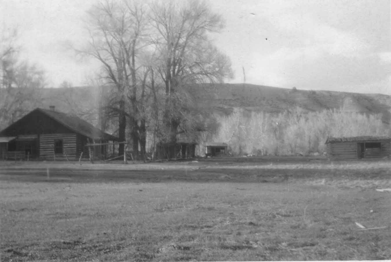
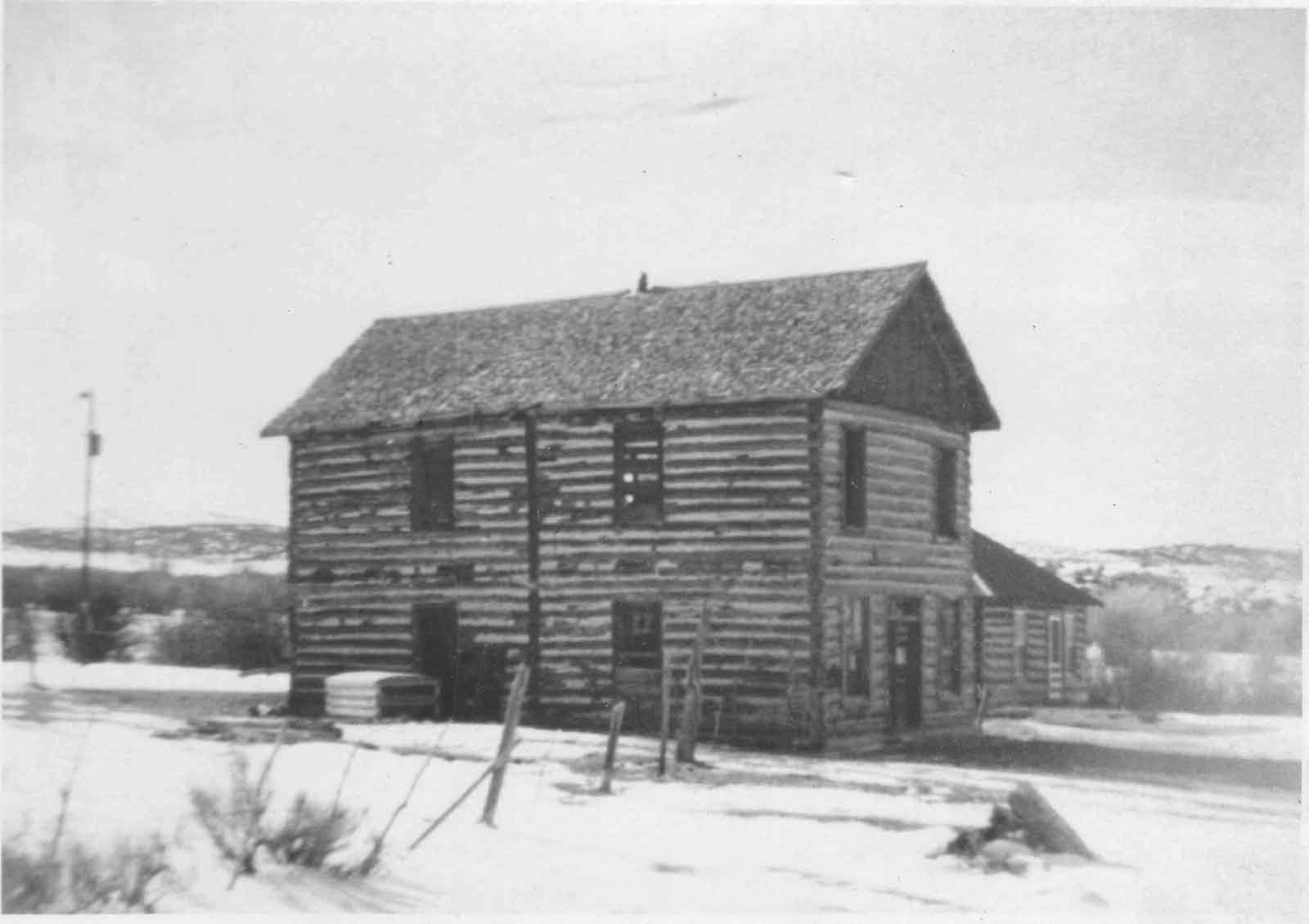
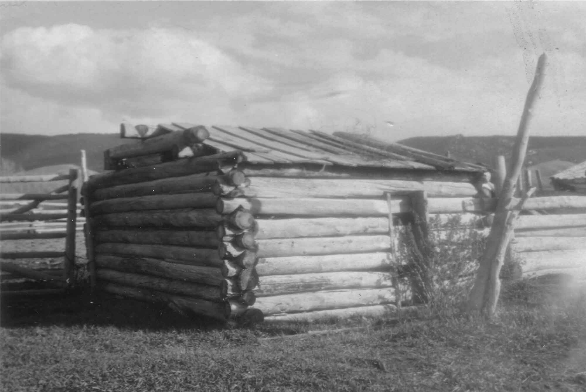
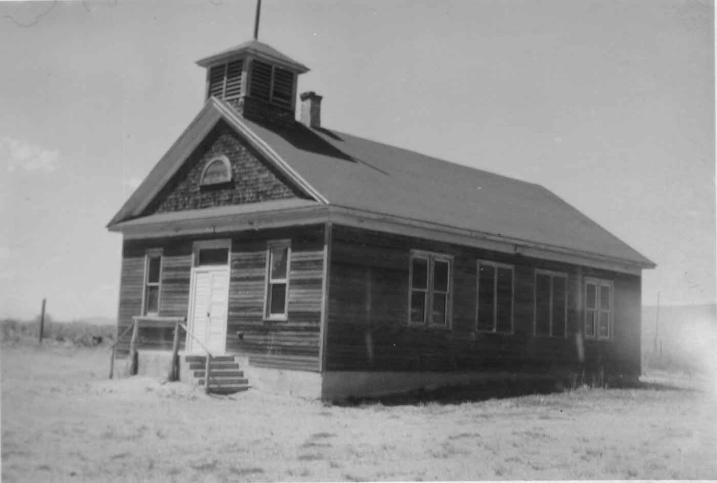
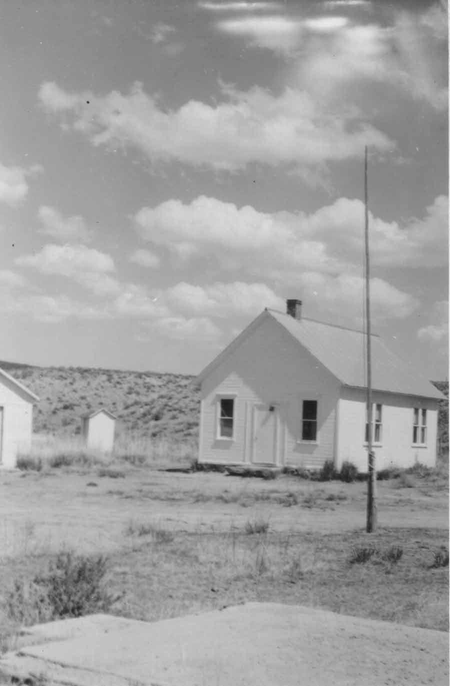
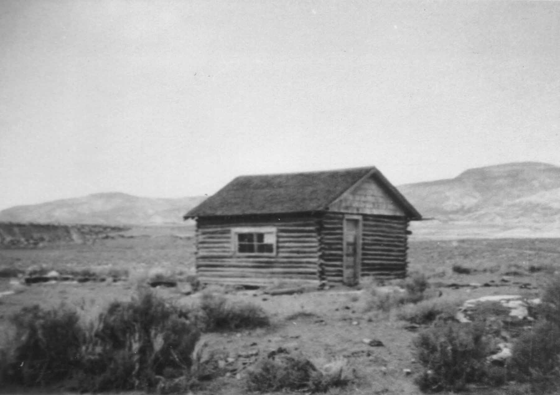
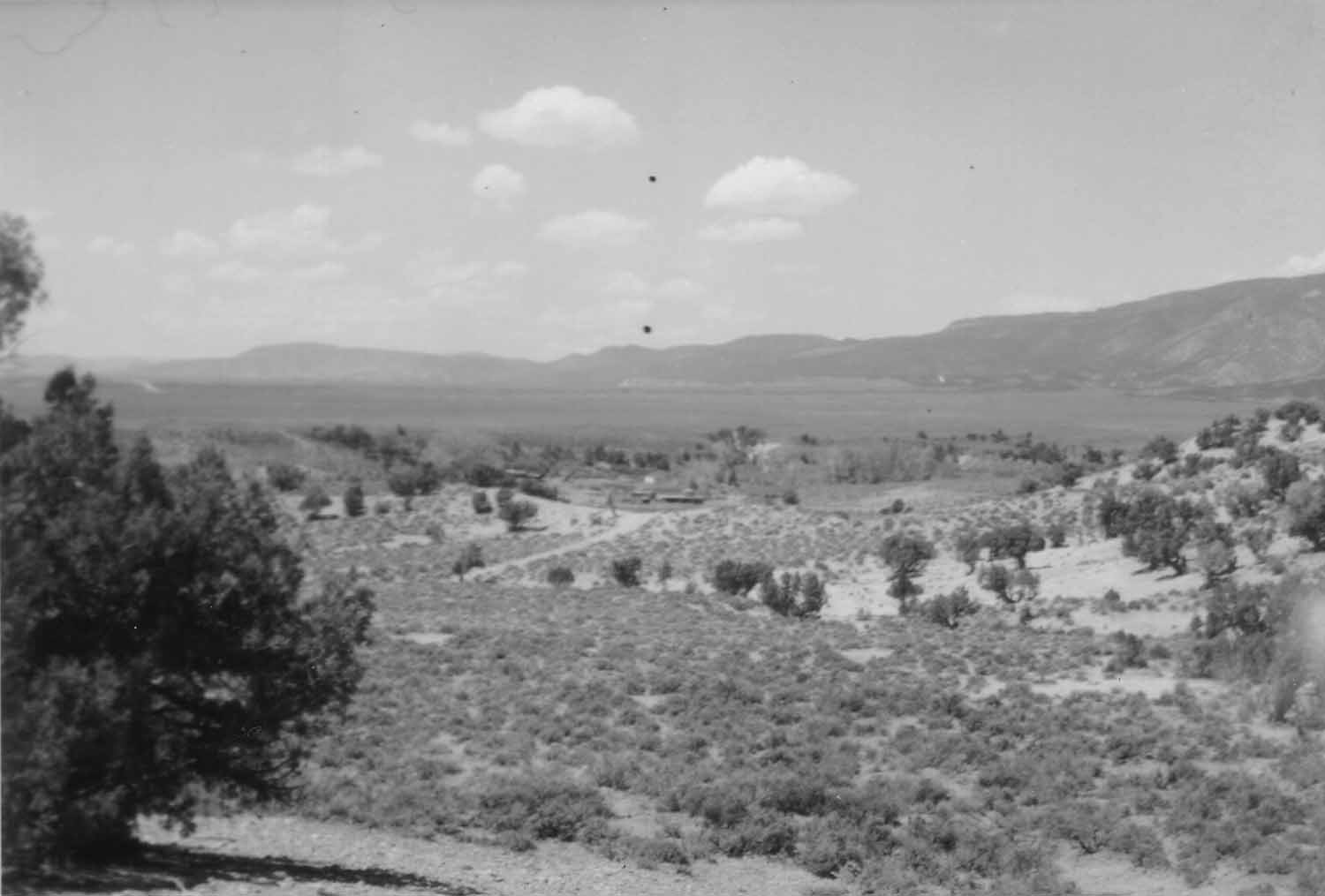
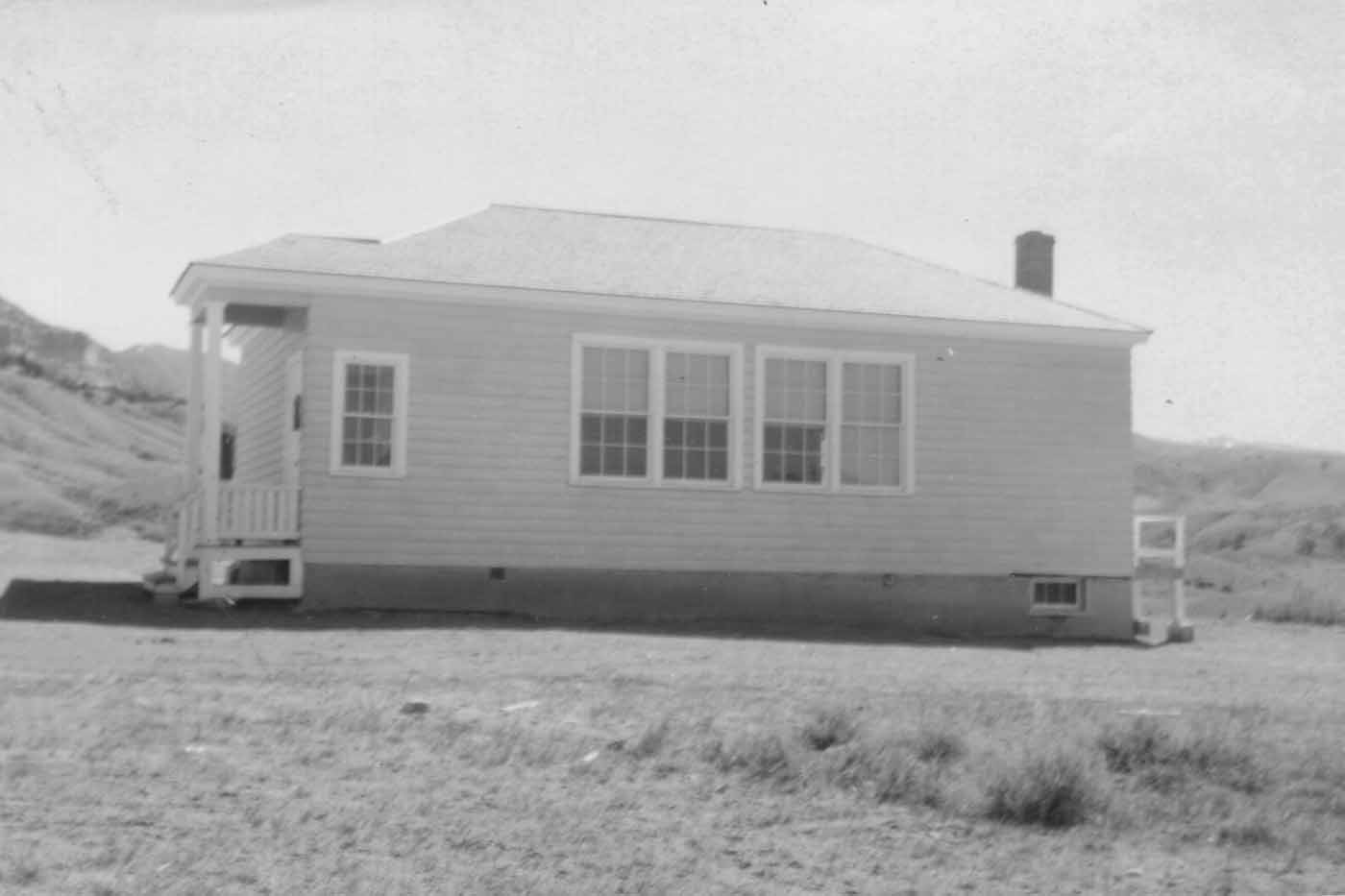
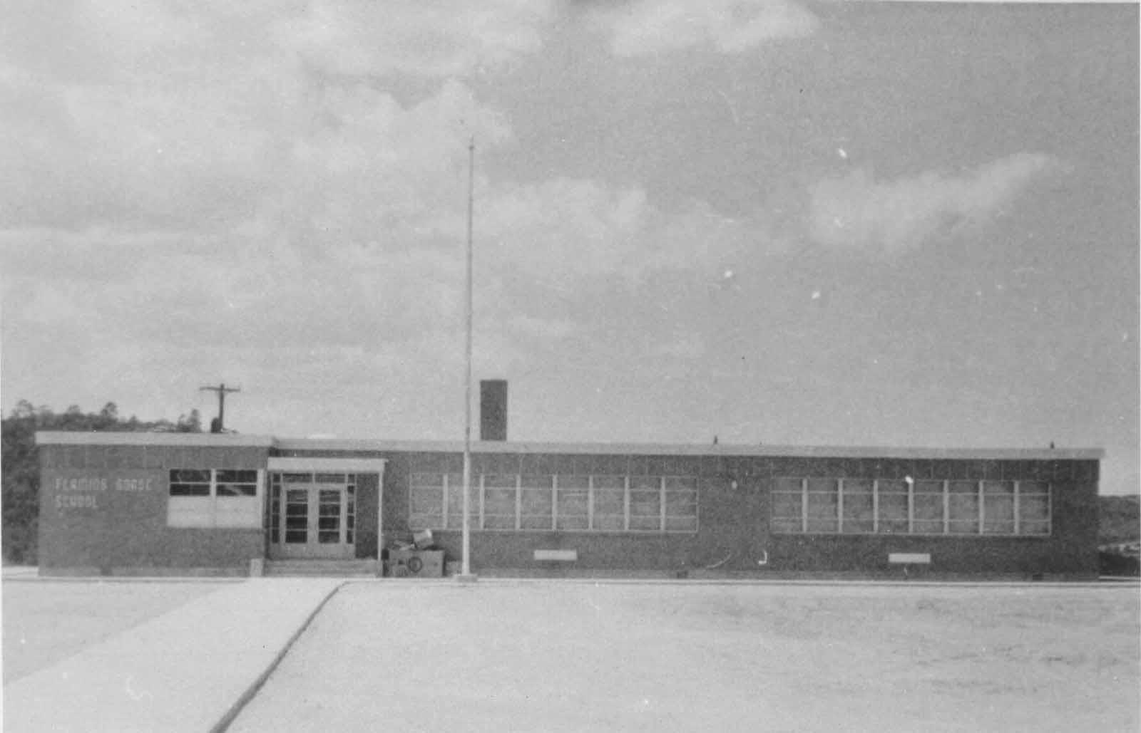
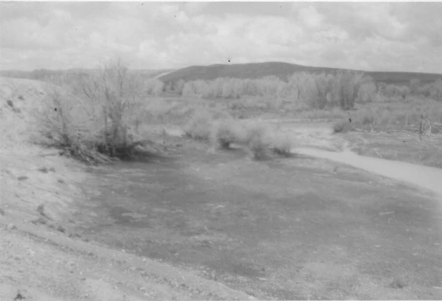
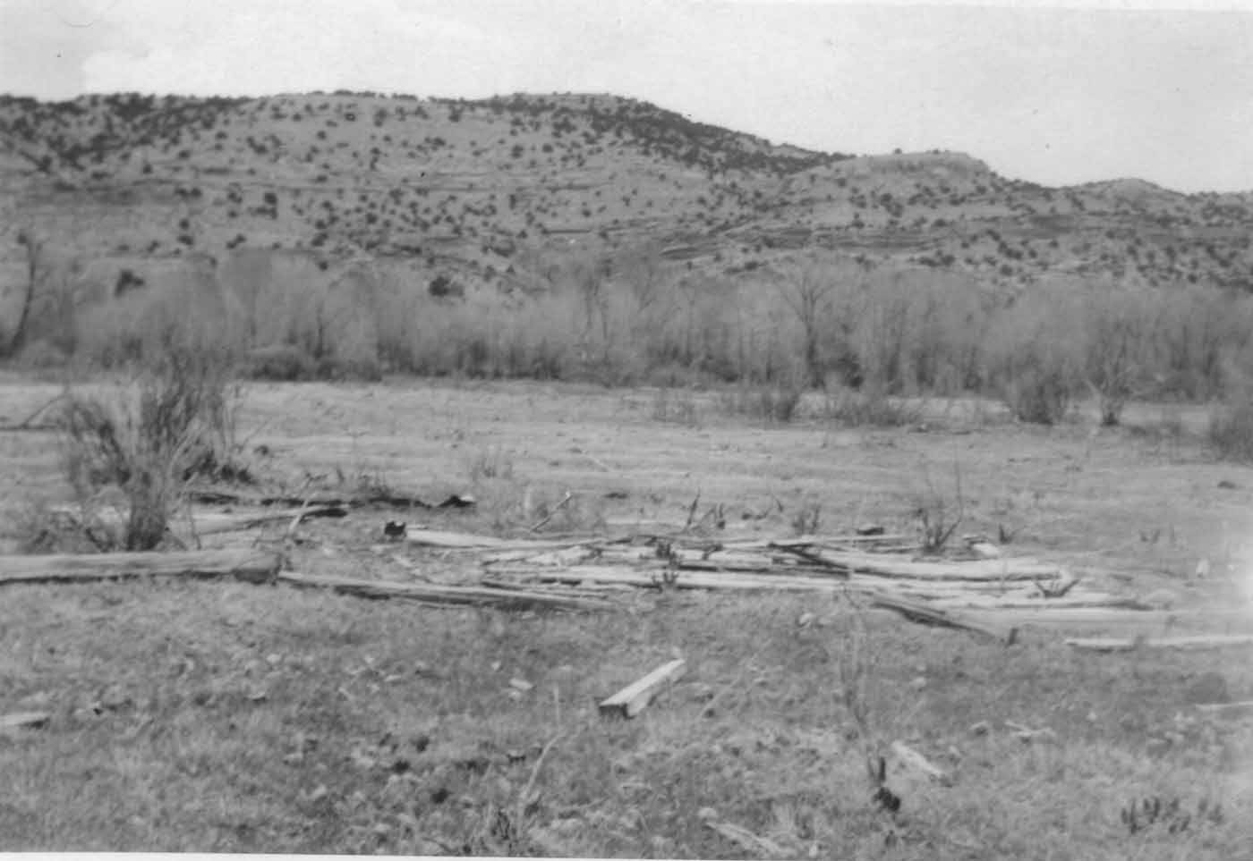
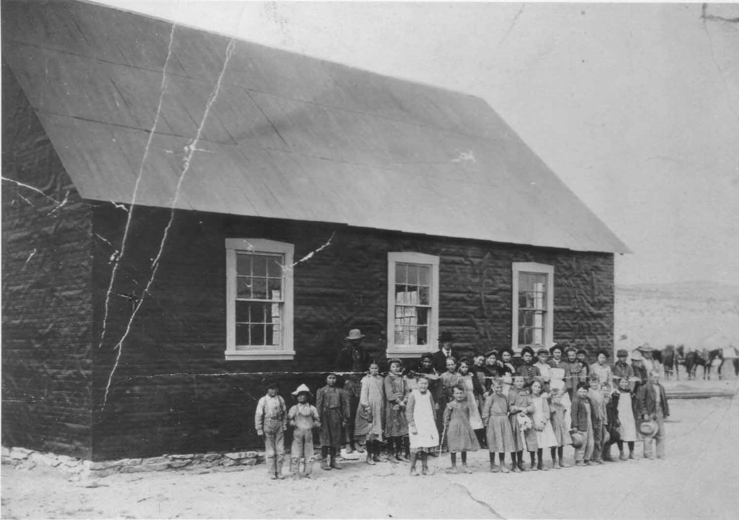
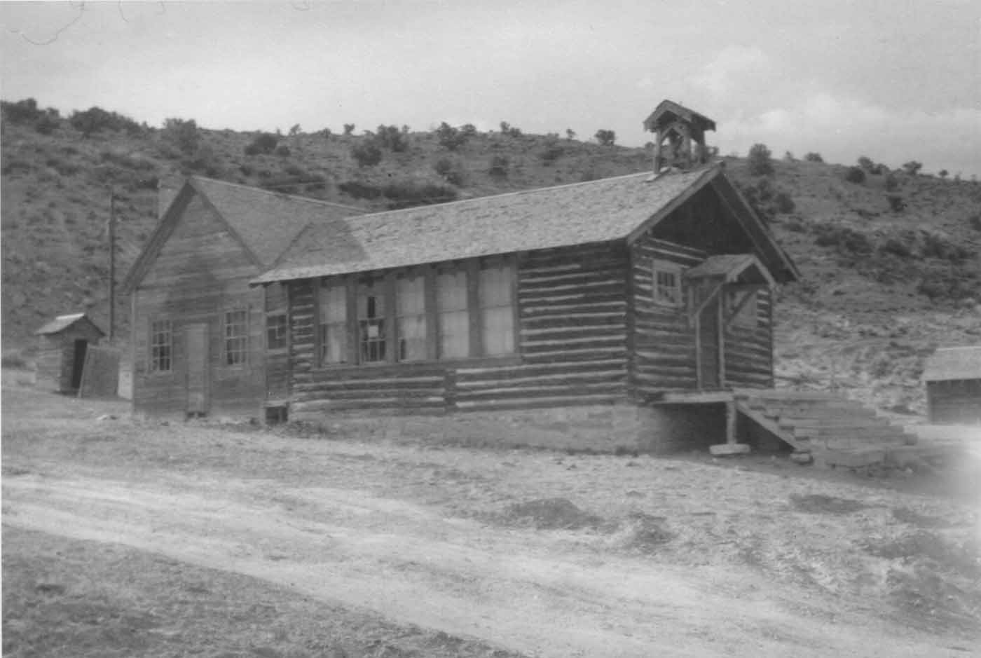
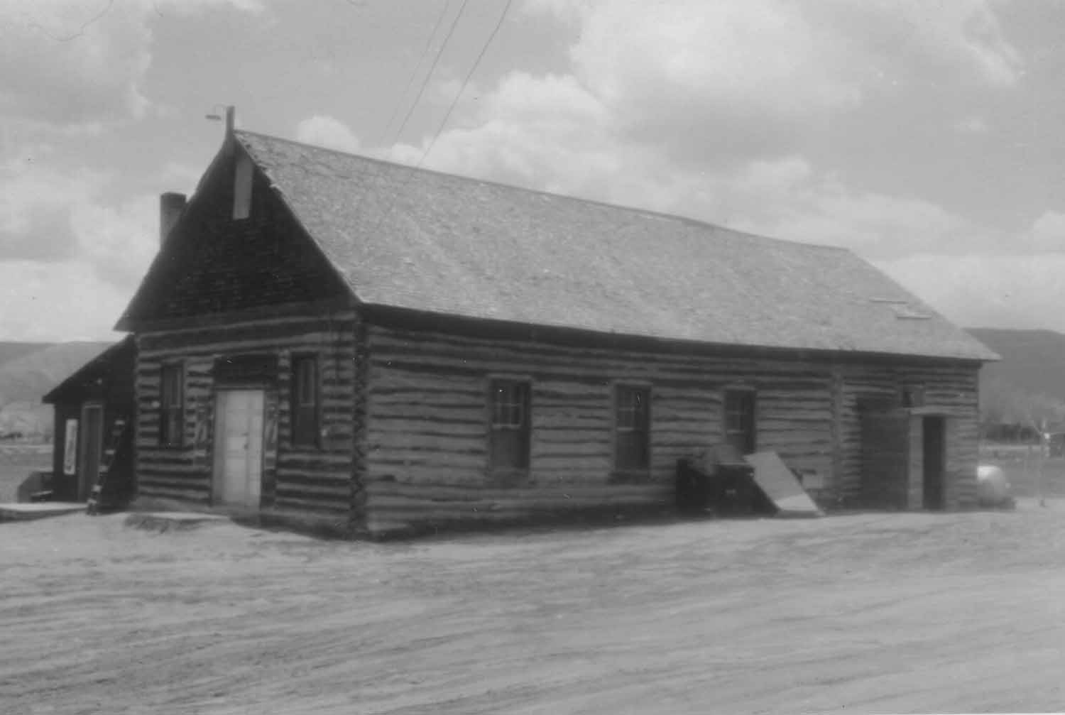
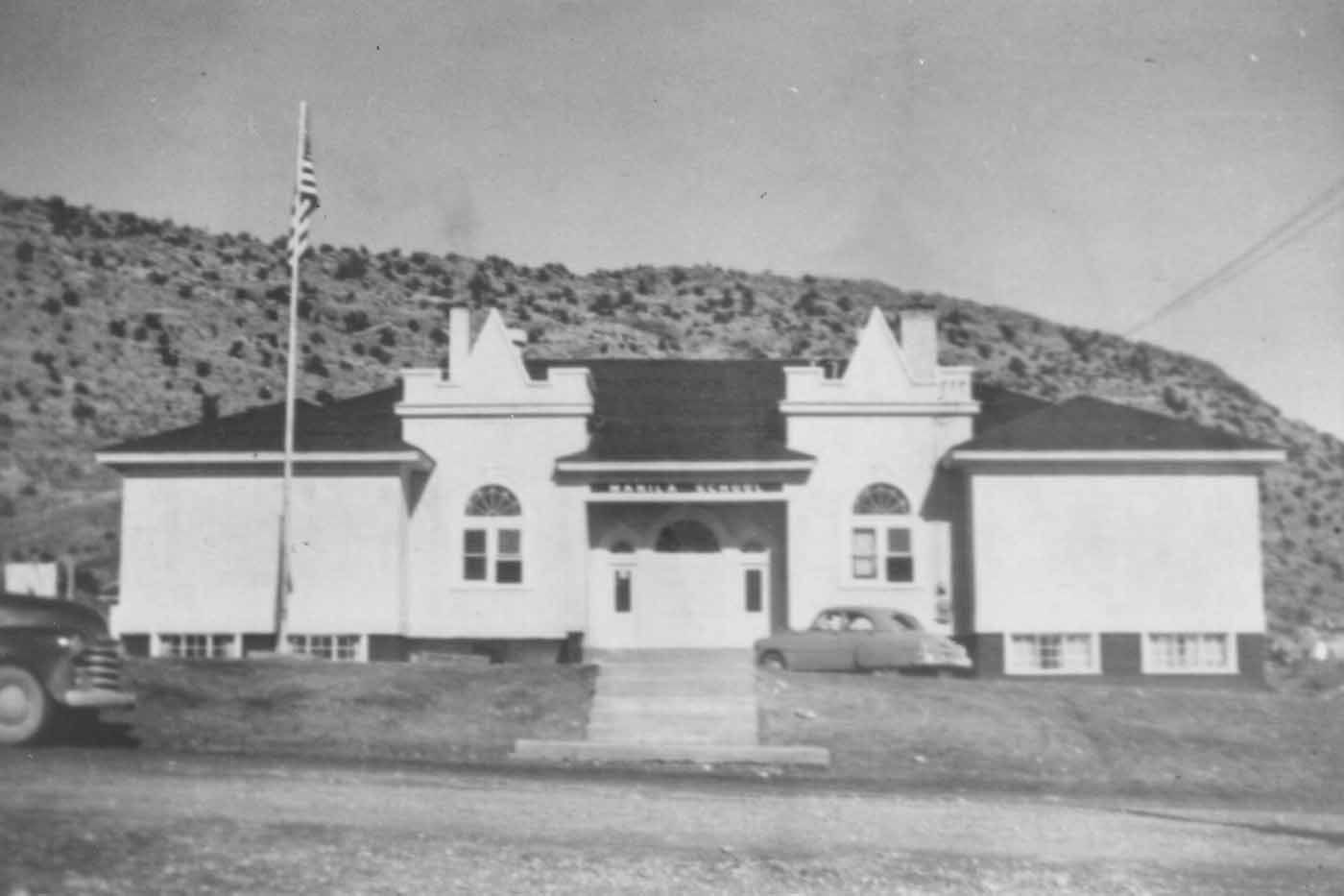
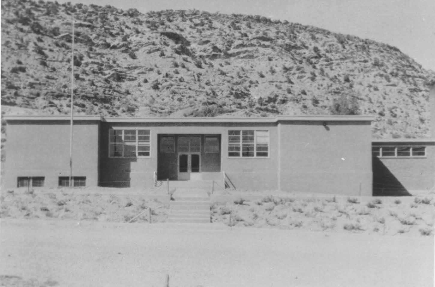
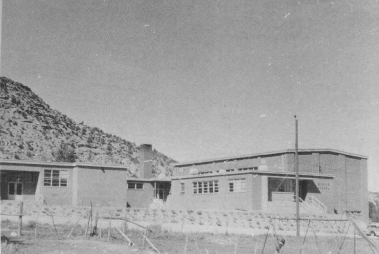